Net of Natural
Trails

Stage 16.1: Logroño - Agoncillo
Description
The Ebro Nature Trail continues from Piedra Bridge (375 m), along Paseo de la Florida to Ribera Park, leaving the River Ebro to the left. It reaches the ring road (A-13), passes under the bridge and turns left onto the footbridge that spans the River Iregua to venture into the Varea neighbourhood.
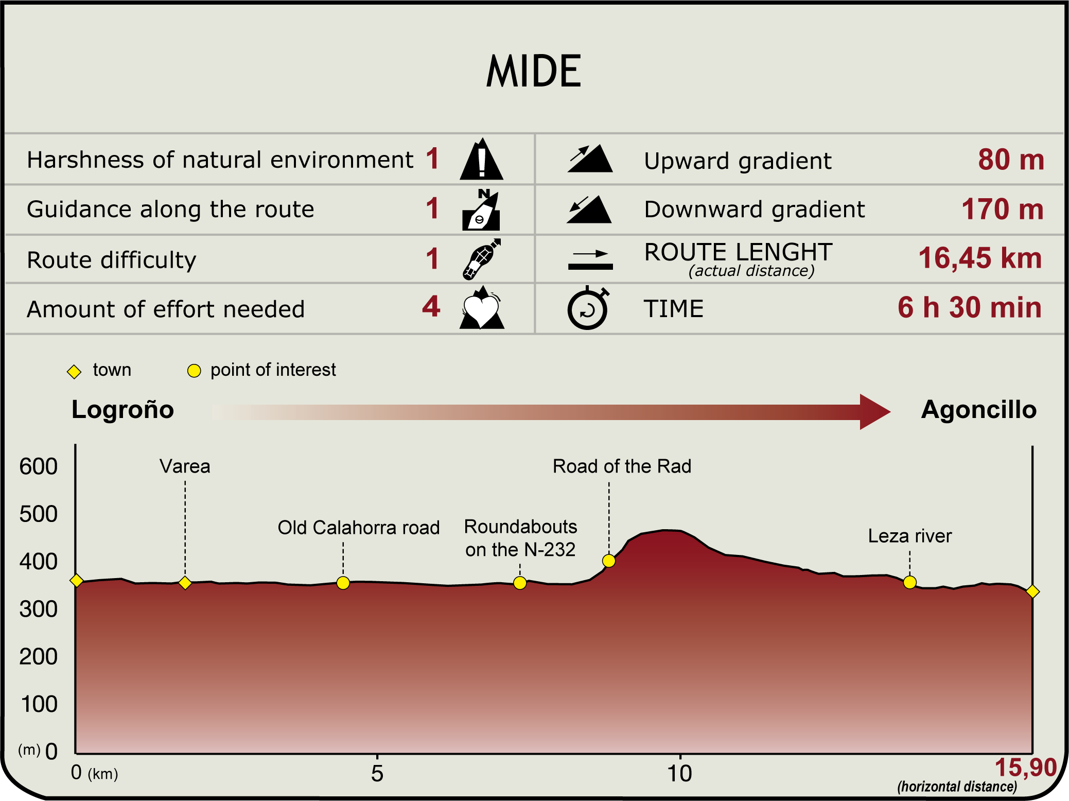
The route continues left through a green zone with walking routes, near where the Iregua joins the Ebro. The route heads along a paved road until the road reaches the side-track to Varea (1.7 km, 20min), with its sixteenth century parish church. The remains of a Roman villa can still be seen (under the Varia public school) in what used to be the former Roman river port of ancient Varaia. The villa consists of several rooms, water canals, wells and tanks. Traces of the Roman road between Tarraco (Tarragona) and Asturica Augusta (Astorga) can also be seen from the N-232 at the edge of the town.

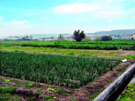
The GR 99 continues along a paved road, surrounded by crops and vegetable gardens. At Pasada del Chivero, the route drifts away from the riverbank, crosses the irrigation ditch or the Batán river, and then turns right at an intersection towards a plant nursery. The route joins the road to Espinal and, after a wide bend, ventures onto the paved road of Camino Viejo de Calahorra, through vegetable gardens. Both the N-232 and AP-68 can be seen to the south.
Along the banks of the Ebro are three woodlands of high environmental interest: El Mediano, La Sabuquera and Los Americanos, a total of 145 ha protected under the PEPMAN. Past an agricultural estate, the route reaches the road that gives access to Recajo military barracks; however, it continues towards the two new roundabouts on the N-232.
The roundabouts lead to the road, where the route runs along the shoulder. Past a petrol station and military housing, the route turns right near the brick factory and takes the tunnel under the PA-68.
It then climbs up a ravine, near some quarries, via the Rad road (8.7 km, 1hr 50 min), and passes under the Rabarera (519 m), a viewpoint with sweeping views of the woodlands and meanders that extend beyond Recajo, to the north, and Logroño, to the west. After climbing for about a kilometre, the route turns onto a paved road at the entrance of the quarry.

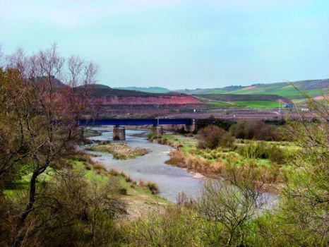
The route descends southeast, then turns northeast to reach Valdeviguera farmyard. The road heads to the right, parallel to the AP-68, until the motorway bridge over the River Leza. After climbing to the N-232, the route crosses the road and descends to the River Leza, which is forded via a concrete pile crossing (13.8 km, 3hr 20min).
After crossing the Leza, the road runs parallel to the river until after the railroad tunnel, where it turns onto a paved track with views of the Logroño-Agoncillo airport. It then ventures into Agoncillo, next to the shrine of Dolores, and continues to the town centre, near the castle and the church (345 m, 15.9 km, 3hr 55min).
Agoncillo sits in an area of staggered terraces. It has traditionally lived from agriculture, both irrigated and rainfed: vineyards, olive trees, asparagus, potato and cereal. Nonetheless, El Sequero industrial estate has produced significant economic, social and demographic changes. As for heritage, worthy of note are the church of Nuestra Señora la Blanca (16th-18th C.), the Castillo de Aguas Mansas (National Historic-Artistic Monument), from the 13th-14th centuries, which now houses the City Hall, the shrine of Nuestra Señora de los Dolores (18th C.), the Velilla de Aracanta archaeological site, and the Logroño-Agoncillo Airport, opened in 2003.
Sites of interest
Puntos de interés
Culture
Hydrography
Municipality
Hostel
Profile

Highlights
Further information
Traditional Vegetable Gardens
The Ebro Nature Trail runs through some of the best lands in La Rioja. Highly productive traditional irrigated lands and fertile valleys with high quality landscape that produce a large variety of fruits and vegetables. Its excellent preservation has led to its designation as areas of natural interest, under the Traditional Vegetable Gardens category - 335 ha at Varea and 820 ha between Agoncillo and Arrúbal.


