Net of Natural
Trails

Stage 13: Haro - Puente de Briñas - San Vicente de la Sonsierra
Description
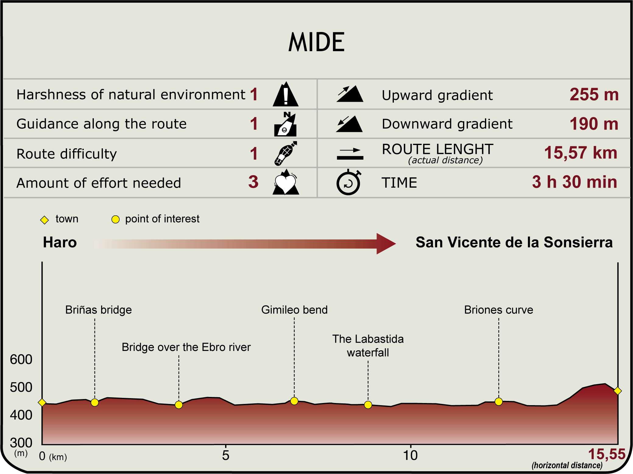
From the left side of the bridge over the River Tirón, at an altitude of 445 m (junction with Section 12), the route heads down the street that runs through the winery district. It then passes under the railway bridge, near Muga Winery, and continues through this neighbourhood until it reaches a path to the left of the paved road that crosses Briñas Bridge, where it links with Section 12.1 (1.4 km, 20min).
The trail continues along a track on the Ebro's right bank, then climbs up to a plain carpeted with vineyards, overlooking the town, leaving behind an offshoot road that descends to the river bank. The route disregards two paths to the left, then turns right with views of Haro and its surroundings. Shortly after, it reaches the LR-212 or A-3202, next to the Ebro and Labastida Bridge, the natural border between La Rioja and Álava.

Across the bridge, after a short stretch along the road, the route turns right onto a paved track next to a winery and, further on, a gravel pit, with views of Haro to the southeast and Labastida to the northwest. The paved road begins a gradual descent, turns into a dirt road, and approaches the river. The Ebro Nature Trail continues along a narrow strip between Mendigurina Hill and the river.
Leaving behind two side-tracks to the left and another to the right, the route continues steady along the riverbank. It takes a shortcut via Recodo de Gimileo (Preferred Natural Area of Interest of the Basque Country), an area carpeted with riparian vegetation including poplars, willows, alders and elms. This landscape is complemented by vineyards, populated with highly diverse wildlife.
After leaving behind another offshoot path to the right, the road runs again along the bank for a long stretch. At a bend, the route turns onto a paved track to the left, and, further on, continues along another track leading to stately, wine-producing Labastida. The GR 99 runs along the dirt track that leads to Labastida waterfall or reservoir, heavily laden with silt due to river discharge (8.8 km, 2hr), and populated with barbels, carps, perches, European mink and otters.
The track crosses the bridge over the bypass channel that supplies water to Labastida power station. Before reaching the station, there is a track to the left that heads up the slope parallel to the river. Once on the summit, the route comes upon a farm road that heads down to the canal.
Further on, the path turns north onto another paved track that heads right and up to a level cultivated terrain. It takes a shortcut at the so-called Curva de Briones (Exceptional Vegetation Site), another area with riparian vegetation of great environmental interest, and home to a Traditional Vegetable Garden (HT-1) under the La Rioja PEPMAN (Special Natural Environment Protection Scheme) (12.3 km, 2hr 50min). A forest road joins the track from the right, and, immediately after, there is a stone-domed hut. Hereafter, there are spectacular views of the islands and coppices that carpet the river's bends.
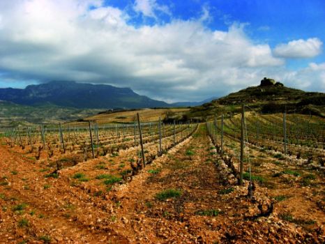
After crossing the Valseca Ravine, the route meets the slip road to San Vicente de la Sonsierra, a town atop an elongated hill, crowned with a castle and the church of Santa María la Mayor (510 m, 15.5 km; 3hr 35min). The route links with Sections 13.1 and 14 at San Vicente.
Sites of interest
Puntos de interés
Hydrography
Infrastructure
Municipality
Hostel
Profile


