Net of Natural
Trails

Stage 12.1: Miranda de Ebro - Puente de Briñas
Description
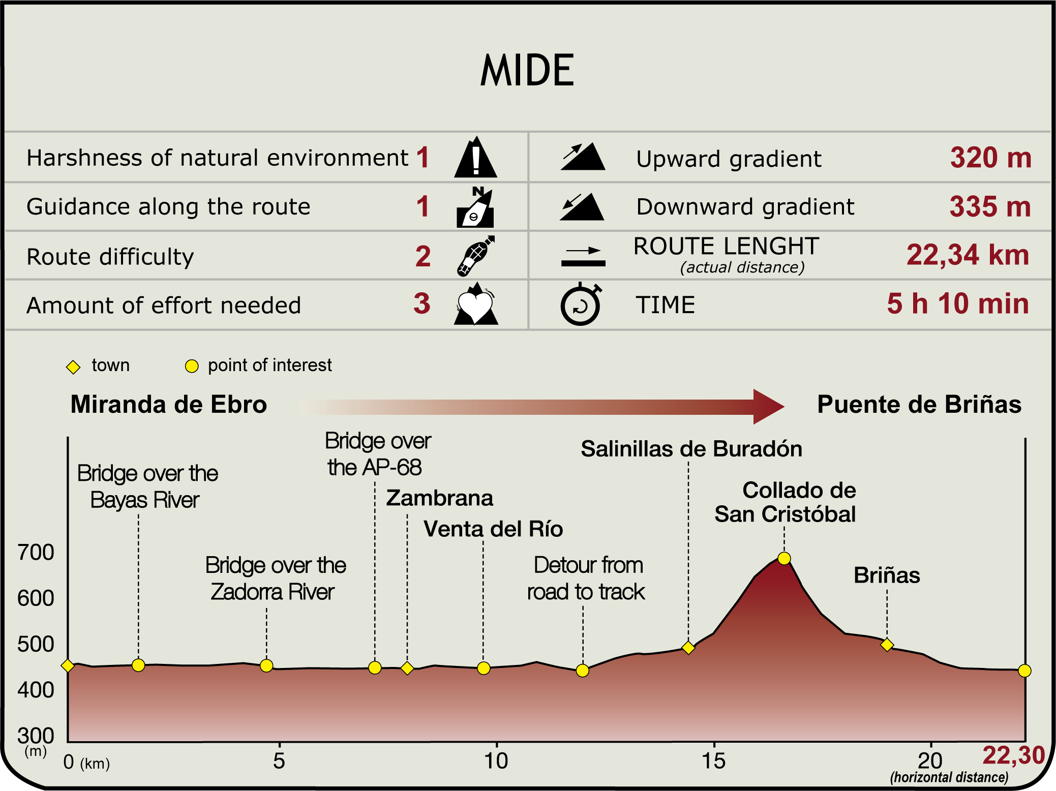
The sports centre, near the football stadium, may be accessed via the Miranda Riverwalk (a beautiful walk along the Ebro’s left bank at an altitude of 460 m). From here, the route traverses a newly developed area, parallel to the River Bayas, in pursuit of the BU-740 bridge over the river. It then turns right and heads out of town.

Past the River Zadorra (4.8 km, 1hr), the Trail runs parallel to the road that gives access to the N-124. Immediately after, it turns onto a southbound track towards the AP-68, where there is a roundabout that leads to a bridge over the motorway. After crossing the bridge, it continues straight ahead towards Zambrana (8.1 km, 1hr 40min), along an old pilgrimage route that comes down from La Puebla. The origin of this route is evidenced by two stone crosses - one Gothic, to the north, and another to the east. The parish church of Santa Lucia (17th-18th C.) and its folk architecture of stone houses and emblazoned façades are worth a visit.
Leaving Zambrana behind to the east, the route continues along a track that leads to the N-124 through farmlands, and past the ruins of Venta del Río (a relic of the Jacobean route). Once on the road, the route continues for about two kilometres along the left shoulder.
After crossing the River Inglares, it merges with the Way of St. James (marked with milestones), and continues past a petrol station. The route now veers to the left, up a dirt track, towards Salinillas de Buradón, a hamlet nestled on a headland.

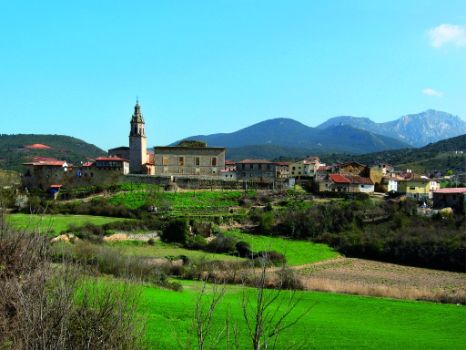
The road makes a wide loop and ventures into a recreation area next to the wall. Salinillas (14.5 km, 3hr 10min) has a beautiful town centre; surrounded by a defensive wall that encloses remarkable stone architecture and the 15th century church of Inmaculada Concepción. Outside the town are several salt mines that were exploited between the 12th and 20th centuries.
From the information panel, the GR 99 heads down the street to the southeast, leaving the cemetery to the right, before it makes a steep climb.
Disregarding two side-tracks, one to the right and another to the left, the route continues straight ahead, climbing through kermes oaks, boxwood patches and pines to the mountain pass of San Cristóbal (700 m), carved out of the rock, with a water intake hut. In the heart of Sierra Toloño, this place is listed as an Important Basque Country Site.

The descent into the valley is via a steep trail that leads to the first vineyards, overlooking Briñas and Conchas de Haro. The route, which merges with the Way of St. James that runs from Irún and San Millán, heads down to El Crucero, a stone cross that marks the boundary between Álava and La Rioja (19.2 km; 4hr 30min), and continues along a track to meet the N-124.
Briñas is accessed by the LR-132. The town harbours the baroque parish church of Asunción, huge stone manors, and beautiful views of the Ebro, Sierra de Toloño and vast vineyards. Briñas Bridge (445 m) is accessed from the south of the town, in a southwesterly direction, parallel to the River Ebro and its large meander. This historic bridge (800 m from Briñas) connects this section with Section 13 (22.2 km, 5hr 10min).
Entidades gestoras:
- Ministerio de Agricultura, Pesca y Alimentación
Enlaces de interés
Puntos de interés
Infrastructure
Municipality
Hostel
Profile


