

Net of Nature
Trails

Turia - Cabriel Nature Trail. Siete Aguas - Jaraguas Section
Description
An adventure across the Valencia fields, between pine woods and vineyards, structured along the shores of the River Magro.
This section starts at the town of Siete Aguas, whose name, “Seven Waters”, reflects the fact that this area is dotted with many water springs. Leaving the comarca of Hoya de Buñol-Chiva behind, our route enters the comarca of Requena-Utiel, where the vineyards – with their native Bobal grape variety – take centre stage. Together with the Aleppo pine forests and the banks of the River Magro, they form a landscape that invites you to embark on this adventure.

This second section starts in Siete Aguas town centre. At the start of the route, an interpretation panel displays some details about the route. After crossing the town along Calle Arrabal y Cañada, the trail leaves the town at kilometre point 41 (bearing in mind that, for us, kilometre 0 was in Pedralba).
A one-kilometre climb gives way to a descent leading down to the CV-388 road; taking all necessary precautions as we cross. Shortly after kilometre point 44, the route crosses an overpass (which in fact is part of the Cañada Real de La Mancha cattle track) over the Madrid-Valencia high speed railway line.
A short while later, we reach an underpass below the A-3 motorway and reach the area of Collado de las Avenas, where a rest area offers walkers the chance to pause and recover their strength. After descending crossing woods of young Aleppo pine (Pinus halepensis), the route allows hikers and cyclists to enjoy the Villingordo Municipal Natural Area. and cyclists to enjoy the Villingordo Municipal Natural Area.

The route continues north-west through the vineyards and running parallel to the Rebollar rambla or dry riverbed. A little further down the road, in the town of El Rebollar, the road continues along Calle Yatova, which leads to the Plaza de La Virgen and finally to the Shrine of Nuestra Señora del Rosario. Further still, at Calle Don Juan, there is a rest area under a weeping willow (Salix babylonica), a place to sit under its cool shadow and to learn more about this route thanks to the information panel standing there.
The route leaves the town of El Rebollar and continues in the direction of the Requena-El Rebollar aerodrome, which stands at kilometre point 55 of this Nature Trail. Immediately afterwards, a stretch begins that is particularly appealing to mountain bikers, with a succession of bends and uphill and downhill gradients which, finally, after passing the 62-kilometre mark, leads to the Shrine of San Blas, standing austerely against the landscape. After a left-hand bend, which is clearly signposted, we cross the River Magro via a crossing built following the tragic floods of October 2024.

Our route turns right to continue running parallel to, and at a short distance from, the River Magro, as far as the CV-4310 road. Cross the road with care, leaving the monumental city of Requena to the right just over a kilometre further on.
The route continues along a wide track to kilometre point 65, where a small stand of pine trees provides welcome shade. Shortly afterwards, you reach the small village of El Pontón, a district of Requena with, of course, a strong wine-making tradition. After walking through the streets and crossing the N-322, which runs through the village, we leave it behind to cross the CV-450.
The farmland takes centre stage, with vineyards and almond groves vying for dominance. The route reaches the village of El Azagador, continuing along an asphalted section that passes behind a winery and after a few metres along the V-810 road, another winery comes into view, leading to a new Requena hamlet, El Derramador, where the wine-growing tradition remains very much alive.

The route continues along wide paths through farmland, dotted with small stands of holm oak and other Mediterranean woodland species that provide a refuge for wildlife. A short stretch of road leads up to kilometre marker 73, and after another kilometre you cross the road, continuing northwards where signs warn of the crossing through the Casa Mosca ravine. Then turn left and continue along an asphalted section of just over a kilometre.
Next, there are two signposted flood-prone areas, where caution is advised in the event of rain. After a left turn, our route takes the Cañada Real de La Mancha cattle road for the next 15 kilometres on a stretch where the landscape is characterised by agricultural crops, especially vineyards and almond groves. On this route, it is necessary to cross several roads (CV-460, CV-453, CV-452 and CV-465), so remember to take extra care. Shortly after hitting the 80 kilometre point, the vineyards intertwine with small evergreen oak patches that offer a welcome degree of shade to the small rest area at this point.
After leaving the cattle track beyond kilometre point 89, the final section down to the village of Jaraguas starts. Passing by a rest area beside the old washhouse and the local swimming pool, the route continues through the quiet village streets as visitors can enjoy the peaceful ambience in what is the perfect place to bring this section of the Turia – Cabriel Nature Trail to an end.
Management entities:
Sites of Interest:
Puntos de interés
Culture
- Cañada Real de la Mancha
- Lavadero municipal de Jaraguas
- Salinas Mina Lolita
- Puente de Jalance
- Ermita de San Blas
- Cañada Real de la Mancha
Hydrography
- Fuente del Amparo
- Aljibe
- Aljibe
- Fuente de Santa Catalina
- Estación de aforo
- Río Magro
- Barranco Rubio
- Rambla El Rebollar
Infrastructure
Municipality
- Jaraguas
- Venta del Moro
- Caudete de las Fuentes
- Utiel
- Calderón
- San Juan
- Barrio Arroyo
- San Antonio de Requena
- Roma
- El Derramador
- El Azagador
- El Pontón
- Requena
- Siete Aguas
Orography
Vegetation
Profile

 Harshness of natural environment
- 1. The environment is not risk-free
- 2. There are more than one risk factors
- 3. There are various risk factors
- 4. There are quite a lot of risk factors
- 5. There are many risk factors
 Guidance along the route
- 1. Well defined trails and crossings
- 2. There is a clearly marked trail and signage
- 3. Requires the identification of geographic features and cardinal points
- 4. Requires off-path navigation
- 5. The trail is interrupted by obstacles that have to be gone around
 Route difficulty
- 1. Walking on a flat surface
- 2. Trails with different types of path
- 3. Walking on stepped paths or irregular terrain
- 4. The use of hands or jumping over the terrain is necessary
- 5. The use of hands is required to progress
 Amount of effort needed
- 1. Up to 1 hour of continuous walking
- 2. Between 1 and 3 hours of continuous walking
- 3. Between 3 and 6 hours of continuous walking
- 4. Between 6 and 10 hours of actual walking
- 5. More than 10 hours of continuous walking
(Calculated according to the MIDE criteria for an average excursionist with a light load)
Highlights
Further information
Requena-Utiel County
Large county to the west of the province of Valencia. Its soft hills and medium altitude of the area, together with its climate, has favoured the marked agricultural characteristic of this land. The most significant crop are vineyards, which boast their own denomination of origin (DO Utiel Requena) and cultivate local varieties of grape, such as bobal. The enormous environmental value of the county cannot be overstated; its hosts good examples of of Aleppo pine woods and Mediterranean scrubland, although, without a doubt, its most remarkable spot is the Hoces del Cabriel Natural Park. The architectural heritage is also vast, boasting historic complexes such as as that of Requena or that of Utiel, not forgetting elements such as the telegraph tower and the trenches from the Carlist wars in Villargordo del Cabriel, the fountains and washhouse in Jaraguas or the Vadocañas bridge over the River Cabriel. The festivals in the area have to do mainly with wine and grape harvesting, since it is the main economic activity. In the area. Especially noteworthy are the fair and Grape Harvesting Festival and Fair in Requena and the festivals honouring Our Lady of Remei, which have strong oxen parading through the streets in a festive atmosphere full of activities.
Multimedia


Downloads

GPS Downloads


Cyclability
Type of road, Nº of portages & difficulty

TYPE OF ROAD, PORTAGES & DIFFICULTY

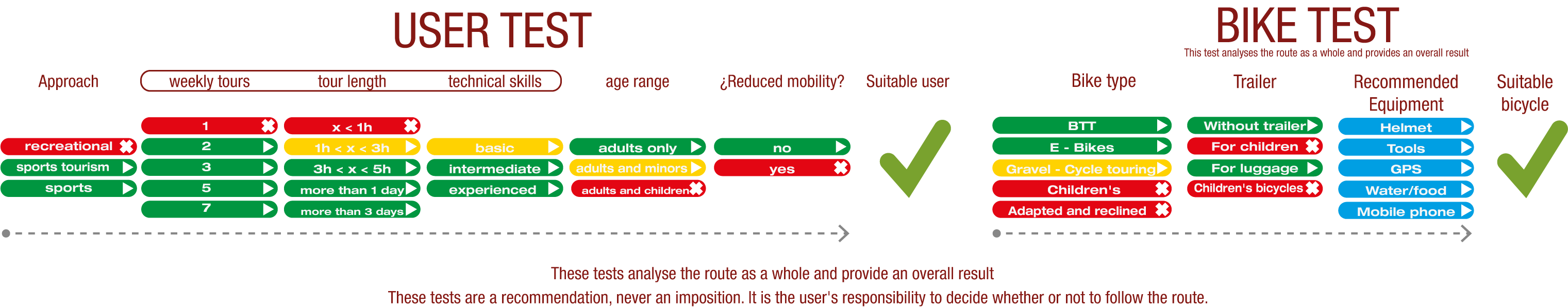
TEST
SAFETY RECOMMENDATIONS
- Sections shared with hikers.
- Transit through the centre of some population centres.
- The Nature Trail has two potentially flood-prone sections in stage 2. This is a seasonal circumstance, during the rainy season or when there is an increase in water flow.
GENERAL RECOMMENDATIONS
- Find out about the technical aspects of the route and the weather on the day.
- Take care of the environment. Take care not to disturb animals or damage vegetation. Respect private areas.
- You must give priority to pedestrians and comply with general traffic rules.
- The environment in which you will be riding is open, free to move around and an area where many activities are carried out (sporting, forestry, livestock and agricultural activities). Always have an understanding, prudent, responsible and respectful attitude.