Net of Natural
Trails

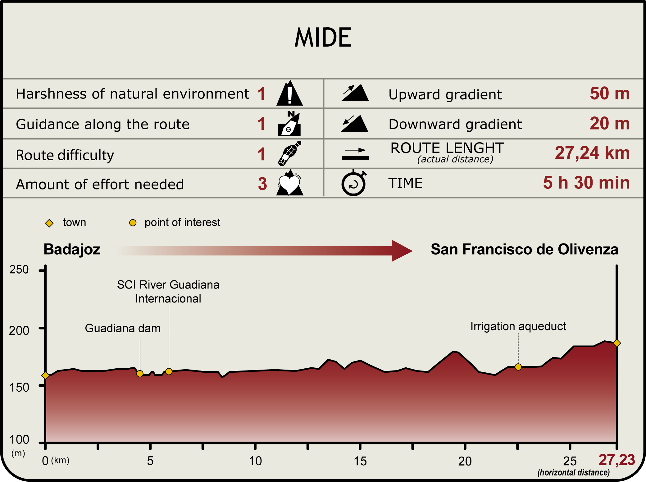
Stage 36: Badajoz - San Francisco de Olivenza
Description
Between the bridges on the Guadiana
Having admired the bridges in Badajoz, and enjoyed the wildlife along the river, the Trail continues its journey towards San Francisco de Olivenza, through crop fields and Extremaduran dehesa.
The route starts on the left bank of the River Guadiana, near Autonomía Bridge, which it crosses to reach the right bank. It then climbs down a flight of stairs to a riverside promenade. At Universidad Bridge, the route climbs up a ramp onto a street that runs parallel to the river that leads to Real Bridge. Here, the traveller may approach the River Caia or continue along the main route towards San Francisco de Olivenza.
Caia Branch

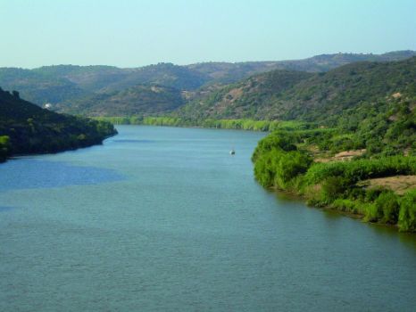
The alternative route to Caia, conveniently signposted, runs along the right bank of the River Guadiana. The route heads along the paved path of the riverside promenade that ends at an intersection with a sandy gravel track flanked by eucalyptus (Eucalyptus ssp.). The route turns left onto this track, and after about 50 m, approaches the diversion dam on the River Guadiana. About 500 m further on, it reaches a fork where the route takes the left path along the river. The walk from here to the end is well worth the effort. The route begins at the diversion dam, and traverses through the “Río Guadiana Internacional” Site of Community Importance (SCI), with riparian landscape and wildlife. About halfway through the route, it merges onto a one-kilometre path that has several fishing spots popular with anglers. Past this area, the alternative route passes through a few small tunnels formed by willows before it ends at the mouth of the river. There is a rest area with benches and shade, where one can enjoy the stunning views of the Guadiana at its confluence with the River Caia. One must backtrack to the starting point to follow the main route.
Main Route

The main route passes under Real Bridge, and continues along the paved road and sidewalk of the recently renovated riverside promenade, past a canoeing club and a small pier. It then continues along the dirt road on the left bank for about 200 m until it reaches the Guadiana diversion dam.
Past the diversion dam, it approaches an intersection from where it continues left, always parallel to the river, following the signs. It crosses along the upper edge of the embankment, without ever approaching the riverbank, until it reaches Los Batanes. The Trail turns left here, and drifts away from the river. About 50 m further on, at the intersection, the route leaves behind the Cañada Real de Sancha Brava and the Cáceres-Badajoz Corridor Nature Trail, along which the Trail has been running since Stage 35. The route turns left at this intersection and continues toward San Francisco de Olivenza. The route straight ahead leads to Piedraguda Reservoir (26 km away), which is not included in this Stage.
The path leading to San Francisco de Olivenza winds through fields of corn, sunflower, olive, orange and peach. Further on, the path ventures about one kilometre through a stretch with fences along property lines. Past this stretch, the route turns onto the road from Badajoz to Olivenza, known as Malos Caminos. It traverses through large irrigated farms, with tracks to the right and left that provide access not only to these farms, but also to the Olivenza-Badajoz road (left) and the River Guadiana (right). Eight kilometres after the intersection with the Cañada Real Sancha Brava is a crossing over the Caballerizas Creek, with a derelict metal structure to the right, known by several names, including Mina Tere, Cortijo Santa Barbara, and Cortijo Albalá. As the Trail advances, the agricultural landscape of crops and fruits gives way to the typical image of Extremadura: holm oak (Quercus ilex).

The travellers who wish to rest and relax before tackling the final stretch of the Stage may follow the sign that appears two kilometres further on, indicating the Malpica alternative route to the right that leads to the River Guadiana and a rest area (1 km). Recreational fishing is allowed in this area with tables.
The main route continues straight ahead through large irrigated farms until it reaches the River Olivenza, which it crosses on a wooden bridge. Further on is a new intersection. The travellers who do not wish to walk the stretch to and from San Francisco de Olivenza, shared by Sections 36 and 37, may proceed directly to Stage 37 from here and head towards Villarreal.
If you wish to complete this Stage, the route turns left at this intersection towards San Francisco de Olivenza. One of the many aqueducts used to irrigate the rich fields found in this area can be seen along this path. Further on, the route turns right along a paved road leading to an intersection, where one must pay close attention to the signs in order to continue along a dirt track to the right, which may be concealed by dense vegetation. At the next intersection, the route will continue along the left lane, which runs parallel to another irrigation canal.
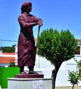
In the last few metres, the Stage traverses through several irrigated fields before entering San Francisco de Olivenza, a small village of about 400 people where one always feels at home. As the local saying goes: “nobody is a stranger at San Francisco de Olivenza”.
Sites of interest
Profile

Highlights
Further information
Azud de Badajoz SPA
The Azud del Río Guadiana has been declared a Special Protection Area for Birds (SPA) owing to its rich diversity of bird species. One of its main attractions are the breeding colonies of herons, which bring together Cattle Egrets (Bubulcus ibis) and Little Egrets (Egretta garzetta), as well as other species including Black-crowned Night Heron (Nycticorax nycticorax), White Stork (Ciconia ciconia) and Grey Heron (Ardea cinérea). The main colony, located just downstream from the dam, nests on the trees that populate several islands in the middle of the river. There are also three interesting heron species of great interest in this Stage of the Guadiana: Purple Heron (Ardea purpurea), Squacco Heron (Ardeola ralloides) and Great Egret (Egretta alba). The first cormorants (Phalacrocorax carbo) arrive in late August, and the population continues to increase until it reaches its carrying capacity.
The vegetation along the banks is particularly exuberant in the area between the diversion dam and the mouth of the River Caia, where the river looks most natural with dense willow thickets (Salix sp.) in which numerous species of birds nest. Reed thickets (Phragmites australis) care another interesting habitat for birds, although they are easier to hear than see owing to the dense coverage.
Waterfowl abound in the open waters between the Autonomía Bridge and the wall of the diversion dam, including Mallard (Anas platyrhynchos), Northern Shoveler (Anas clypeata), Gadwall (Anas strepera) and Common Coot (Fulica atra).
The two viewpoints located at both ends of the diversion dam are undoubtedly two highly interesting of this route. If one is lucky, it is possible to see more than 15 different species on the diversion dam wall.
In winter, as the day progresses, Lesser Black-backed Gulls (Larus fuscus) and Common Black-headed Gulls (Larus ridibundus) concentrate on the diversion dam.


