Net of Natural
Trails

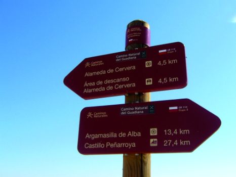
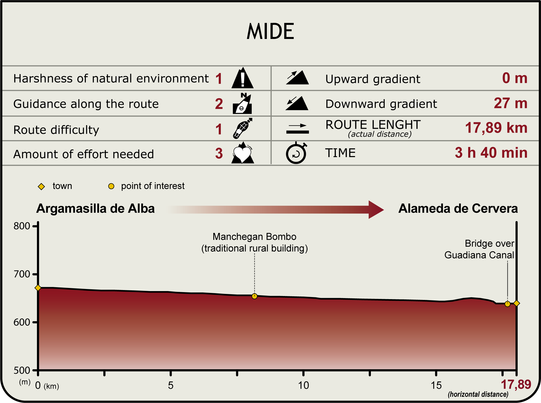
Stage 3: Argamasilla de Alba - Alameda de Cervera
Description
Through farmland
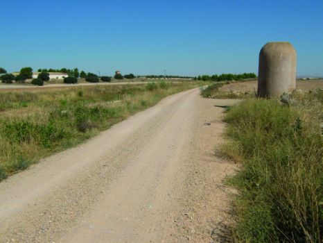
The Stage runs along the flattest part of La Mancha plateau, at an average altitude of 600 to 700 m above sea level. Strongly influenced by human activity, the flat landscape stretches to the horizon, amidst a sea of vineyards dotted with olive trees and fields of grain.

The Stage starts in Argamasilla de Alba, next to the old N-310 that used to traverse the centre of the village, now diverted by a relief road. The route crosses Argamasilla south to north, near the River Guadiana and the Gran Prior Canal (Peñarroya Canal) towards Alameda de Cervera, 18 km away.
The Trail leaves Argamasilla de Alba behind, and continues north along the right bank of the river. Further on, the route crosses a bridge to the left bank. Close attention should be paid here, as a farm road that continues straight ahead could lead to error. A farm located to the right after crossing the bridge, with a few houses within, can be used as a landmark.
Further on, Argamasilla's cemetery appears to the left. The Stage continues until another intersection with a livestock farm, where it continues straight ahead. One can see, grazing in the fields, herds of sheep that produce the milk for the world-famous Manchego cheese. These lands are also home to large populations of hare (Lepus europaeus) Red Partridge (Alectoris rufa), Quail(Coturnix coturnix) and Turtledoves (Streptopelia turtur).

The route continues straight ahead to another intersection, where it turns right onto a path leading to a bridge that crosses to the opposite side of the canal. From here, the Trail runs along the River Guadiana. Further on is yet another crossroads where the route continues straight ahead, only to cross again another bridge that takes the route back to the opposite side of the river. A few agricultural houses can be seen further on, opposite the path with a "bombo manchego”.
The route crosses again the River Guadiana to the right bank, near a small country house. About one kilometre further, the Trail merges with another Nature Trail. A second "bombo manchego" stands here.
At the next crossing, the route continues straight ahead towards the underpass below the Viñedos Motorway (CM-42) and the overpass on the CM-400. About 600 metres onwards, there is a huge earthen jar, and a third “bombo”.

The secondary sector (wineries, olive oil mills and cheese factories), closely linked to the primary sector, has seen growth in recent years owing to huge developments in agriculture, in particular irrigation (melon, corn, alfalfa and peppers), and the existence of large population centres.
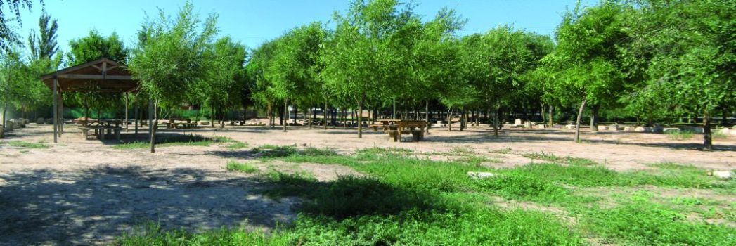
The Trail turns onto a slip road to the left, drifting away from the River Guadiana, and ventures through croplands during 2 km, until it reaches the Viñedos Motorway. It continues parallel to the motorway until the River Guadiana, where it turns left using an underpass. The Cervera Rest Area with benches, bins and shaded areas stands about 500 m from the endpoint of Stage 3.
Sites of interest
Profile
Highlights
Further information
Argamasilla de Alba
According to the topographic records from the days of Phillip II, Argamasilla de Alba was established in 1531-1532 by the keeper of Peñarroya Castle. However, the name, which dates back to 1214, was taken from Argamasilla Castle, which stood close to Peñarroya and Sotillo castles. The new town of Argamasilla was initially populated with inhabitants from nearby villages, such as Moraleja and Santa Maria, who lived in unsanitary conditions along the banks of the River Guadiana, upstream from its current location. These villages were abandoned, and the new Argamasilla was established in its current location. It was granted a city charter in 1612.
The town is home to several historic buildings that merit a visit, including the Church of San Juan Bautista (a votive painting by Rodrigo de Pacheco can be found within), the shrine of San Anton, Medrano's House, the house of Bachiller Sansón Carrasco (under renovation), and two granaries.
Bombos manchegos
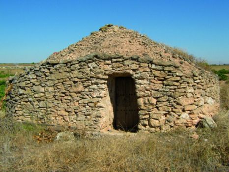
They are rural agricultural buildings, built with local stones (flagstone or slabs) unearthed by a plough, which are stacked along the property line.
The builder had to be an expert as the stones were laid without mortar. In architecture, this technique is known as the "dry-stack" method. The roof or cover is a false vault, and the floor is usually round. The dwelling may include a chimney, benches for resting, niches used as cupboards, hooks or stakes driven into the walls to hung farm tools, and a separate area used as a stable, where animals provided a heat source during the night.
There are three "bombos manchegos" in this Stage of the Trail.


