Net of Natural
Trails

Stage 14: Albergue Juvenil Puente de Retama - Puebla de Don Rodrigo
Description
Through the pine forests of Saceruela mountain range
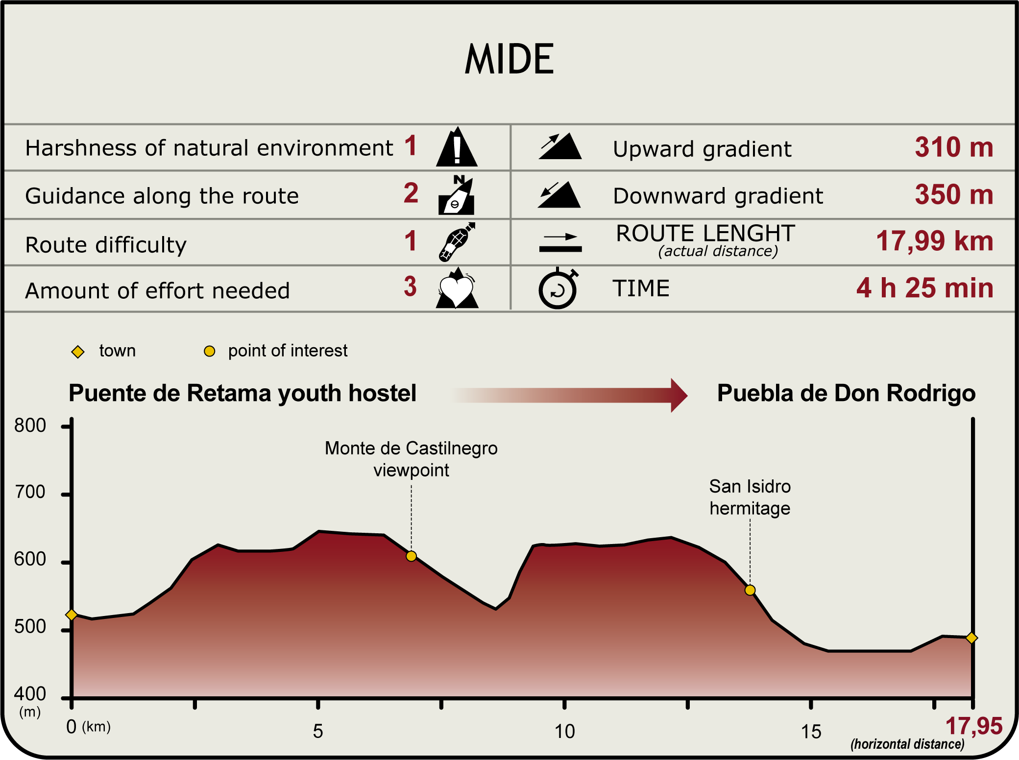
This Stage runs between a youth hostel in the forest and the town of Puebla de Don Rodrigo, on the edge of the River Guadiana. The first half of the route traverses through the pine forests of Sierra de Saceruela and the heathland, oak forests and scrub thickets of Sierra de Peribáñez. From the latter mountain range, the route winds down into a valley towards the N-430, along which it runs until Puebla de Don Rodrigo, the endpoint.centrada

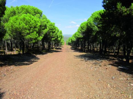
This Stage starts near Puente de Retama Youth Hostel, which offers sanitary facilities and accommodations, and nature-related leisure activities. After crossing the CM-415, the route runs mostly parallel to the N-430, albeit a few kilometres away, along trails that venture through the forests that cover the slopes of Sierra de Saceruela. Stone pines (Pinus pinea) and holm oaks (Quercus ilex), coexist or alternate initially. Further on, the forest vegetation is almost entirely pine, with an occasional oak stand.centrada
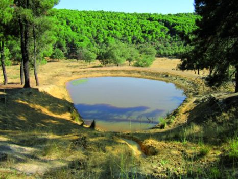
Traversing through the pine forest, the slopes lead to Peña de los Gavilanes, from where the first panoramic views are visible from the edge of the Trail. The landscape here is dominated by dense stone pine forests, whereas the steeper areas and forest clearings are covered by thyme (Thymus sp.) The route passes next to a fire pond, an artificial lagoon fed by a creek, used by water-dropping helicopters and pump engines to load water. The route also passes next to the ruins of a shelter, beside which grows a small oak (Quercus suber), stand, an unusual thing in this Stage. The Peña is situated on a highland, amidst tall trees.
The short walk along a firewall offers panoramic views of great depth of the River Guadiana, including the mountain ranges across the valley with their holm oak forests and scrub thickets.

The route skirts around Alto de la Alcachofa, Morro de la Gila and Morro de Castilnegro, occasionally running above the tree line, with stunning views of the pine forest and, even, of the holm oak woods across the valley. The Morro de Castilnegro is the highest peak of this mountain range. It is clearly visible from the beginning of this Stage, owing to the string of booster aerials installed on it. There is a well-signposted path from the Trail to the peak, next to a small goat farm. From here, the route runs through a pine-holm oak forest, with an occasional gall oak (Quercus faginea).
A paved road to the right leads to Casa de la Celadilla, a rest area near the River Guadiana, next to the N-430. Shortly after this intersection, the road drifts away from the pine forest. There is a viewpoint at the edge of the forest, also called Celadilla, from where one can enjoy a panoramic view of Guadiana Valley. From here, the route ventures into moorland dominated with thyme thickets, with scarcely any trees. At the end of this stretch, a long path perpendicular to the N-430 leads to the foothills of the mountain range. The landscape drastically changes to holm oak "dehesas", owing to centuries of human activity and livestock grazing.derecha

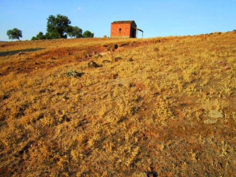
At the end of the slope, atop a hill to the left of the Trail, stands the shrine of San Isidro, a semi-derelict ancient building no longer used for religious worship. From here, one can enjoy beautiful views of the western slopes of the mountain range that the route has just passed through, of the nearby holm oaks and the dehesa in the valley.
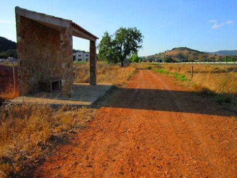
The remainder of the Stage to Puebla de Don Rodrigo runs along a dirt track parallel to the road, thus avoiding having to walk on the shoulder or along the road. This track has benches located throughout the route, as well as young trees and shelters (benches covered by a canopy), which provide cover from sun and rain.
The last stretch, between the road and the foothills of the mountain range, is dominated by dehesas where livestock graze. Cattle freely roam throughout the area, which has many ponds and watering holes, such as the one located at the foot of the hill where a beautiful shrine that blends in with nature stands.

Near the town, the route passes next to a recently built pedestrian stone bridge, which is part of the Trail's infrastructure. This bridge crosses over the Agua de las Cañadas Creek. The Trail ends on the edge of Puebla de Don Rodrigo, at the point marked by a Caminos Naturales information panel.
Finally, it should be noted that part of this Stage, just like previous sections, traversed through the “Ríos de la cuenca media del Guadiana y laderas vertientes” SCI (Site of Community Importance) and SPA (Special Protection Areas for Birds).derechaAdditional information
Sites of interest
Profile
Highlights
Further information
La Mesta
The Mesta is regarded as one of the most important corporate groups or guilds in medieval Europe, and the first cattle-breeders guild in Europe.
One of the main legacies of the Mesta is the cattle trails found throughout the country that were used for seasonal migration of livestock. Some of these trails are part of the routes used to design the Guadiana Nature Trail.Interesting linksAyuntamiento de Puebla de Don Rodrigo


