Net of Natural
Trails

Stage 13: Luciana - Albergue Juvenil Puente de Retama
Description
From Campo de Calatrava to Montes County
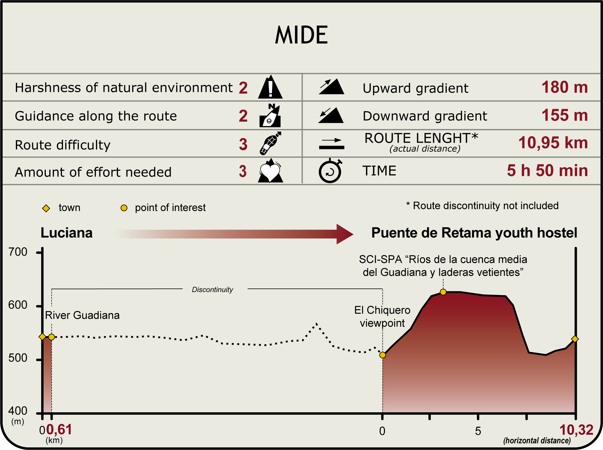
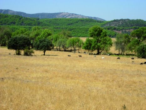
This winding Stage traverses through Montes County, always along the River Guadiana, which it fords three times. Holm oaks and livestock pastures, flanked by small mountain ranges, dominate the landscape. The route ends at a youth hostel in the shadow of a stone pine forest.

The Stage starts in the outskirts of Luciana, near a playground. From here, it heads to a large rest area under a large tree canopy with tables and benches. This first part of the Stage overlaps with the final stretch of the Stage 11. The route advances towards an intersection where several roads leading to Luciana come together: the road from Pozuelos de Calatrava and Alcolea de Calatrava (refer to Stage 12) and the path from Peñuelas, which starts on the N-430, near the bridge over the River Bullarque.
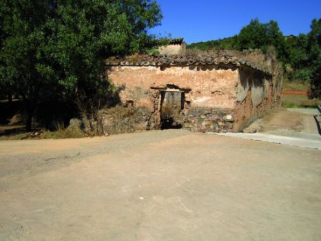
Soon after, the Trail arrives at Comendador Mill, a derelict building of ethnological and cultural value, situated in an ash forest with trees of remarkable height and thickness. Next to the mill is a wide footbridge on the Guadiana that spans both branches of the river. From here to the next crossing over the Guadiana, the Stage overlaps with the short CR-24 route.
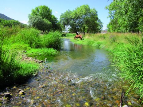
The road continues west, hugging the left bank of the river. The beauty of this section of the river, with well-formed riparian vegetation, including poplars (Populus sp.), ashes(Fraxinus angustifolia) and willows (Salix sp.).

The Trail and the river gradually advance towards the foothills of Villarreal Mountain Range. Through the faults in the rocks and clearings in the forest, one can enjoy a spectacular view of the width and flow of the Guadiana along this Nature Trail, and of Luciana and its surroundings on the other bank.
Several colonies of white water lilies (Nymphaea alba): can be found near El Batán. These aquatic plants, with floating leaves and large flowers that are rooted in the bottom of the river, will be a constant presence in the next Sections of the Trail.
Past Despeñadero de Michos Creek, a small stream along the Trail, the route comes across a few isolated, inactive livestock farms. Increasingly, there are clear signs that this is a protected area. The territory is dominated by rain-fed crops, and animals are a common sight, including deer (Cervus elaphus) and small mammals.

Past an umbrella-shaped bend in the river, the landscape to the left of the Trail becomes increasingly populated with holm oaks (Quercus ilex ) scattered throughout pastures. The Guadiana continues its course along the right bank, occasionally dividing into two branches with an island in the middle. This section of the river can be easily accessed to contemplate the riparian vegetation and abundant amphibian fauna.
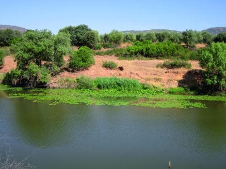
Past Boquerón Creek, a rapid-flowing watercourse from Sierra del Campillo that bounds the narrow Guadiana valley to the left, the route fords the river again. However, this should only be attempted when the water level does not pose a danger. This is the endpoint of the aforementioned PR-CR-24. After crossing the ford, the route comes upon the CR-25, another short route that runs perpendicular to the river, across the flood plain along the right bank. It continues along Camino de los Malos Pasos, at the foot of the slope, which bounds the valley to the north. After about one kilometre, the route crosses a fence, then turns north and takes a shortcut through Vereda de la Dehesa; thus avoiding the River Guadiana as it meanders through Rincón de la Vega, an area without any path near the river. It then passes next to Valparaiso Lagoon, blanketed with vegetation. Leaving the lagoon to the right, the route continues along a tight meander of the Guadiana. This Stage abandons PR-CR-25 at this point where the river folds back on itself. Further on, the route arrives at Chiquero Viewpoint where one can relax and enjoy the beautiful landscape.

The Trail heads back to a ford in the river and crosses to the left bank, along which it will continue until the end of the Stage. The path winds along Camino de Luciana; first, through a holm oak forest known as El Encinarejo, and then along the slopes above the valley, skirting around Raña de la Huelga. Past Valhondo Creek, a stream that rises in one of the small mountain ranges to the south, the Trail skirts around a fenced hunting reserve. The final stretch traverses through Cordel de Navalrincón, a cattle track perpendicular to the route that emerges from a pine forest, and then continues towards the flood plains of the Guadiana. Further ahead, it also crosses Riofrío Creek, which carries quite a lot of water; although it runs dry in summer.
Henceforth, the Trail runs along a wide path on the edge of stone pine (Pinus pinea) forests that surround Puente de Retama Youth Hostel, the endpoint of Stage 13.
As in other Sections, the Trail traverses through the “Ríos de la cuenca media del Guadiana y laderas vertientes” SCI (Site of Community Importance) and SPA (Special Protection Area for Birds).
Sites of interest
Profile
