

Net of Nature
Trails

Stage 2. Degollada de Peraza – Chipude






Description
Among the striking rock formations and natural fortresses, visitors find themselves immersed in the heart of the laurisilva forest, its unique beauty etched into the memory
The 16.6 kilometres of the second stage of the Nature Trail, from Degollada de Peraza to Plaza de Chipude, winds through a spectacular landscape of rugged terrain, dotted with rocks and impressive ravines. This section passes through one of the island’s most valuable natural areas, Garajonay National Park, home to the finest example of laurisilva forest in the entire Canary Islands archipelago.

The Degollada de Peraza viewpoints is the starting point for this new stage. Our route begins on the path to the right of the information panel, continuing up a flight of steps adjacent to the GM-2 road, leading to a small flat area known as Los Campos de las Nieves. Along this stretch, heather emerges on either side, a sign that we are entering the area where the vegetation transitions towards the edge of the cloud forest.

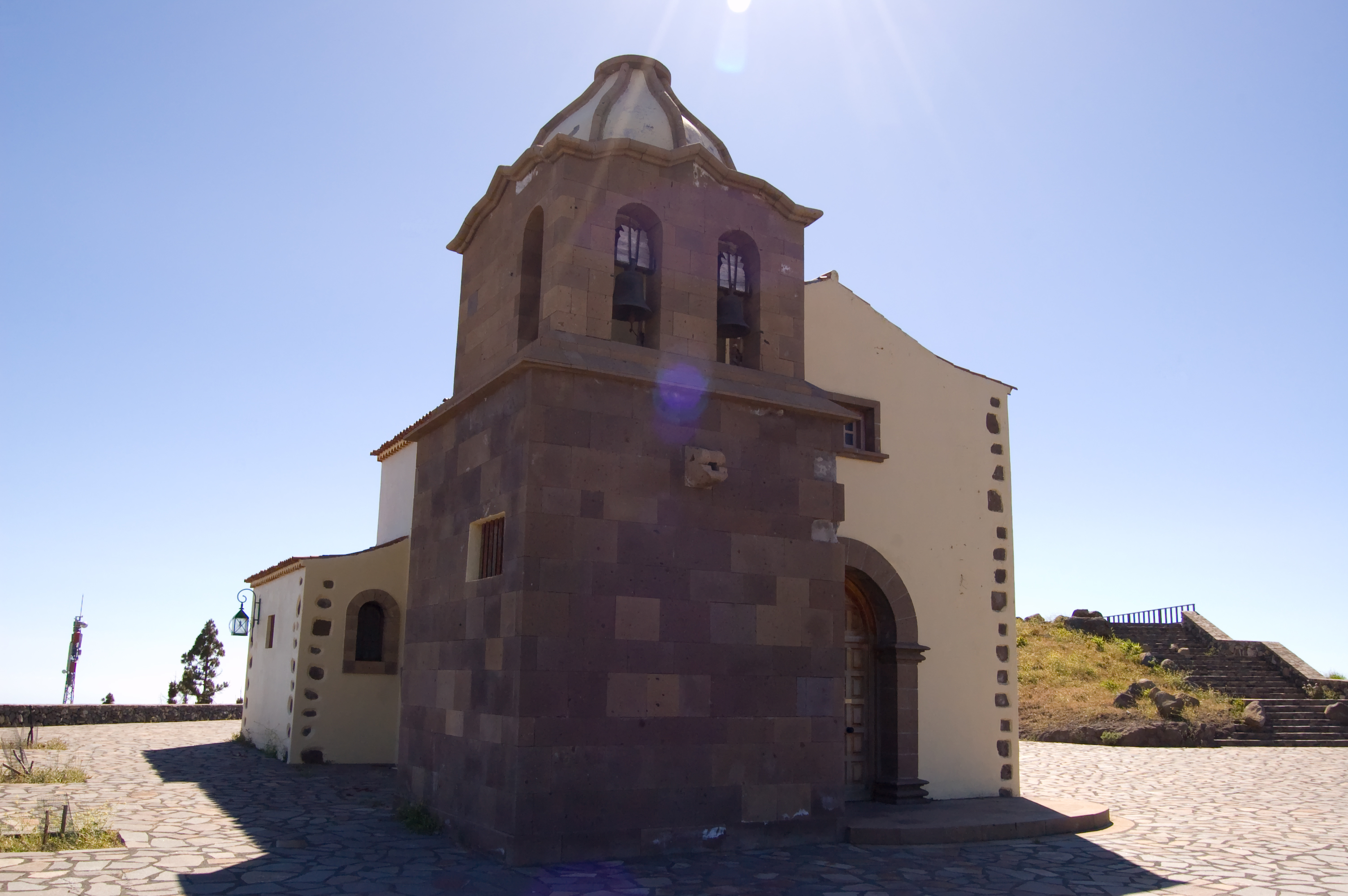
After walking for about 800 metres, and turning right at a private house, we reach the junction with the road leading to the Shrine of Las Nieves. Continue along this paved path for 700 metres, as the heather becomes increasingly dense and lush as we approach the shrine. A stone ramp to the right leads to the recreation area at the Shrine of las Nieves, where here are numerous tables and barbecues for visitors enjoy some respite and really take in the surroundings. Inside the shrine there is an image of the Virgen de la Salud, whose feast day is celebrated on the second Sunday in October.

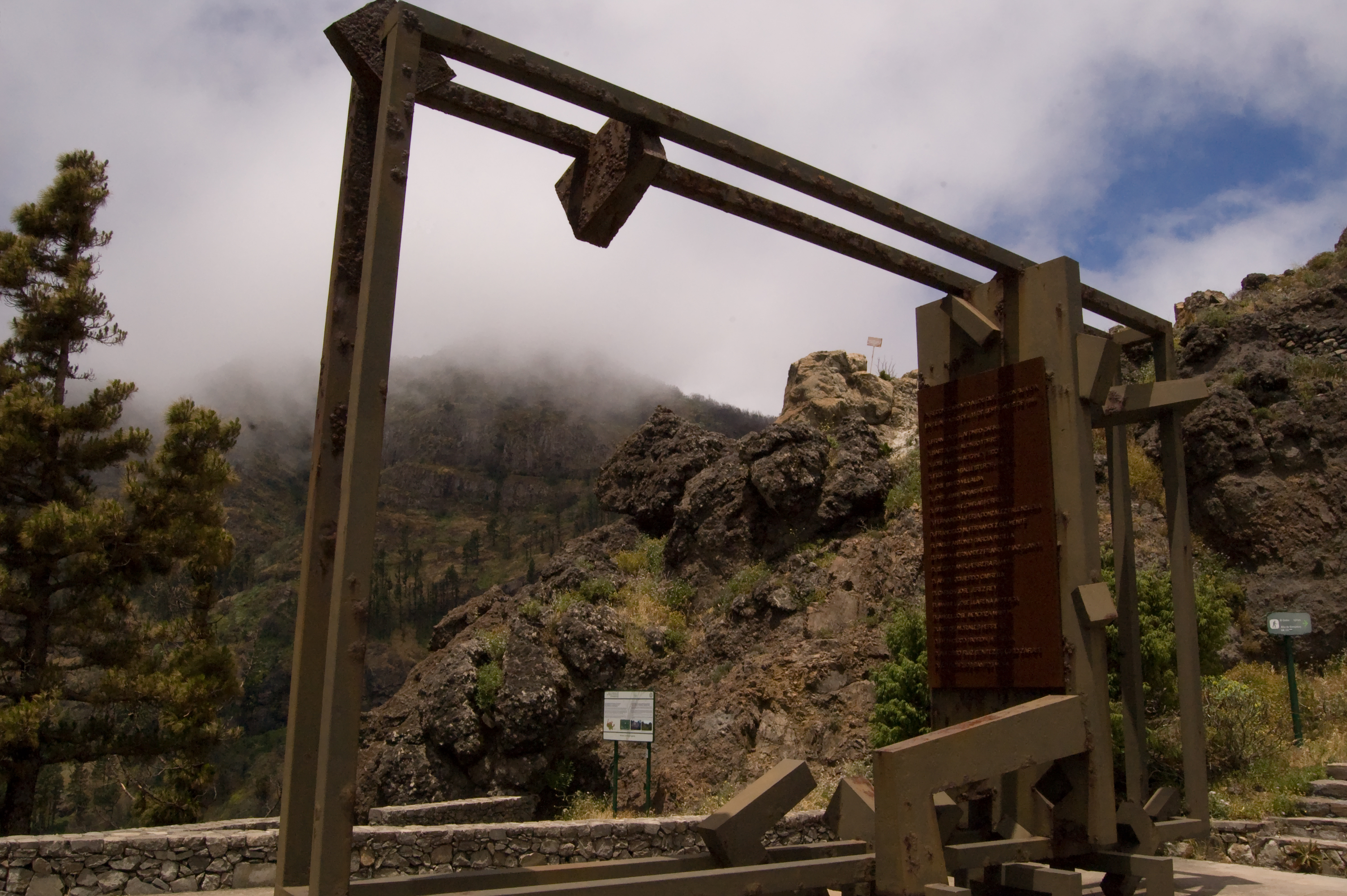
Returning to the trail, we cross a section where the path winds its way between moss-covered slopes. Descending through Canary Island pine forest and dense heathland, we reach the GM-2 road. On our right is a dense forest covering the slopes of the Las Lajas ravine. The route continues along a narrow metal footbridge running parallel to the road, from which we can see a typical volcanic dyke up close on one of the embankments. A few metres further on, after crossing the road, the walkers can stop at the viewpoint where the monument to the victims of the tragic 1984 forest fire stands, while taking in the imposing mass of the Roque de Agando outcrop, at the head of the Barranco de Benchijigua ravine. The path continues towards the Los Roques viewpoint, from where, weather permitting as mist is so common in this area, visitors can once again admire the steep slopes of the Barranco de Benchijigua ravine.

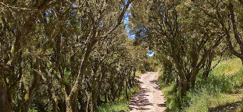
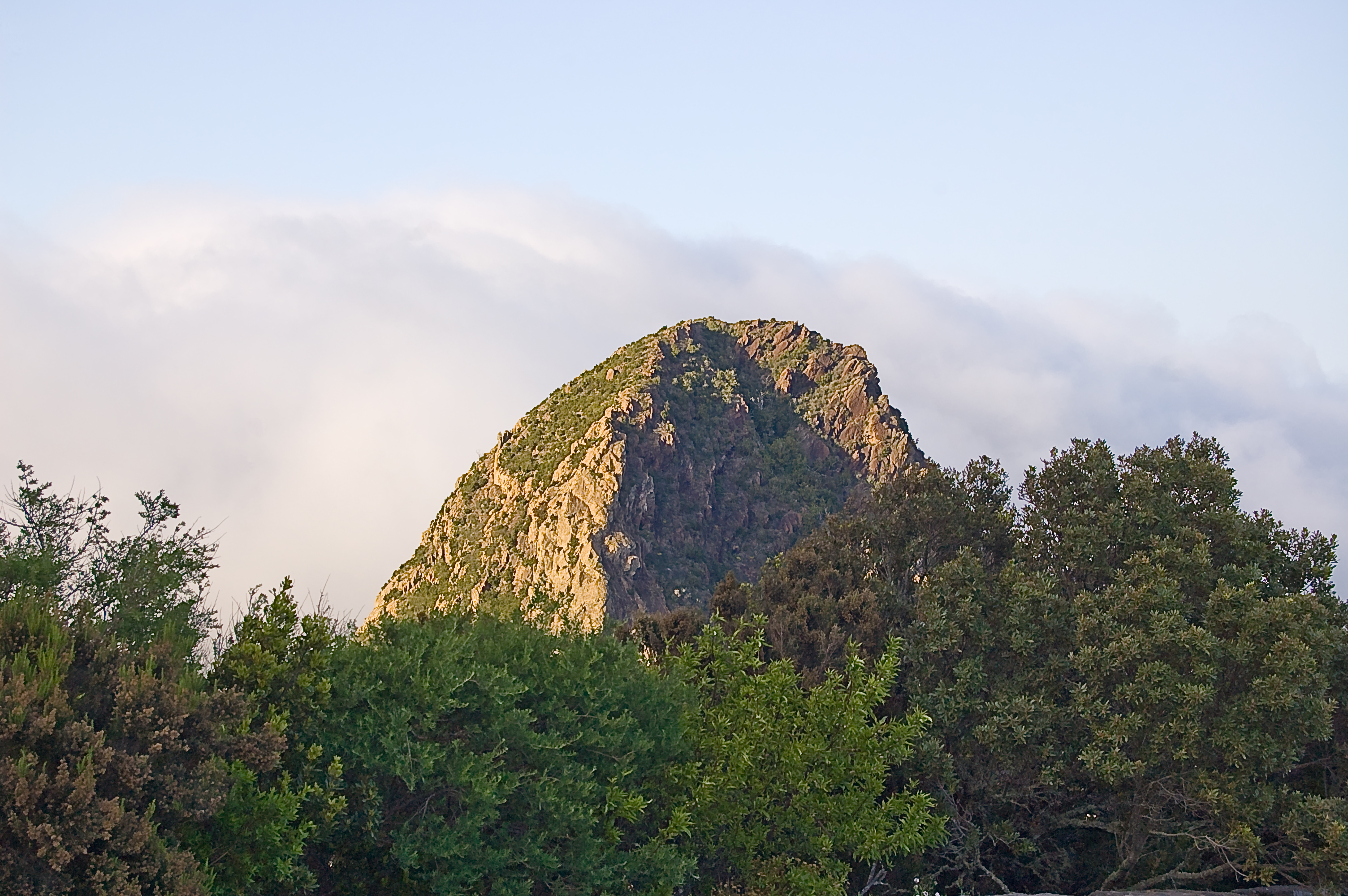
Crossing the road, the path leads us straight into the island’s characteristic fayal-brezal woodland, where faya (Myrica faya) and brezo bush grow alongside other species like Canary Island holly (Ilex canariensis), laurustine (Viburnum rigidum) and peralillo (Maytenus canariensis) along with an abundance of ferns. Crossing the road once more, the path winds its way uphill through this woodland, where ivy, long curtains of moss and lichen cover the tree trunks. Advancing further still, a sign indicates a turn-off that's not to be missed, leading as it does to the spectacular Morro de Agando viewpoint. From here, one can take in the full view of the Los Roques Natural Monument, an impressive group of volcanic peaks that make up one of the most striking landscapes along the route, with the Roque de Agando directly ahead and Roque de La Zarcita and Roque de Ojila standing imposingly on the left. This spot also offers a chance to see how nature is slowly reclaiming this area so badly devastated by wildfire in August 2012 – a blaze that affected 3,000 hectares of the island and destroyed more than 20% of the Garajonay National Park. Returning to the trail, a wooden footbridge crosses the GM-2 leading to the Tajaqué viewpoint. Here, weather permitting providing the frequent mists carried by the trade winds don't obscure the view, visitors can once again admire the volcanic caldera of Benchijigua, one of the island’s great ravines and home to the Benchijigua Integral Nature Reserve.

The path continues for a few metres alongside the road, before descending the hillside, where walkers can see the slow but steady recovery of the forest in the areas affected by the 2012 fire, noting how most of the beech trees have resprouted vigorously from their stumps. Further on, the path joins a forest track; turning to the right before reaching the road again. At this point, the route continues parallel to the GM-2, offering views of the area known as the Lomo de La Mulata, with the imposing outcrop of Roque de Agando on the horizon, until we reach the Pajarito roundabout.
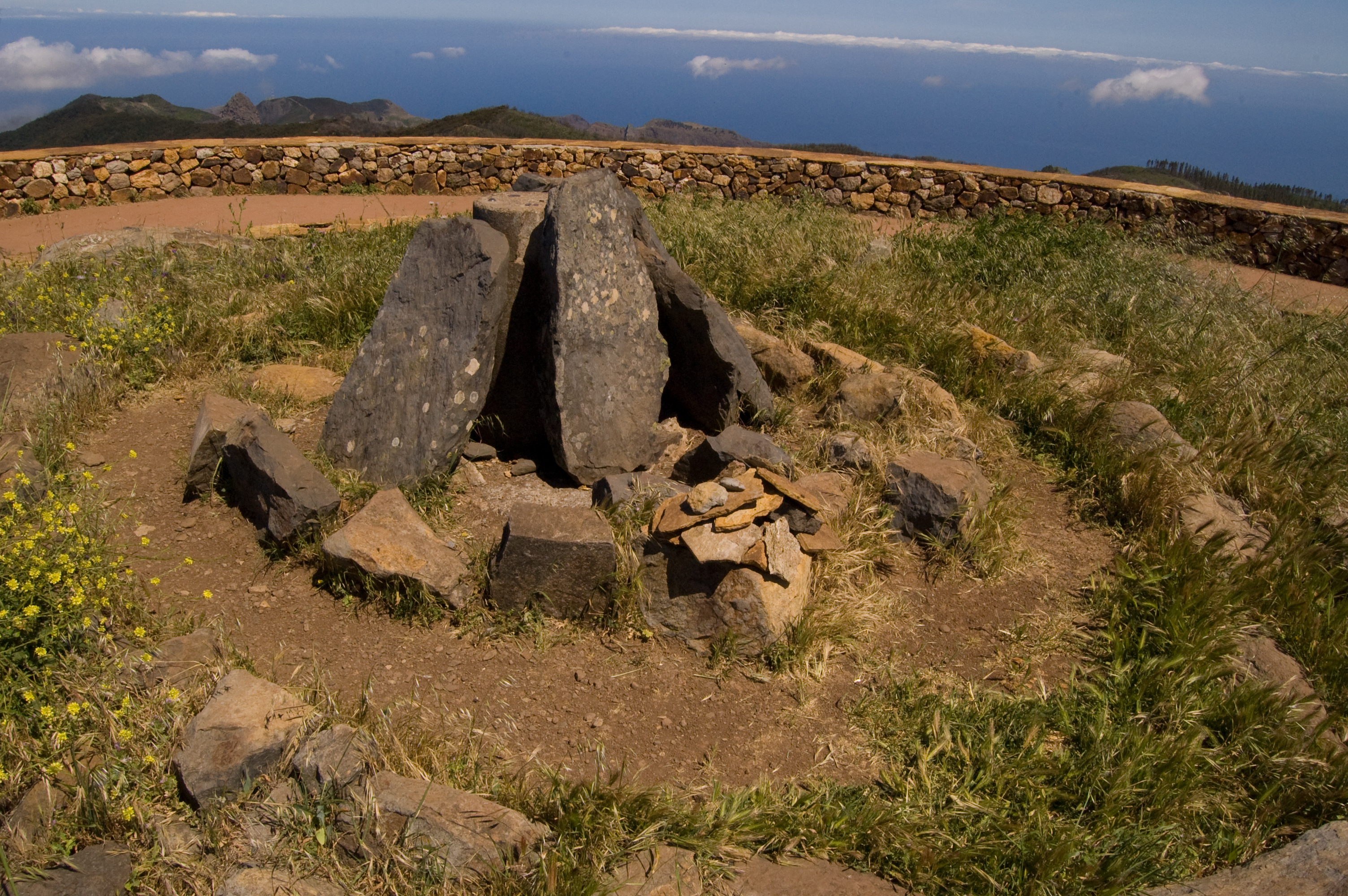
To the left of the junction, like the rest of the route, clearly signposted, we embark on an uphill stretch of path of almost 1 kilometre; the first section offering a glimpse of what these hills were like before the 2012 wildfire. A young fayal-brezal woodland, where heather, gorse and a few laurels are accompanied by a sparse undergrowth of local thistle (Sonchus hierrensis) and nettles (Urtica morifolia), accompanying us on the ascent to the peak of Alto de Pajarito. A left turn leads directly to Alto de Garajonay, which, at 1,487 metres above sea level is the highest peak on the island. On clear day, one can even make out the neighbouring islands of Tenerife, La Palma, El Hierro and even Gran Canaria. It's the perfect opportunity for visitors to pause and take in the island’s many valleys, ravines, natural "fortresses" and rocky outcrops. Skirting the hilltop stone structure, once a ceremonial site for the pre-Hispanic inhabitants of La Gomera, take a stone path to the right, beginning the gentle descent towards Igualero.

Several routes converge at this point, but the signposting makes it easy for us to continue the route. With the imposing silhouette of one of the island’s most distinctive natural landmarks guiding us – the Chipude Fortress – after just over 1 kilometre we leave the forest track and take a winding path downhill to the right, where we can see the reforestation work carried out in the area affected by the 2012 fire.
Reaching the CV-17 road, the trail continues along the access road to Igualero, although it soon veers off to the right onto a path that runs parallel to the road and leads to the open area at the Igualero viewpoint. This viewpoint features a monument to the Gomero whistle, and a shrine built in honour of Saint Francis of Assisi, patron saint of the forestry trade. Why not take a pause here to take in the full panorama of the Barranco de Erque ravine, within the Orone Protected Landscape, with the Chipude Fortress Natural Monument in the background, and observe how the dense vegetation of the island’s central highlands gives way to scrubland and, gradually, to an increasingly arid landscape.

The route continues along the asphalt path to the left of the shrine, leading us down to the village of Igualero. After just over 500 metres, and following a right-hand turn, the road becomes a footpath which, running along the edge of a steep slope with the Fortress still on the horizon. The trail winds its way around the Erque ravine, offering a sweeping panoramic view of the landscape, dotted with groves of Canary Island pine.
Once past the China Dam, the route continues for around 700 metres along a tarmac section shared with road traffic, where we can admire formations of Canary Island date palm trees (Phoenix canariensis), before turning left onto a path running under the north face of the Fortress, at the foot of which lies the village of Pavón. On the almost vertical faces of this iconic mountain, one can see a rich variety of rock-dwelling flora, including endangered species such as the cabezón de sataratá (Cheirolophus satarataënsis) and siempreviva (Limonium redivivum), amongst other endemic species.
Once in Pavón, and after crossing the CV-12 road and the Barranco de Iguala ravine, the route alternates between paved and unpaved sections until it reaches the village of Chipude, within the municipality of Vallehermoso. Here, this second stage of the Camino Natural comes to an end in the village square.
Entidades gestoras
Puntos de interés
Culture
- Ermita de las Nieves
- Iglesia de La Candelaria
- Ermita de Igualero
- Monumento a las Víctimas del Incendio del 11-9-84
Geology
Hydrography
Information
Municipality
Orography
- Fortaleza de Chipude
- Alto de Garajonay
- Barranco de Erque
- Roque de Agando
- Roque de Ojila
- Roque de la Zarcita
- Barranco de Iguala
- Alto del Pajarito
Hostel
Vegetation
Profile
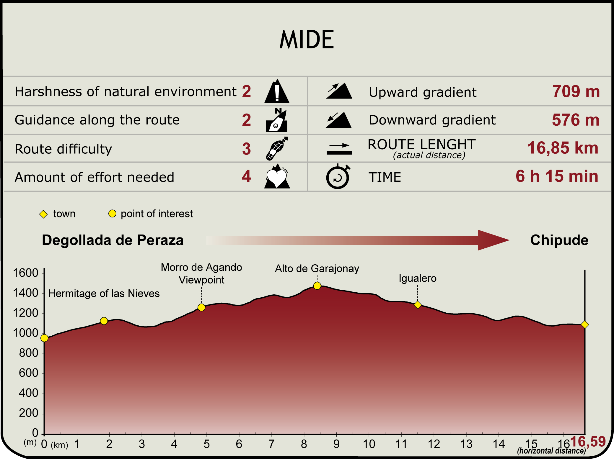
 Harshness of natural environment
- 1. The environment is not risk-free
- 2. There are more than one risk factors
- 3. There are various risk factors
- 4. There are quite a lot of risk factors
- 5. There are many risk factors
 Guidance along the route
- 1. Well defined trails and crossings
- 2. There is a clearly marked trail and signage
- 3. Requires the identification of geographic features and cardinal points
- 4. Requires off-path navigation
- 5. The trail is interrupted by obstacles that have to be gone around
 Route difficulty
- 1. Walking on a flat surface
- 2. Trails with different types of path
- 3. Walking on stepped paths or irregular terrain
- 4. The use of hands or jumping over the terrain is necessary
- 5. The use of hands is required to progress
 Amount of effort needed
- 1. Up to 1 hour of continuous walking
- 2. Between 1 and 3 hours of continuous walking
- 3. Between 3 and 6 hours of continuous walking
- 4. Between 6 and 10 hours of actual walking
- 5. More than 10 hours of continuous walking
(Calculated according to the MIDE criteria for an average excursionist with a light load)
Highlights
Further information
Rocks and fortresses
La Gomera is a volcanic island with geological formations whose basalt complex dates back more than 20 million years, formed by the accumulation of material ejected from various eruptive periods interspersed with long periods of calm. Unlike the other islands in the archipelago, the last eruptions took place over two million years ago, and the differential erosion of the erupted materials has given rise to these impressive geological formations.
Roques, volcanic rocky outcrops are geological formations of volcanic origin formed by the accumulation of dense masses of lava that became trapped in volcanic conduits without reaching the surface, cooling very slowly and solidifying from within. The subsequent erosion of the materials covering these central lava flows gave rise to the numerous volcanic peaks found on the island, such as Roque Cano and Roque de Agando.
Fortaleza, or fortress, is the name given to certain mountains characterised by rocky slopes and a more or less flat summit. The Chipude Fortress, which stands at an altitude of 1,243 metres above sea level and has a diameter of 300 metres, is one of the most striking in the Canary Islands and is clearly visible from the island of La Palma. It is of intrusive origin (trachyandesite, which is acidic and highly viscous), formed by the accumulation of highly viscous lava that travelled very little distance on the surface; this lava, accumulated at the mouth of the volcanic pipe and has since been exposed by erosion. It has been a Natural Monument since 1994 and is part of the Orone Protected Landscape Area. It is also included in the Natura 2000 network as a Special Area of Conservation.
Multimedia






Downloads

GPS Downloads