Net of Natural
Trails

Stage 5: La Calera (Valle Gran Rey) - La Dama
Description
Heading off south, between hills and ravines
Along the 16.5 km of this Stage of the trail, which runs between La Calera and La Dama, we will meet steep slopes, such as those of the hill of Lomo del Harinero (Harinero Ridge) or the ravine of Argaga, but also gentle hillocks dividing the ravines in the southern part of the island. At the end, we will reach the village of La Dama, with one of the most extensive banana growing areas in the whole island.

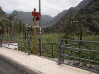
This Stage of the trail begins in La Calera, at the small parking situated next to the main road CV-7, right in the place where we can see an information board about the nature trail. After little more than a kilometer, the trail runs along the road to Arure, until reaching the small village of El Guro, where the trail turns right towards Gerián and La Dama. After taking this detour, the trail crosses a wide ravine bed where the ravines of Arure and Valle Gran Rey converge, and where we will see a thick reed field.
These ravines, created in dry periods, when there was no vegetation cover to protect the soil from the erosion caused by the action of water, are now an important source of life and fertility, since the water flowing through them makes possible the growing of numerous orchards and crops. The large-scale hydrological projects carried out in the riverbed - which can be seen in the first part of the trail – show the least amiable side of these deep ravines, which, in the rainy season, carry a considerable amount of water with a high load-bearing capacity; for this reason, it is possible that hikers might not be able to cross the river bed.

After passing the river bed, a set of steps leads to the “ermita” or shrine of Los Reyes, dating back to the sixteenth century and located under the shadow of a beautiful Aleppo pine (Pinus halepensis). As indicated on a plaque mounted in the square next to the church, residents of the valley used the movement of the shadows cast early in the morning by the ravines on this place to fix the schedules of irrigation water turns between Valle Alto (the upper valley) and Valle Bajo (the lower valley).
After going around the shrine, the trail veers right, passing under a sediment retaining dam wedged into the steep walls of one of the numerous ravines that make up the valley. Under the shadow of two huge trees next to the stone paved road, a sign reminds travelers that they are entering the protected natural space of Valle Gran Rey, and, accordingly, they should be extremely careful to respect the environment traversed by the trail.

The trail continues, coasting between terraces along a hillside, with beautiful views of the palm grove which occupies the bottom of the valley and of numerous agricultural terraces - now invaded by spurge (Euphobia sp.), century plants (Agave americana) and prickly pears (Opuntia maxima), - that go up the steep slopes of the ravine as if climbing up a ladder. The blackened trunks of palm trees serve as a reminder of the dreadful fire that razed in 1992 a large part of the valley, forcing the evacuation of the local population, and are also a sign of the fragility of the environment; for this reason, environmental protection rules must be respected, and extreme caution should be used to prevent a repetition of the catastrophe that took place that fateful year.
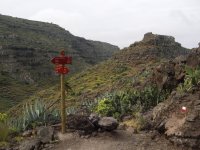
After some 10 min, a directional post near a beautiful house marks the point from where the hiker has to turn right in order to start an extremely challenging and long ascent that runs along a set of stone steps during the first meters.

This steep ascent up a rocky hillside soon offers hikers spectacular views of Valle Gran Rey, immersing them in a landscape of dazzling beauty in which the traveler can see the tracks of different mudflows corresponding to successive eruptive periods in the higher parts of the valley, with nearly vertical rock faces and rocky cliffs almost completely bereft of vegetation, except for small rupicolous plants surviving in crevices. In the lower, less steep parts of the valley there are many villages and rural settlements such as Casa de La Seda, los Granados, La Vizcaína or Chelé, with white houses that catch the eye of visitors among the green of the lush vegetation that grows in the fertile bed of the valley, where there is a beautiful palm grove.
After a twisty and challenging ascent along Lomo del Harinero (Harinero Ridge) we finally reach Collado del Cerrillal (650 m), where we can revel in the magnificent views of Valle Gran Rey, with the hillock of Mérica across from us (traversed by Stage 3 of the Nature Trail) and the fertile ravine of Argaga, with its terraced slopes carpeted with a green mantle speckled with Euphorbias, century plants, and beautiful palm groves, and home to several endemic plants threatened with extinction, such as the Chirolophus sataratensis or the Limonium dendroides.

The hiker is now faced with a stretch of smooth descent under the cliffs, and, after negotiating the brook of Argaga, there is another ascent – much less challenging this time – towards Gerián. We can see again on this hillside numerous terraces that support some almond and fig trees, another sign of the agricultural past of this region. Here hikers will meet a path to the left towards Chipude; however, the nature trail goes on straight ahead, gaining height, and soon offers beautiful views of the shrine of Guará or Ntra. Señora de Guadalupe, which clings to the spur of Roque de Guará.
After the ascent, the road turns right and continues a gentle descent along the hillside toward Gerián. After crossing the access road to the small shrine, the trail continues its descent – between derelict terraces invaded by spurge - toward Casas de Gerián. As we continue our journey between the houses of the village, we reach an asphalted Stage of the road that offers a spectacular view of the ravine of Argaga, on the right side of the route; shortly after, the road veers right and continues its descent, crossing again the asphalt road a few meters ahead.

After the small rural village of Gerián, the road descends, surrounded by an inhospitable landscape that offers no shelter whatsoever to hikers, and crosses the small ravine of Tejo, through which we can glimpse the beach of Las Arenas at the mouth of the ravine of Argaga.
After almost 1.5 km, the trail crosses a dirt track and, after converging with it for a few meters, it branches off to the left to descend along the hillock of Pelé toward Verodal along a well-marked path, from which we can see La Dama and its banana groves over the other hill.
If the hiker looks back, he will be surprised by the imposing profile of Fortaleza de Chipude dominating the horizon. To the left of the path, we will see the ravine of Iguala, with several banana groves stretching out on the steep slopes. After kilometer marker #78, we move away from a small village in the area known as El Verodal, as we descend gently but steadily down the ridge. After we skirt the remains of the walls of old banana plantations that used to operate in this place, the path reaches Punta de Iguala, offering gorgeous views of the majestic cliffs towering over the beach of Las Arenas, as well as of the place where the ravine of Argaga meets the sea and the point of Santa María.

On the hill, a directional post indicates the distance to the next village, La Dama, still 5.9 km away. Now starts a Stage of steep descent toward the beach of Iguala. After crossing the bed of the ravine of Iguala (one of the largest ravines of La Gomera), where a lot of sediments are accumulated after having been dragged by the strength of the water, and where the ever green balos (Phlocama pendula), seem to thrive without any hindrance, the trail begins its ascent, going up the ravine and, after about 1 kilometer, we pass by a detour to the left that leads to an old traditional well. A little further on, we must make a sharp turn to the right and pass by another path to the left that leads to the banana groves that we have already seen from the hill of Gerián.
After reaching the small Degollada de Tirneo, and after passing by the ravine of Quines, the trail continues its ascent immersed in a fascinating combination of colors created by the brownish, rocky slopes covered with balos, gorse and spurge, shrubs perfectly adapted to the arid conditions prevailing in the southern part of the island, where rainfall is less than 300 mm/year and sunshine duration is more than 3,000 hours per year.

After taking a sharp curve to the left, skirting Cabezo de los Guirres under the ridge of Lomo del Verebal, we advance now – for approximately 1 kilometer - along one of the slopes of Barranco del Horno (ravine of Horno). After a gentle but steady ascent, we take another sharp turn to the left, passing under the walls of the numerous banana farms that carpet the wide hillock and, after some 600 m, we reach the main road to La Dama, CV-12, where, a few meters ahead, there is an information board that marks the end of this Stage of the trail.
Managing Entities
Puntos de interés
Culture
Municipality
Hostel
Passport
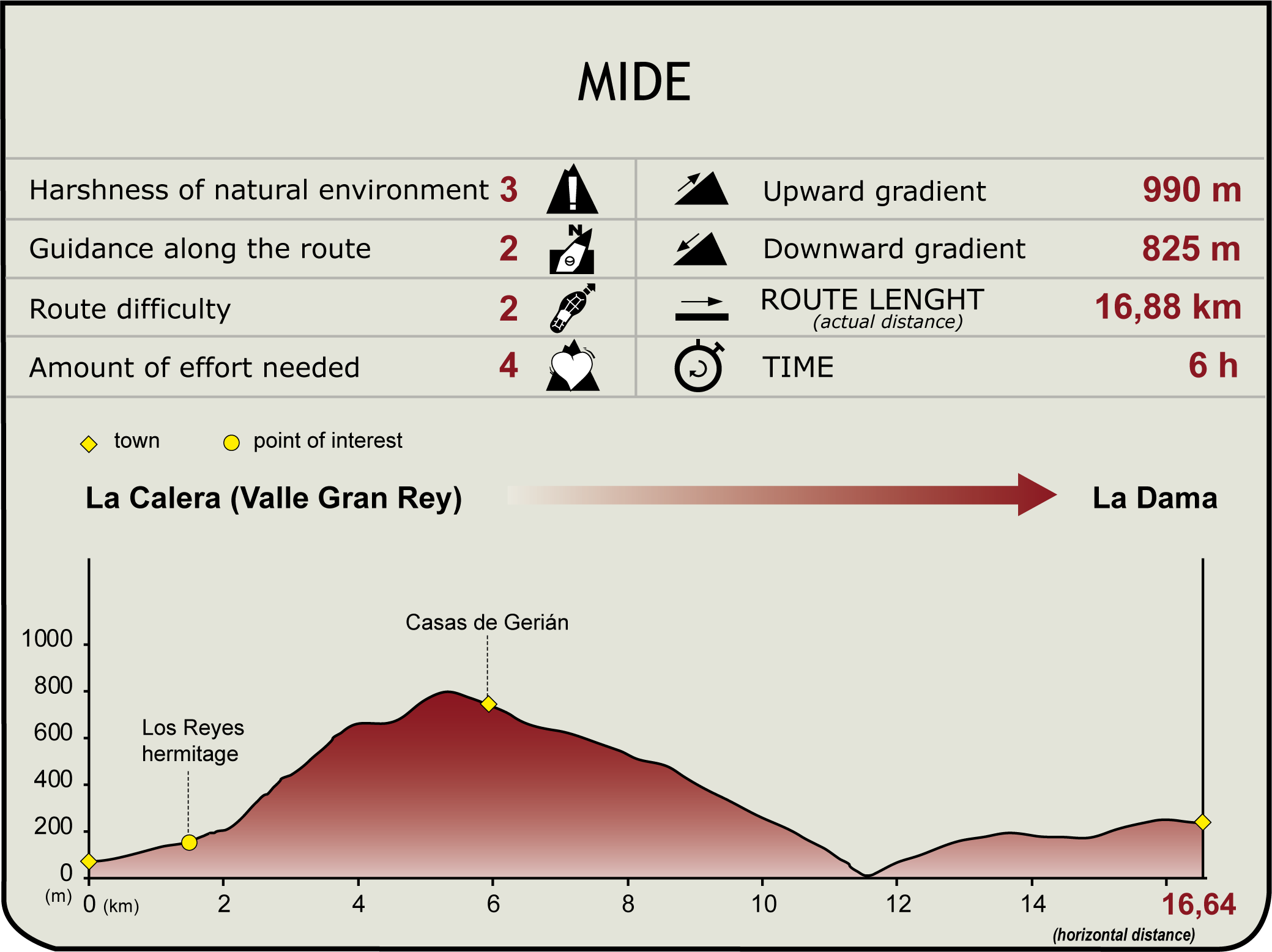
Profile

(Calculated according to the MIDE criteria for an average excursionist with a light load)
Highlights
Further information
The origins of the banana tree in the Canary Islands
Banana trees are plants of the genus Musa, characteristic of tropical climates, with mild temperatures and abundant water. They originally come from tropical Asia (Southeast Asia, India and Malaysia) and now grow on five continents. The arrival of this genus to the African continent dates back to the fifth century, reaching the mainland through Madagascar and then thriving on the shores of the Mediterranean from the sixth century. The arrival of the banana tree to the Canary Islands took longer, as it finally reached the archipelago through Guinea as a result of the African conquests of the Portuguese. From the Canary Islands, bananas were introduced in America in the course of the colonizing expeditions to the New World.
Banana cultivation in the Canary Islands was promoted by British merchants at the end of the nineteenth century, and banana farms were created in all the islands except Fuerteventura and Lanzarote, where water was too scarce. Large-scale banana cultivation in the Canary Islands began in the early twentieth century, when strong investments were made mainly by British firms; a decisive part in this trend was played by the modernizing of irrigation systems, which, in turn, fostered the development of a flourishing agricultural sector based initially on the farming of tomatoes and then of bananas.


