Net of Natural
Trails

Stage 8: Cala de Algaiarens - Cala Morell
Description
The transition between a landscape shaped by the tramontane and another shaped by drought
This short stage begins in a pine grove over sandy areas and then climbs up to the cliffs of Curniola. On the way you will pass from a landscape shaped by the tramontane to a landsape shaped by drought, with the consequent change in the vegetation. The entire stage runs through Natura Network areas, and the La Vall SCI and SPA.

The Algaiarens beach car park is the starting point for this new stage. This beach is one of the most visited in this area of the island, so be careful with car traffic. Leaving the car park behind, you will continue along the dirt track, walk on sand and enters a dense pine forest of Aleppo pines (Pinus halepensis) accompanied by typical Mediterranean vegetation such as green heather (Erica sp.) and evergreen oaks (Quercus ilex).
After about 800 m of walking under the pleasant shade of the pine forest, you will leave the sandy track to your left and enter the Fontanelles cove. Unlike other coves in the north of Menorca, which have a more natural appearance, this small cove bears the marks of a heavy human use, with a concrete pier occupying almost half of the cove, a building on the right bank and ruins of other constructions on the left bank.
The trail continues precisely between the remains of these constructions and the rocks of the cliff. It begins to climb up the west wall of the cove, among labiérnagos and scorpion broom, which are soon accompanied by lentisk trees, heather, small pines and bushes of the wild chamomile which is endemic to Menorca. The route then takes a wide left turn, leaving Punta Blanca to one side. Looking straight ahead, you may enjoy beautiful views of Punta de Curniola and the codolars (small pebble beaches) of Curniola and Binatram.

Before arriving there, you will walk along the Binatram codolar. Some black junipers are dotted among the vegetation and, straight ahead, there is a stone wall that marks the enclosure of farm and, further on, a track coming from the right you must ignore, as your trail continues northwards, until it reaches a gate that you must cross.
The route continues between a stone wall on the left and shrubby vegetation made up of gorse, laburnum, heather and mastic trees on the right. As you go on, the pines grow denser until you end up walking through a real pine forest. In the middle of the forest, attached to the stone wall, the path comes across the Corniola cistern, a traditional construction for collecting rainwater.
After going around the cistern, the pine forest begins to lose its density, giving way to the scrubland landscape already known in other sections, and the houses standing by Cala Morell begin to be seen on the horizon. The path, which continues alongside the stone wall, comes to another wall that encloses the residential complex, and continues northwards until it reaches the gate that allows access to the village.

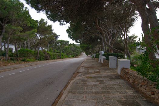
The route runs along Via Làctia street, passing through the villas of the residential complex. Along this stretch you will pass by a detour that indicates how to reach a Naviform settlement located on the point of Cala Morell. It is important to remember that you are going through a town, so you must respect the rules of the road and take care at road junctions.
You will reach a roundabout just before leaving the village: take the exit on the right, which goes down Calle Lira and leads to the access to the necropolis of Cala Morell. We recommend you to visit this necropolis, which as used from the pre-Talaiotic period until the 2nd century, and before walking the rest of the stage, it is advisable to take a look to the north and enjoy a beautiful panoramic view of the ravine that begins next to the necropolis and ends at the cove from which the residential complex of Cala Morell. The end of the stage is near.
To reach it, you just have to walk about 150 m up the slope of Calle Lira until you reach a gate that allows you to leave the residential complex.
Links of interest
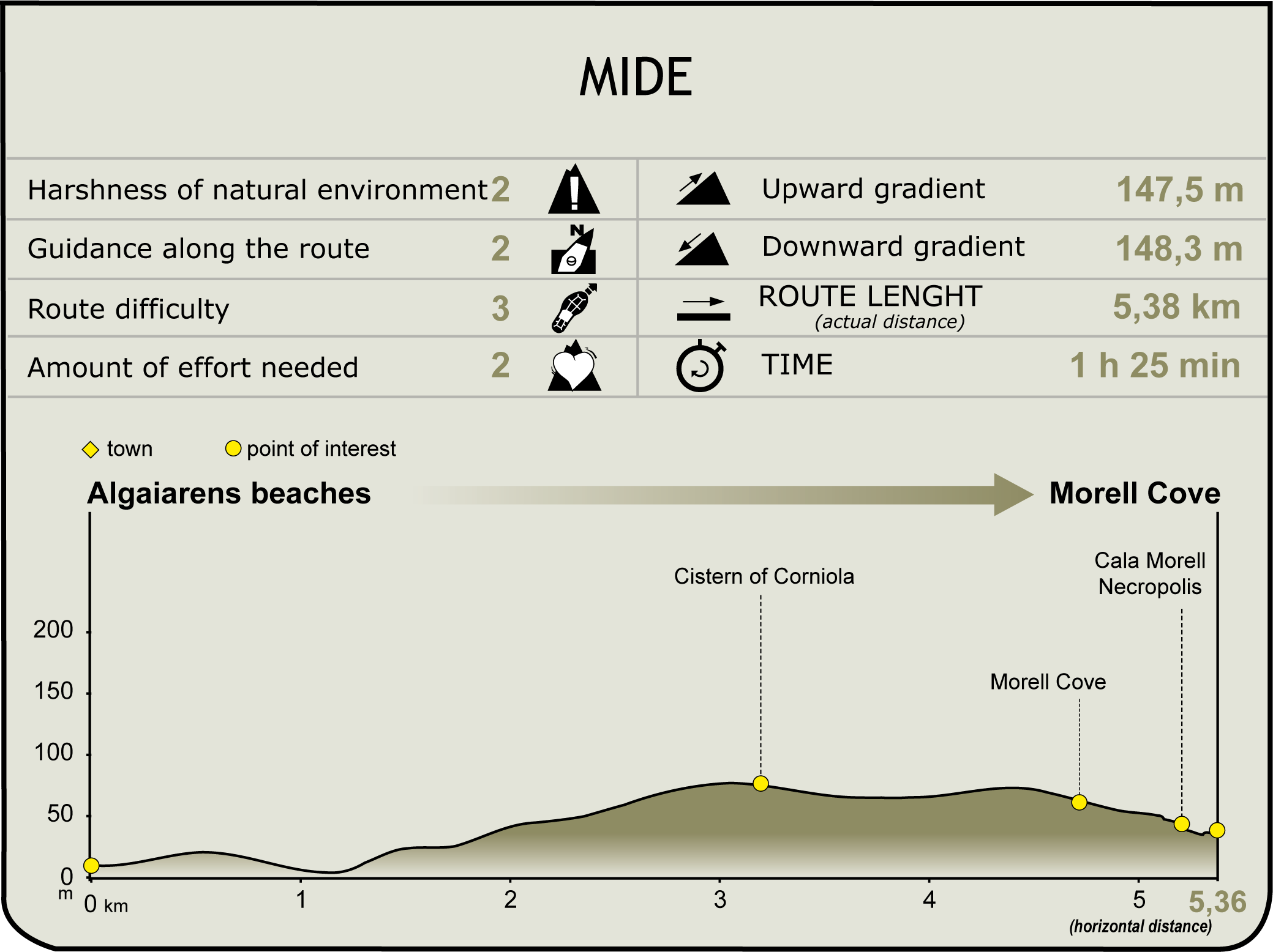
Profile

(Calculated according to the MIDE criteria for an average excursionist with a light load)
Highlights
The use of water in the Menorcan countryside: Cisterns
Traditionally, water was supplied to agricultural and livestock farms mainly by three methods: wells, usually tapping aquifers; rainwater collectors, which collect rainwater from the roofs of buildings; and cisterns.
These structures consist of a large open-air platform with a slope that channels water into a well built or cut into the rock. The wells were covered with an ashlar hut called es coll, from where water was drawn by means of a pulley and a rope with a well. If the function of the cistern was as a watering place for livestock, as in the case of the Corniola cistern, water was poured into a channel that filled the different basins. Water from the cisterns could also be used for human consumption, an example of this being the Es Mercadal cistern, which is still in use today.
Nowadays, towns such as Maó have implemented plans to recover these traditional methods of water use.
Necropolis of Cala Morell
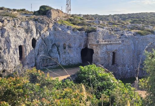
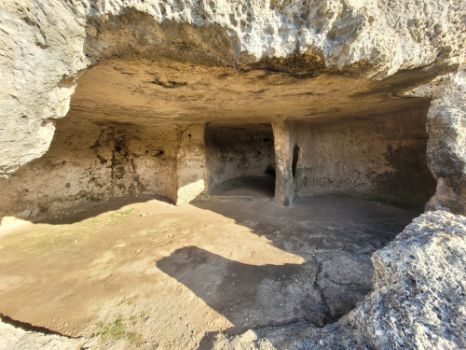
The necropolis of Cala Morell constitutes interesting evidence to the type of burial rites that were carried out in Menorca over last centuries of prehistory. The Menorca inhabitants of Menorca at that time buried their dead in large necropolises consisting on a hypogeum or an artificial cave dug into the rock of the cliffs of the ravines and the coast or in the rocky outcrops near the settlements.
The necropolis of Cala Morell dates from the late Talaiotic period (500 - 1st century BC), and is located in the rocks of the ravine that leads to the cove. It remained in operation until centuries after the Roman conquest of the island in 123 BC.
The necropolis is made up of fifteen hypogea, most of which have a circular or complex ground plan, and was designed as a collective tomb for the deceased members of a community, clan or family, with variations in the treatment given to the deceased depending on the customs of each of them.
One of the most common rituals was to place the body on a wooden bed or in a coffin, accompanied by the grave goods. Sometimes, the deceased was placed on a funeral pyre with the grave goods, limestone was placed on top of it and it was set on fire. While the flames burned the soft parts, the stone turned into quicklime and, once cold and solidified, the remains were collected and deposited in a space in the cave. Some tombs had richer grave goods than others, although it is not possible to confirm with certainty whether there was social differentiation among the deceased.
Several elements stand out in the necropolis. On the one hand, a cave whose entrance door and façade are decorated with sculpted architectural elements. There is also a hypogeum that was reused as a cistern in modern times to water livestock through troughs dug into the rock and, finally, some small oval cavities in one of the crags, popularly known as "capades de moro", literally "Moor headstrokes", and whose function is unknown.
Special attention should also be paid to two small caves that preserve the remains of an access corridor. The stones in this corridor are the oldest on the necropolis: more than three thousand years old.


