

Net of Nature
Trails

Stage 20: Cala Sant Esteve - Maó
Description
Travelling through the island's historical heritage
The last stage of the Camí de Cavalls runs from the cove of Sant Esteve and goes up a small slope and continues along an urban road that offers magnificent views over the entrance to the Port of Maó. Once you leave behind the castle of Sant Felip and the village of Es Castell, the route continues until reaching Maó, the capital of Menorca. The history city of Maó goes back millennia, as prove in the different architectural styles and monuments of the city. The final stretch of the path crosses the city and goes down to the end of the port of Maó which, being 5 km long, is considered the second largest natural port in Europe.

The start of the last stage of the Camí de Cavalls is in front of the bend formed by the Cala de Sant Esteve cove, where the bottleneck ramp is located, close to the access to Fort Marlborough. From here, the path goes forward to the bottom of the cove where, sheltered among wild olive trees (Olea europaea var. sylvestris) and lentisk trees (Pistacia lentiscus), the Camí Romá de sa Cala (Roman Road to the Cove) begins, a pedestrian access to the cove that also connects with the Camí de sa Cala Sant Esteve (the road to the Sant Esteve Cove).
From this point onwards, the trail runs parallel to asphalted roads with pavements for most of the route. It is for this reason that extreme caution is recommended on stretches shared with road traffic.
The route runs along 500 m of the Camí de Sa Cala Sant Esteve until it reaches the turn-off to the Sant Felip Castle, turning left and entering the Sant Felip road in the direction of Es Castell. The place offers a panoramic view from where you can see some elements of the Sant Felip Castle complex, the mouth of the port of Maó, the Mola Peninsula and its fortress, and the Llatzeret Island.

Continuing 300 m along the hard shoulder of the Sant Felip road, the route passes in front of the Es Castell cemetery, turns to the right, safely crosses the intersection of the Me-6 road and begins the route through the urban area, leaving behind the views of the port and the walled agricultural plots. The Me-6 road serves as a guide, as it runs parallel to the tracing of this stage for at least another kilometre, passing to the right, next to the es Clot de ses Ànimes Park and entering Es Castell.
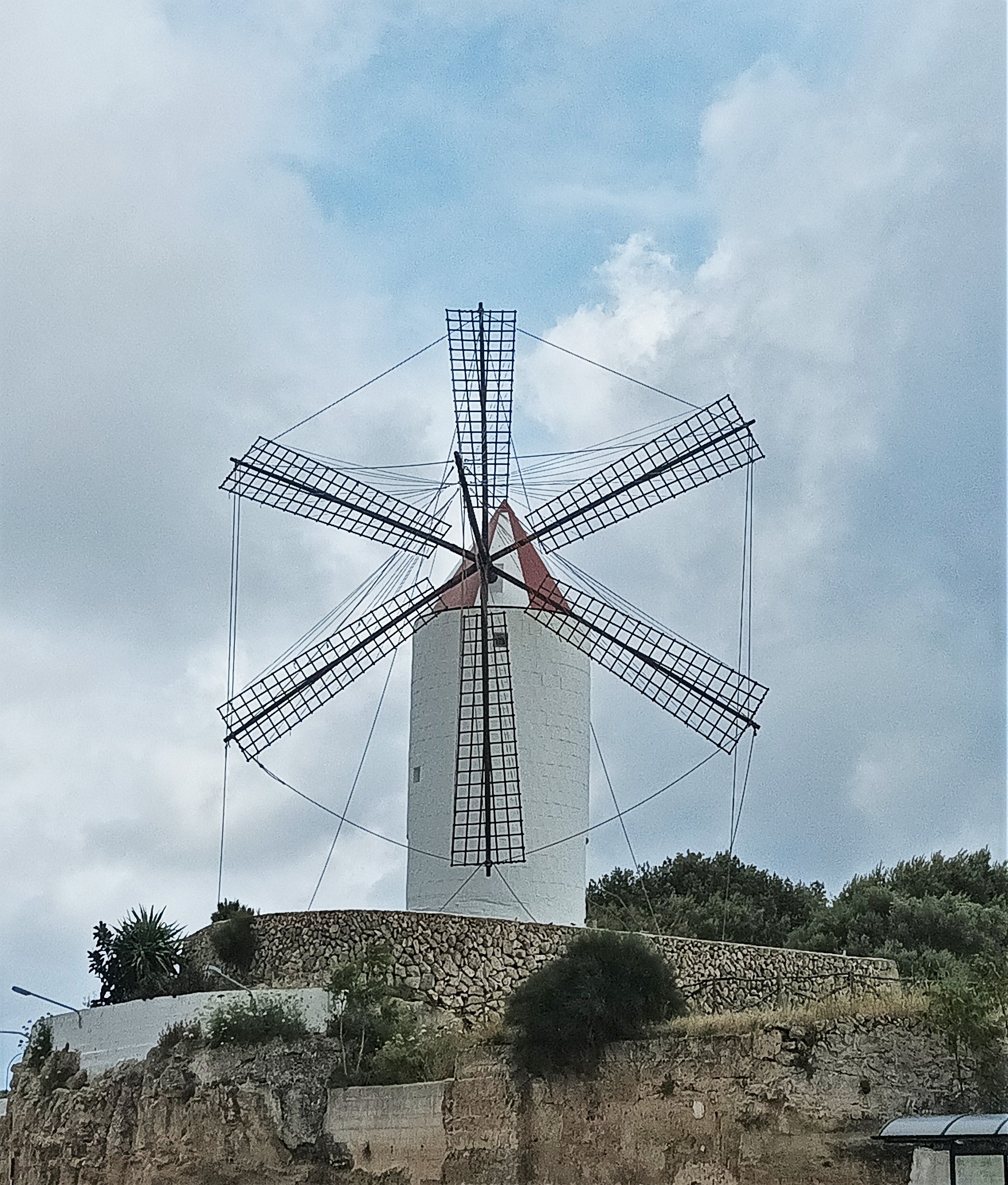
The trail covers a 1.9 km stretch of the Camí de Cavalls along the Me-2 heading north towards Maó, it passes next to the town of Es Castell, passing, on the left side, a traditional grain mill now used as a tourist office, while on the right side you can see the town's church.
It is worth mentioning that Es Castell was originally built as a suburb, close to the fishing town of Cales Fonts, where the merchants and relatives of the castle of Sant Felip lived. It was razed to the ground during the first British occupation in the early decades of the 18th century and rebuilt around 1720 further away from the castle. The current local church dates from this period, built using elements from the previous church in honour of Our Lady of the Rosary.

A few metres before entering the town of Maó, the Camí de Cavalls makes a slight descent, crossing the Cala Figuera slope and climbing again to leave the Me-2. To do so, it passes next to a service station and finally enters Maó along the Camí des Castell. A walk through the urban fabric of Maó reveals the historical legacy of the capital of Menorca.
Along the Camí des Castell, most of the houses and buildings that the traveller will find along the way have elements reminiscent of Georgian architecture, which was trending in the United Kingdom between the 18th and 19th centuries, which can be distinguished by the use of rectangular sash windows with external wooden shutters painted in green, blue or black.
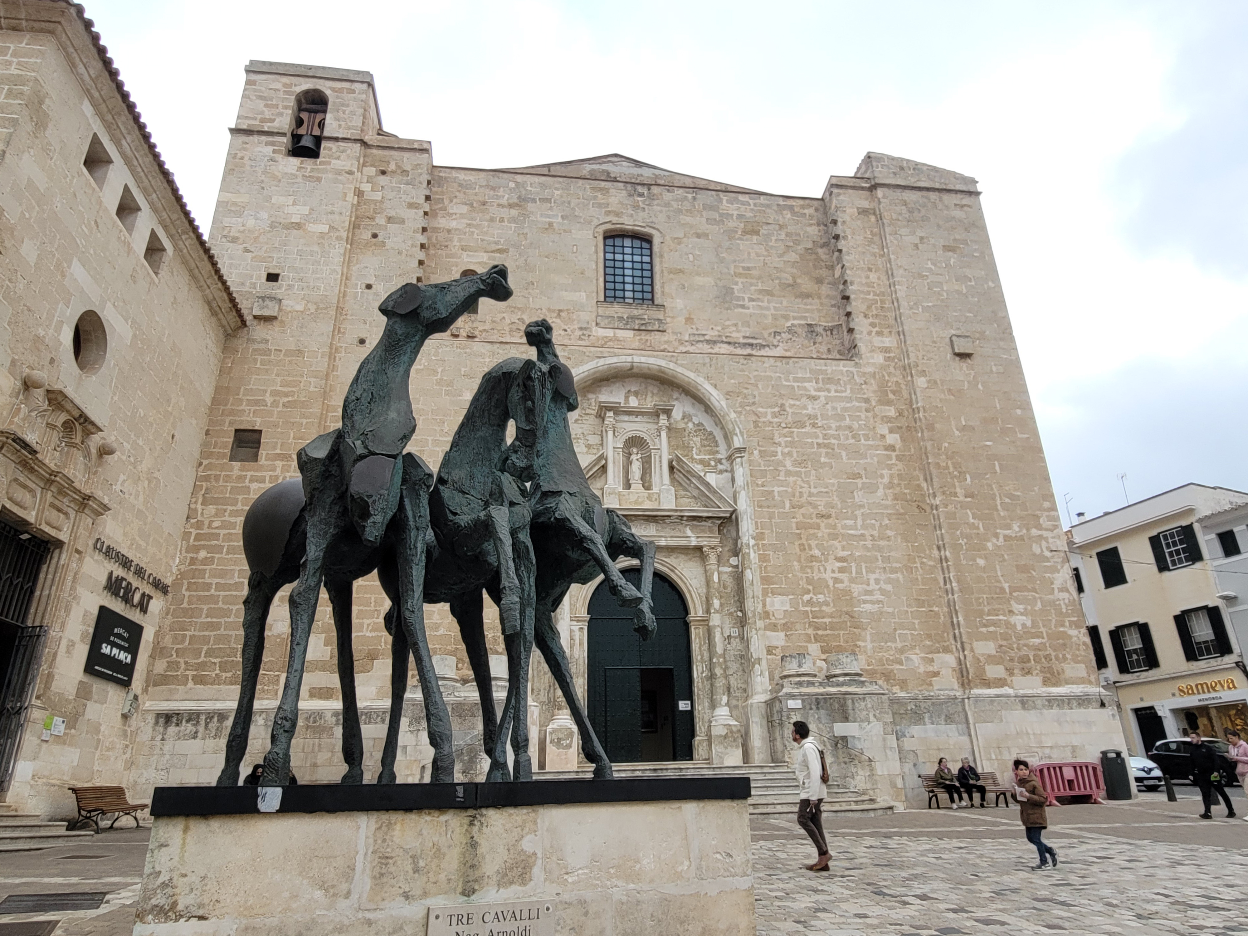
Shortly after, the stage reaches the Plaça del Príncep, located on a slope, where the church of Nuestra Señora del Carmen is located, built as a monastic complex at the end of the 18th century and whose cloister currently houses Maó's food market. A few metres from this place, the route reaches the lowest point of the slope between Plaça d'Espanya and the Fish Market, to go up Carrer Portal del Mar to Plaça de la Constitució. You can make a stop in this square to admire both the both the Church of Santa Maria de Maó, built in the mid-18th century on top of a previous building from the 14th century, and the town's town hall.

Once you have left the Plaça de la Constitució behind, the Camí de Cavalls continues along Carrer d'Isabel II, passing by the palace of the same name in the direction of the Museum of Menorca. The museum itself is at the end of the street, currently housed in the cloister of the Sant Fransesc d'Assís church, the oldest surviving part of this ancient convent built between the 15th and 16th centuries.
From here, the stage descends towards the port, surrounding the museum, along the Costa de Ses Piques, which runs parallel to the limestone rock walls that once was used as part of the defensive system to the city. Here you can make a short stop at a small square that serves as a lookout point, where there is a small information board and from where you have a beautiful view of the bottom of the port. At the end of the slope, the Camí de Cavalls crosses towards the port promenade and runs along its last 800 m next to the boats moored there. After crossing the bridge over the torrent of Santa Sirga, located at the bottom of the port, this stage is completed, and the Camí de Cavalls Natural Way comes to an end.
Links of interest
Profile

 Harshness of natural environment
- 1. The environment is not risk-free
- 2. There are more than one risk factors
- 3. There are various risk factors
- 4. There are quite a lot of risk factors
- 5. There are many risk factors
 Guidance along the route
- 1. Well defined trails and crossings
- 2. There is a clearly marked trail and signage
- 3. Requires the identification of geographic features and cardinal points
- 4. Requires off-path navigation
- 5. The trail is interrupted by obstacles that have to be gone around
 Route difficulty
- 1. Walking on a flat surface
- 2. Trails with different types of path
- 3. Walking on stepped paths or irregular terrain
- 4. The use of hands or jumping over the terrain is necessary
- 5. The use of hands is required to progress
 Amount of effort needed
- 1. Up to 1 hour of continuous walking
- 2. Between 1 and 3 hours of continuous walking
- 3. Between 3 and 6 hours of continuous walking
- 4. Between 6 and 10 hours of actual walking
- 5. More than 10 hours of continuous walking
(Calculated according to the MIDE criteria for an average excursionist with a light load)
Highlights
Sant Felip Castle
The castle of Sant Felip is located at the southern mouth of the port of Maó. It was built in 1555, during the reign of Charles, Holy Roman Emperor ( to defend the island from the continuous attacks by Turkish ships. The work was carried out under the supervision of the Italian engineer Juan Bautista Calvi, who designed a castle with four bastions linked by curtain walls, surrounded by a narrow, deep moat dug into the stone. During the 17th century, it was enlarged by covering the curtain walls with ravelins on the other side of the moat, and the entire complex was surrounded by a walkway, stakes and a glacis.
In 1708, under British rule, the castle was renovated and rebuilt with its characteristic 8-pointed star shape, making it one of the greatest fortresses of the time. In 1802, the Spanish crown recovered the island and, in 1807, Charles IV ordered the castle to be demolished, leaving only the batteries for defending the port.
Today the remains of the complex have been restored and its underground galleries can be visited, thanks to the work of the Consortium of the Military Museum of Menorca.
La Mola Fortress
Also known as the fortress of Isabel II, as it was built under her mandate, it is located at the northern mouth of the port of Maó, on the peninsula of La Mola.
The history of this military complex began with the demolition of the Sant Felip Castle in 1850, leaving the island unprotected in the face of the international tensions that began in the Western Mediterranean when France invaded Algeria, leading the British army to consider occupying the island as a strategic point to cut off French communications that interfered with their commercial route through the Mediterranean. Amid this situation, in 1852 work s on the defensive castle began.
The fortress was to be a base of operations for the army on the island and to defend the harbour. However, by the time the works were finally completed in 1875, international arms development, the precursor to the military era of the 20th century, had advanced to such an extent that the facilities were outdated, which led to the need to continue the works by installing new batteries.
The fortress was never used for the defensive purposes for which it was built, but throughout its history it has been used as a military training centre and even a prison. Since 2007 the Balearic Government acquired the infrastructure as a tourist facility.
Maó
The history of the capital of Menorca goes back millennia and is marked by settlements by peoples such as the Phoenicians, the Greeks and the Turks, as well as numerous incursions from other peoples. Despite the Talaiotic remains, the origins of the towns go back to the arrival of the Carthaginians on the island, and it was the brother of the famous Hannibal, Mago, who founded the city and named it after himself. The Romans came later, and then the Vandals and Byzantines took over.
Due to its strategic position in the Mediterranean Sea, it was coveted by many peoples, such as the Normans and Muslims, who managed to rule the island for many years. Other peoples’ came to trade, as was the case with the Greeks and Phoenicians or the Carthaginians, who recruited the skilled Menorcan slingers for their armies.
The present-day city of Maó was born around the castle that King Alfonso III ordered to be built after the Muslim conquest. Strolling through its streets you can appreciate the rich historical legacy accumulated over the centuries, as well as the different architecture and monuments that enrich the town.
From 1708, the island was under British rule, and the port of Maó became a British naval base that would maintain its hegemony for seventy years. Proof of all this are some of the most emblematic buildings in the capital of Menorca, such as the Sant Roc bastion, the main gate in the city walls; the Santa María Church; the Museum of Menorca, in Sant Francesc or the Claustro del Carmen Market.
Multimedia


Downloads

GPS Downloads


