Net of Natural
Trails

Stage 6. Viveiro - O Vicedo
Description
Viveiro and O Vicedo, two pretty villages with long fishing and seafaring traditions
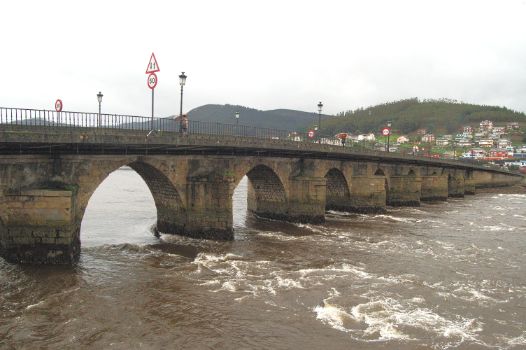
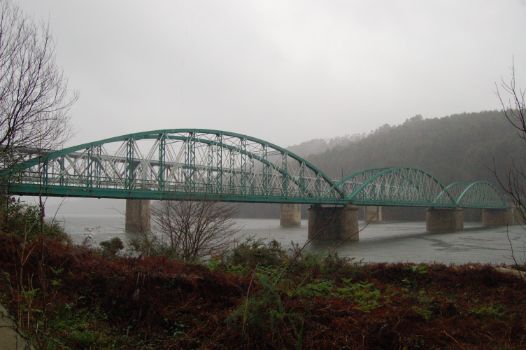
The Misericordia Bridge crosses the Viveiro ría, leaving the town behind. Between the Covas and Abrela beaches, the traveller can take a deviation to visit the O Cargadoiro ethnographic site. The San Román Calvary, in the beach of the same name, bear witness of the roughness of the sea. Finally, the trail reaches O Vicedo, which is a spectacular ending to this sixth stage.
This sixth stage of the Cantabrian Sea Nature Trail starts in Viveiro and ends in O Vicedo, which stands at the border between the provinces of Lugo and A Coruña. This stage starts at the Viveiro bus station. If the traveller continues approximately 200 m, they reach the Charles V gate, which stands opposite the Misericordia Bridge. The traveller must cross the Viveiro ría by this bridge and continue along the seafront promenade, leaving the ría to their right.

A few metres after kilometre point 1, the seafront promenade turns left, and, after continuing for another kilometre, reaches Covas beach. The trail continues all along the Covas beach and on by the pavement for approximately 100 m. At this point, the traveller must cross the road by the pedestrian crossing ant take the Río Loiba street, which climbs to the left.
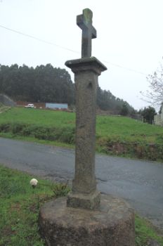
Shortly after kilometre point 3, the trail crosses the narrow-gauge railway tracks by an overpass, and can admire a calvary, so typical of the area, to the left. Later on, the trail leaves the asphalt road and climbs a dirt path to the right which runs across a dense eucalyptus wood. Following the signals, the traveller walks among the trees until crossing the railway tracks by an underpass and leaving the woods behind.
At kilometre point 5, the dirt path turns asphalt road which runs among the houses of Escourido and crosses the LU-862 road. Shortly afterwards, the trail leaves the road by the dirt path that leads to the left. At this point, and continuing by the asphalt road to the right, a perfectly signalled detour shall take the traveller to the O Cargadoiro ethnographic site.

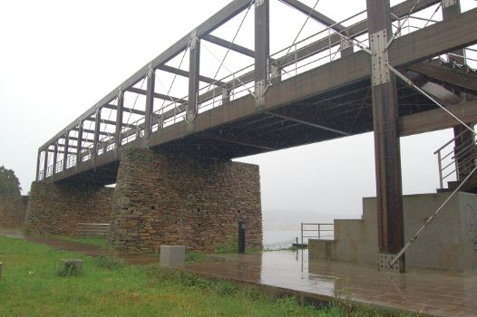
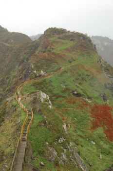
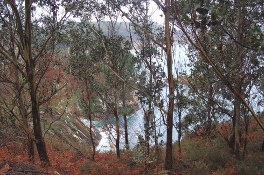
Back to the trail, a few metres before kilometre point 6, the trail continues along the road until reaching a wooden paved section that runs parallel to the Abrela beach, and from which start several accesses to the beach. The trail takes the road by the left deviation and starts an uphill section, leaving houses at both sides of the road. At a certain point, the trail offers two different routes up: a ramp to the left and a staircase straight on. Besides, from this point starts a 2 km detour that leads to the area known as Fuciño do Porco or Punta da Abrela. After this forking, the trail becomes one again, and the road becomes a wide dirt path that leads into a patch of eucalyptus trees, which surround the traveller.
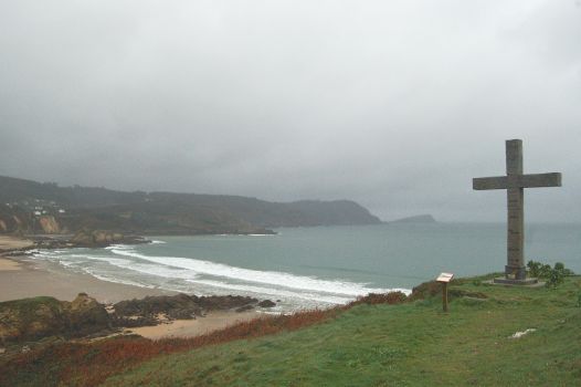
At kilometre point 9, the trail stops going up and turns down south by the path to the right until reaching the next forest track. Once there, it goes up and down until reaching the San Román Calvary, a granite cross that honours the memory of the four people dead at the shipwreck of the Dracula yawl in front of this coast. From this calvary, the trail leads to the beach. From this point the Cantabrian Sea Nature Trail coincides with the O Vicedo Coastline Trail (PR-G 156).
The Nature Trail continues parallel to the beach, and passes past several accesses to it. After approximately 500 m, the trail reaches the LU-862 road and is interrupted for approximately 700 m due to the dangerous nature of this road.
The traveller must act with the utmost care to reach the point where the trail starts again at the right side of the road (same side where it was interrupted), and takes a wide dirt path which runs among eucalyptus in the direction of the road that will take the traveller to the village of Vilasouso.

Without leaving this forest track, and still walking under eucalyptus, the trail circles the small peninsula that offers a magnificent view of the Coelleira Island, where, in the past, a monastery used to stand.
After the descent, the trail takes the road just opposite that leads to the Xilloi beach. A few metres before kilometre point 19 the trail offers to alternate routes: the first by a ramp and an asphalt road and a dirt path and the second by a steep slope. If the traveller chooses the second route, they will have to continue along the seafront promenade, leaving behind kilometre point 19 and taking a steep slope which ends shortly afterwards in a wide dirt path.

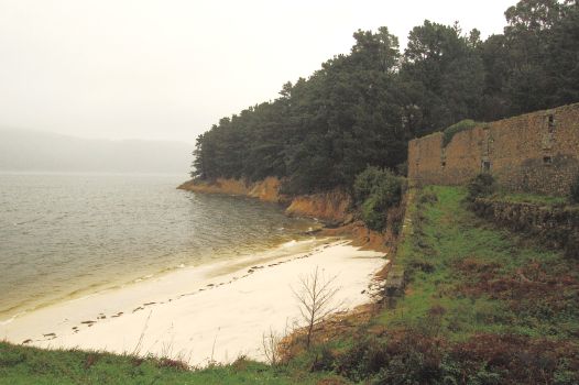
Here, the two routes converge in a single trail and advance by a forest track parallel to the cliffs, among eucalyptus trees. After kilometre point 21, the trail goes down and takes the asphalt road to the right. After leaving behind the village of Piñeiro, it reaches the Caolín beach by a pedestrian paved road, flanked by the remains of the old fish salting factory.
The trail leaves the beach by a narrow path. Here, the traveller faces again a choice: whether to reach the Vicedo Vello beach by a ramp or by the staircase. The traveller leaves behind the Vicedo Vello, and shortly afterwards reaches the fishing port of O Vicedo. The trail approaches the centre of the town of O Vicedo by the Rúa do Porto. An information panel at the start of the path of Camiño a Praia Fomento marks the end of this sixth stage of the Cantabrian Sea between Viveiro and O Vicedo.
Sites of interest
Puntos de interés
Culture
Hydrography
Information
- Playa de Covas
- Playa de Xilloi
- Playa de Caolín
- Playa de Abrela
- Playa de Vicedo Vello
- Playa Area Grande
Infrastructure
Municipality
Orography
Hostel
Vegetation
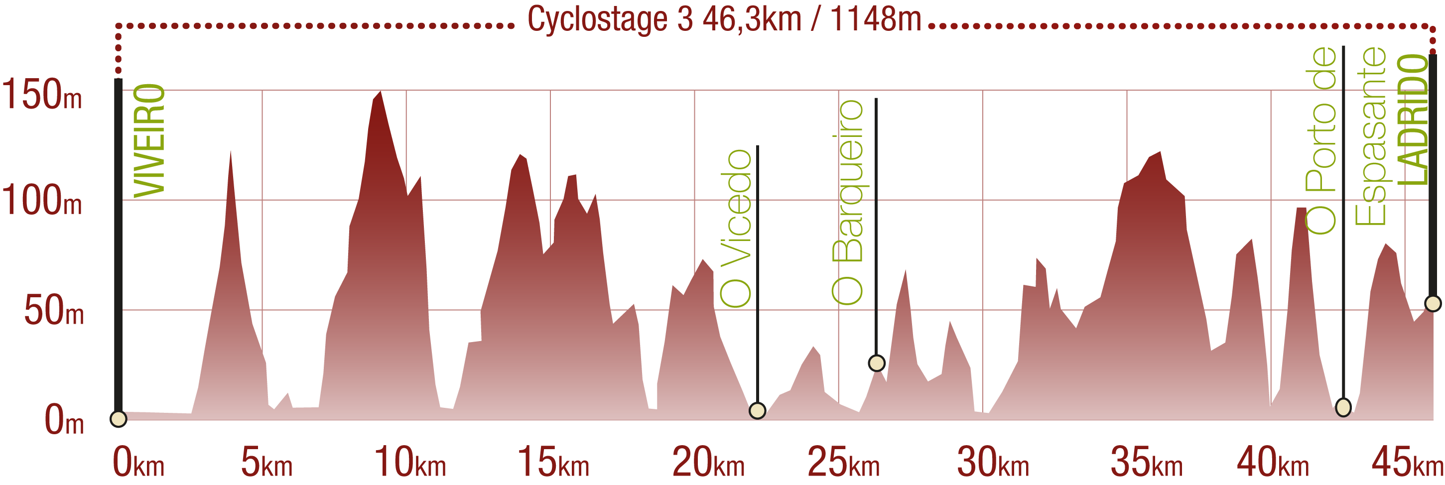
Profile

Highlights
Further information
O Vicedo
A town in the province of Lugo that borders the province of A Coruña, at the other side of the mouth of the Sor river. Although there is evidence of previous settlements, the town consolidated in the 11th century, and the islands within the municipality are dotted with Romanesque remains. The village has been associated with fishing since ancient times. On the third Sunday of July, the village honours the Virxe do Carme (Our Lady of the Mount Carmel) with a festival and the locals decorate the streets with spectacular flower carpets.
Multimedia
Downloads
GPS Downloads
Documents
Cyclability
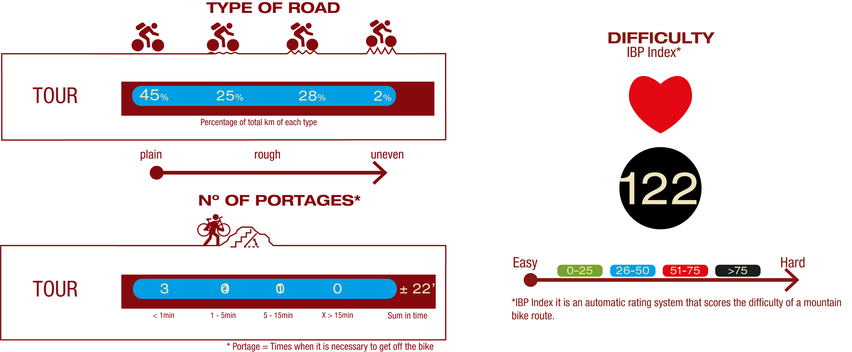
TYPE OF ROAD, PORTAGES & DIFFICULTY
SAFETY RECOMMENDATIONS
- Sections shared with hikers.
- Transit through the centre of some population centres.
GENERAL RECOMMENDATIONS
- Find out about the technical aspects of the route and the weather on the day.
- Take care of the environment. Take care not to disturb animals or damage vegetation. Respect private areas.
- You must give priority to pedestrians and comply with general traffic rules.
- The environment in which you will be riding is open, free to move around and an area where many activities are carried out (sporting, forestry, livestock and agricultural activities). Always have an understanding, prudent, responsible and respectful attitude.


