Net of Natural
Trails

Stage 20: Boinás - Tuña
Description
In the land of “vaqueiros”
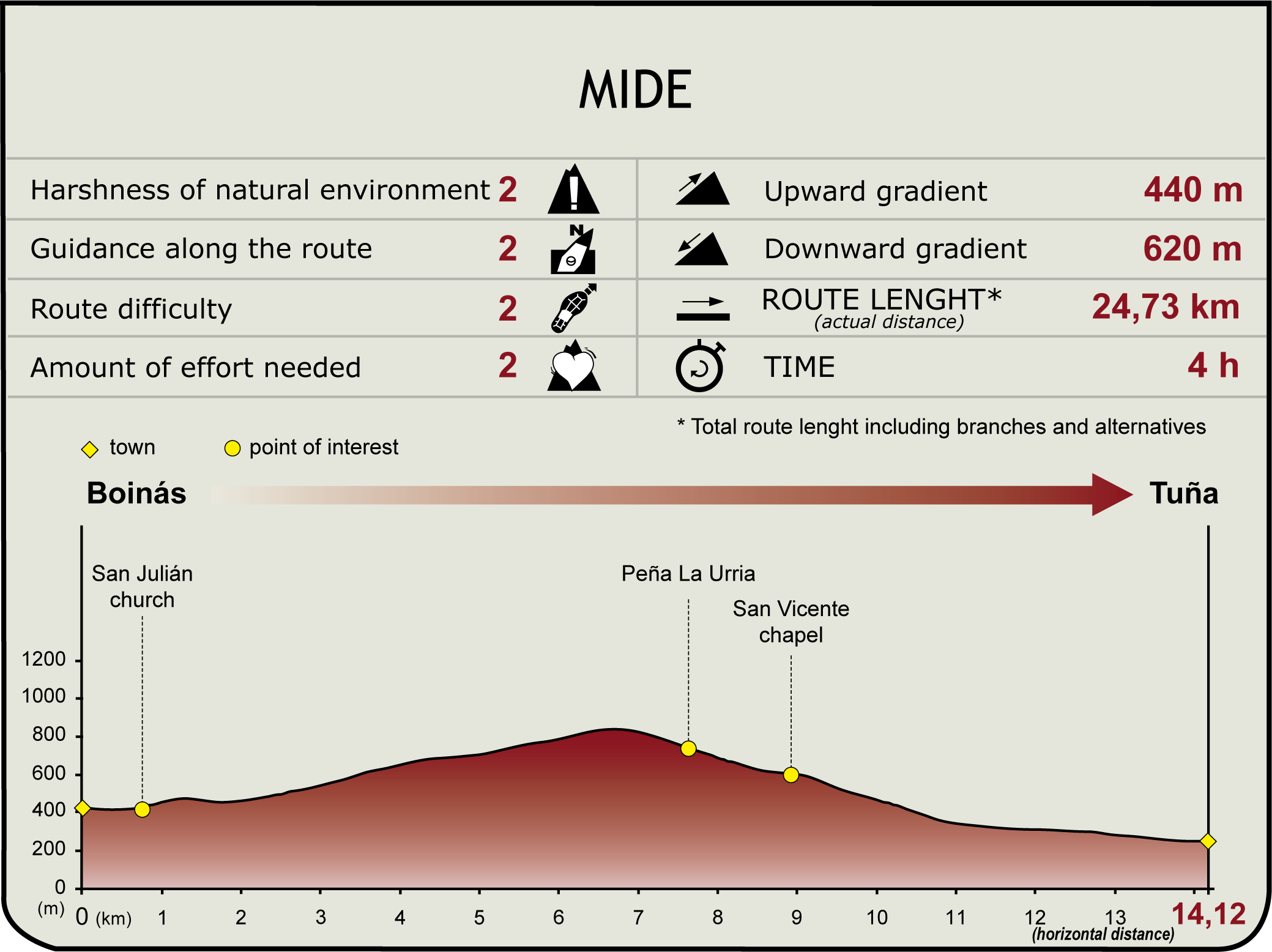
This stage traverses the counties of Belmonte de Miranda and Tineo through the land of “vaqueiros” (nomadic herders). It runs from the village of Boinás to the town of Tuña, located in the Genestaza River Valley, close to one of the most unique geological phenomenon of Asturias, the Fana de Genestaza, where regular landslides threaten to sever the mountain.

From Belmonte de Miranda County, the Nature Trail heads towards Tineo County through the land of “vaqueiros”, the most unique nomadic and transhumant group in Asturias, who together with their families and belongings, move twice a year from the highland pastures (alzada) in the summer to lower altitudes (braña) in winter. Several “brañas vaqueiras” can still be found in Belmonte de Miranda, as well as in the villages of Villaverde, Santa Marina, Carricedo or Pontigo.
Starting from Boinás, the route leaves the village along the road to Quintana. To reach this village, the route crosses the River Cauxa by road, near the mill on the bank, and starts to climb, leaving the church of San Julián to the right.
Once in Quintana, the route follows the directional signs and heads down along a narrow road, next to an “hórreo” to the left. It crosses again the river Cauxa, passing through meadows and chestnut (Castanea sativa) forests, towards the rural village of Alcedo (Alcéu).

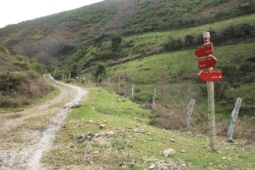
After leaving Alcedo behind, the road begins a moderate descent, only to climb again towards an intersection where a sign indicates two alternative routes to Tuña. The main route continues along a gravel track leading to the village of Espinaredo (Espinareu), while the alternative route heads down the road.
To continue along the main route, the track descends through meadows and scrubland until the rural town of Espinaredo (County Tineo), where it joins a road. Along the way, there is a thematic table that explains the panoramic views of the area.
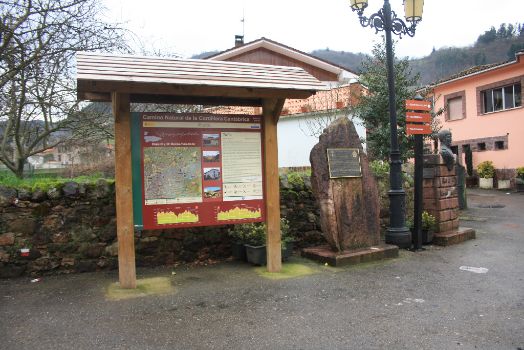
From Espinaredo, the route runs along the road and, shortly after crossing the River Genestaza, reaches the village of Torayo (Torayu). It then continues through meadows and chestnut and oak (Quercus robur) forests to Tuña. The start-end panel of this section is located at General Riego square, next to the church of Santa María.

The alternative route from the intersection outside the town of Alcedo continues down the road, through meadows and scrubland, until it reaches a directional signpost. From here, the Trail descends moderately, passes through the village of Solanos and, immediately after, turns onto a paved track. Soon after, it veers off to the road to Tuña.
Sites of interest
Puntos de interés
Hydrography
Municipality
Orography
Hostel
Profile

Highlights
Further information
“Vaqueiros de alzada”
The origin of these nomadic herders can be traced to the fourteenth and fifteenth centuries, when the nobility acquired the power that the monastery of Santa María de Belmonte had once held. A social group of serf-workers was created to manage the herds of the noblemen.
Herders, travellers, people with no permanent roots, with their own customs and traditions, the nomadic herders are a social group with deep ties to livestock farming and transhumance. In May, these nomadic herders would drive their livestock to the fresh pastures in the mountains. When winter neared, the animals were driven to the “brañas”; hence they also had to relocate their homes, family, and belongings. This process was repeated throughout the sixteenth, seventeenth and eighteenth centuries.
The “vaqueira” transhumance is practiced along a strip of land between the rivers Nalón and Navia, within two main areas: in the west, towards Allande and Cangas del Narcea, and some areas in Sierra de Tineo, and in the western central area, towards Teverga, Somiedo and León.
Quintana Tower
The Quintana Tower (15th century), together with the Montonovo façade, is one of two stately towers that remain in Belmonte of Miranda County. They belonged to two noble families, Quiñones and Miranda, who wielded their power during the Middle Ages.
It is a three-storey, square tower of which only two façades are visible- The other two façades remain hidden by other buildings. The visible façades have several openings and embrasures, with a defensive machicolation on the top floor.
The Fana de Genestaza
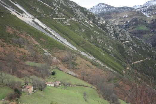
One of the most unique geological phenomena of Asturias, the so-called Fana de Genestaza (Xinistaza), is situated on the outskirts of the village of Genestaza, south of Espinaredo and Torayo, and near Tuña. It is a huge “argayu” or collapse, in constant erosion. The tail connects with the River Xinistaza near the eponymous village (750 m away), while its head stands at an altitude of 1,429 m.
Since the late eighteenth century, when the first collapse took place, the western slope of Sierra de La Cabra is gradually eroding, threatening to sever the mountain in two. Quartzite abounds in the geology of Sierra de La Cabra. This, together with the extraordinary steepness of its slopes, natural erosion by rainwater, deforestation and the property of the materials (weak rocks), are the cause of these natural landslides.
These landslides occur periodically. The largest took place in 1963, and is still remembered by the local communities. Another major collapse took place in 1993. The last landslide, which occurred in 2002, blocked the access road.


