Net of Natural
Trails

Stage 18: Dolia - Belmonte
Description
Along the Camín Real de La Mesa
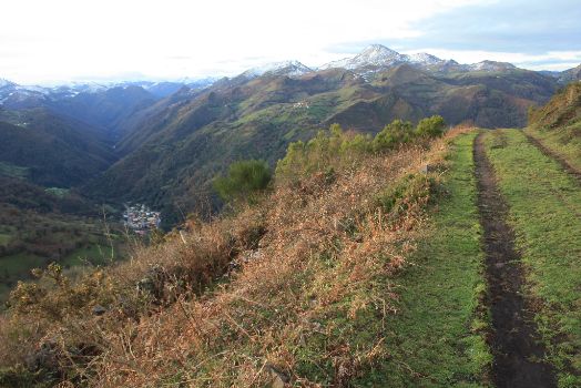
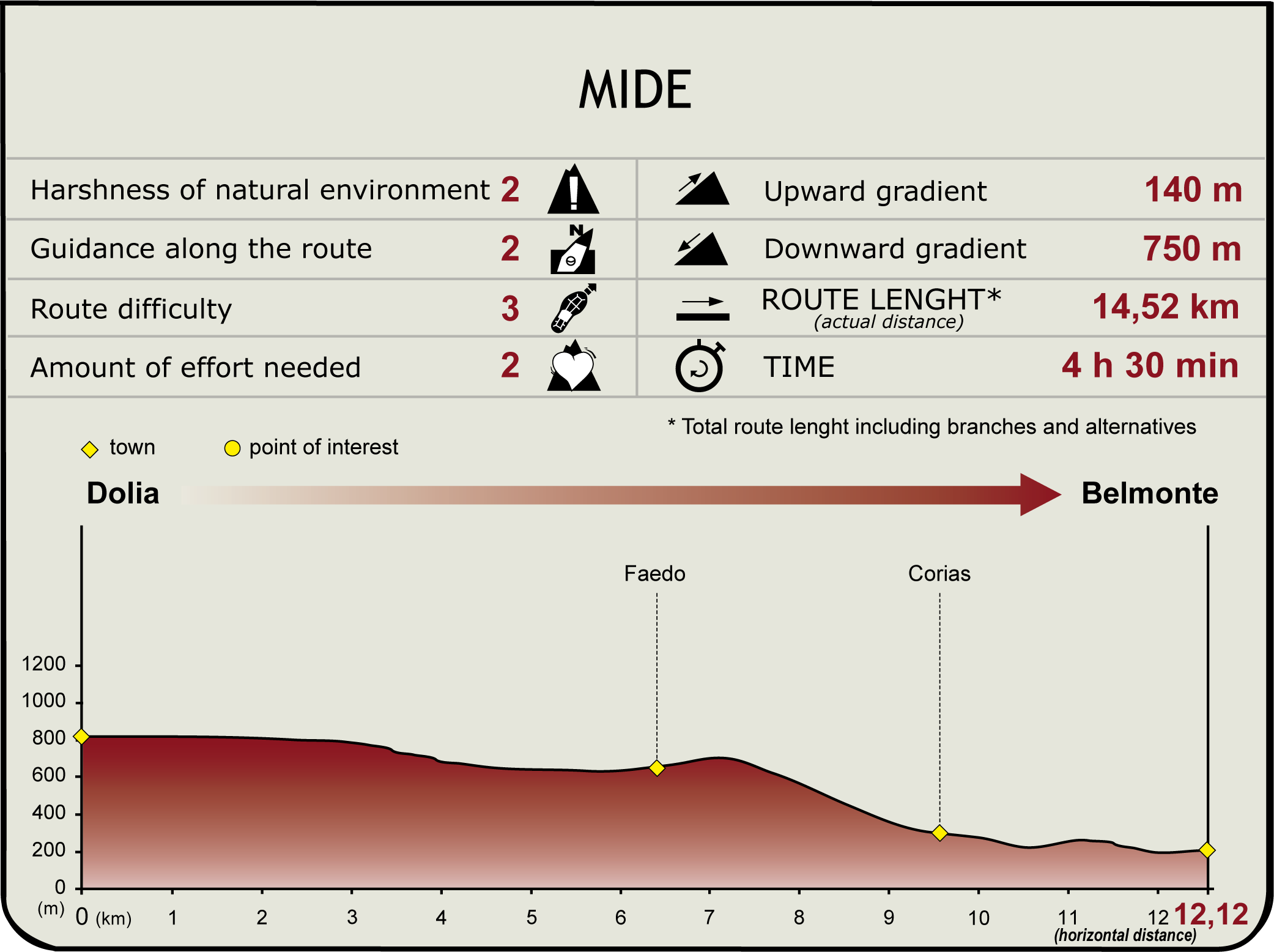
Starting from the village of Dolia, this section runs over the Camín Real de La Mesa. Without leaving Belmonte de Miranda County, it first heads north through Sierra de Meruja, then turns southwest at the end of the route to descend towards the Pigüeña River Valley, and reach the town of Belmonte.
The first part of this section overlaps with the GR-101, the Camino Real de La Mesa, one of the first historic Asturian trails or roads, used by pre-Roman and Roman settlers. The so-called "Camín de La Mesa" ventured into Asturias from León through Torrestío, then climbed to the mountain pass of La Mesa, and headed towards San Lorenzo and Dolia, where the route begins.

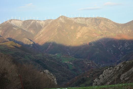
The first part of this section heads due north, across Sierra de Meruja, by road. A wind farm can be seen to the left of the Nature Trail, above Sierra de Begega and, further on, there are pastures and huts in the Pigüeña River Valley, with Sierra de Manteca in the distance. The paved trail continues in a moderate climb at first, and then descends slightly towards Faéu or Faedo.
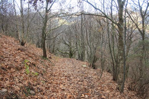
The last part of the route climbs steeply towards Faéu on a concrete track, and then turns onto a dirt road to descend sharply. Belmonte can be seen to the left of the Trail in this part of the route. The steep descent leads to a path through a forest of common oaks (Quercus robur) and chestnuts (Castanea sativa), which crosses a brook, and leads to the rural town of Corias de Arriba.

From Corias de Arriba, the route continues by road, reaching shortly after Corias de Abajo, where it turns left, up a small concrete road, to a narrow path that leads to Belmonte. Extreme caution should be exercised in this final stretch.
An alternative route to Belmonte, via a paved path that crosses the River Pigüeña and leads to AS-227, is shown at Corias de Abajo. The last few metres of this alternative route run along the road to Belmonte, where a panel at the edge of the road indicates the end of the route.
Sites of interest
Puntos de interés
Culture
Hydrography
Municipality
Hostel
Profile
Highlights
Further information
Camín Real de La Mesa
The so-called "Camino Real del Puerto de la Mesa" or "Camín Real de la Mesa" connected León and Asturias through Torrestío. It climbed through the mountain pass of La Mesa (1,782 m), and traversed the summer pastures of Saliencia to arrive at Piedrajueves, the mountain pass of San Lorenzo, Dolia, Venta de las Cruces and the vicinity of Cabruñana. This route crossed through counties Somiedo, Teverga, Belmonte de Miranda and Grado.
The Camino Real de La Mesa is one of the first historical Asturian trails or roads used by pre-Roman and Roman settlers, medieval travellers and modern herders. During the Middle Ages, some stretches had tolls. In the 16th century, the road was reconstructed by order of Fernando Bishop Valdés Salas. In the eighteenth century, the road was made accessible to motor vehicles by order of the Governor Gil de Jaz. However, this seasonal road (closed six months in winter due to snow) lost its significance with the opening of the new Carretera de Castilla through the Pajares Mountain Pass.
Known by various names -Camín Real, Camino Real de Extremadura, Camino de Castilla or Camín de Moros-, it had many secondary roads that led to the valleys of the rivers Trubia, Nalón and Narcea; to Pravia and Salas; to Llanera; and to the outskirts of romanised Gijón, in the centre of Asturias.
Porcabezas Ridge and megaliths
Given that this is a road of pre-Roman origin, the Camín Real de La Mesa is dotted with numerous megalithic sites within an extensively humanised area. Necropoleis appear in numerous places, especially along the Porcabezas Ridge and lateral mountains, mainly between Belmonte, Teverga and Grado. The burial mounds of Piedrajueves, El Cumalón, Sierra de Santa Cristina, Campo de Cueiro, La Forcada, Peñas Negras, Balboa or the necropolis of La Escrita, amongst others, attest to the use of this space both as a transport link and as a seasonal livestock grazing site.
Megalithic remains in Asturias date from the third and fourth millennium B.C., in the mature Neolithic period, during which necropoleis were built across the entire region, from the coast to the mountains. These archaeological stations can be found throughout the Trail. They are the so-called megaliths, known as coteros in the east, arcas in central Asturias, cobayas and cuturuyos in Tineo and madornas in the west. There are more than 1,000 monuments, spread across highly visible areas (coastal slopes, pre-coastal mountains, inland hills and middle and high mountains). The whole area is a genuine necropolis, with dozens of aligned burial mounds.
Not much has been found in terms of tools. The findings primarily consist of stone axes, rudimentary pottery, flint blades or knives. The building method and shape of the megalithic monuments varied with time and materials available. The decoration is typical of Asturias, with painted, engraved or chiselled motifs, the most important being the Santa Cruz dolmen (Cangas de Onís).


