


Net of Nature
Trails

Cacabelos - Quilós Nature Trail







Description
Roman presence among vineyards
The Bierzo depression was home to a large number of Roman settlements, whose inhabitants produced and drank the wines that are still produced in the region today, now under the label of Bierzo Designation of Origin (whose regulatory council is based in Cababelos), just as they surely enjoyed a landscape now crossed by what is known as the French Way to Santiago de Compostela and the La Mirada Circular Nature Trail; this route links them together.
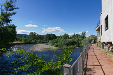
The route begins in Cacabelos, next to the municipal park and the bridge over the River Cúa. The section of the French Way between Ponferrada and Villafranca del Bierzo passes over this very bridge. On the other side of the river, a river beach has been set up where it is possible to cool off and take part in water sports.
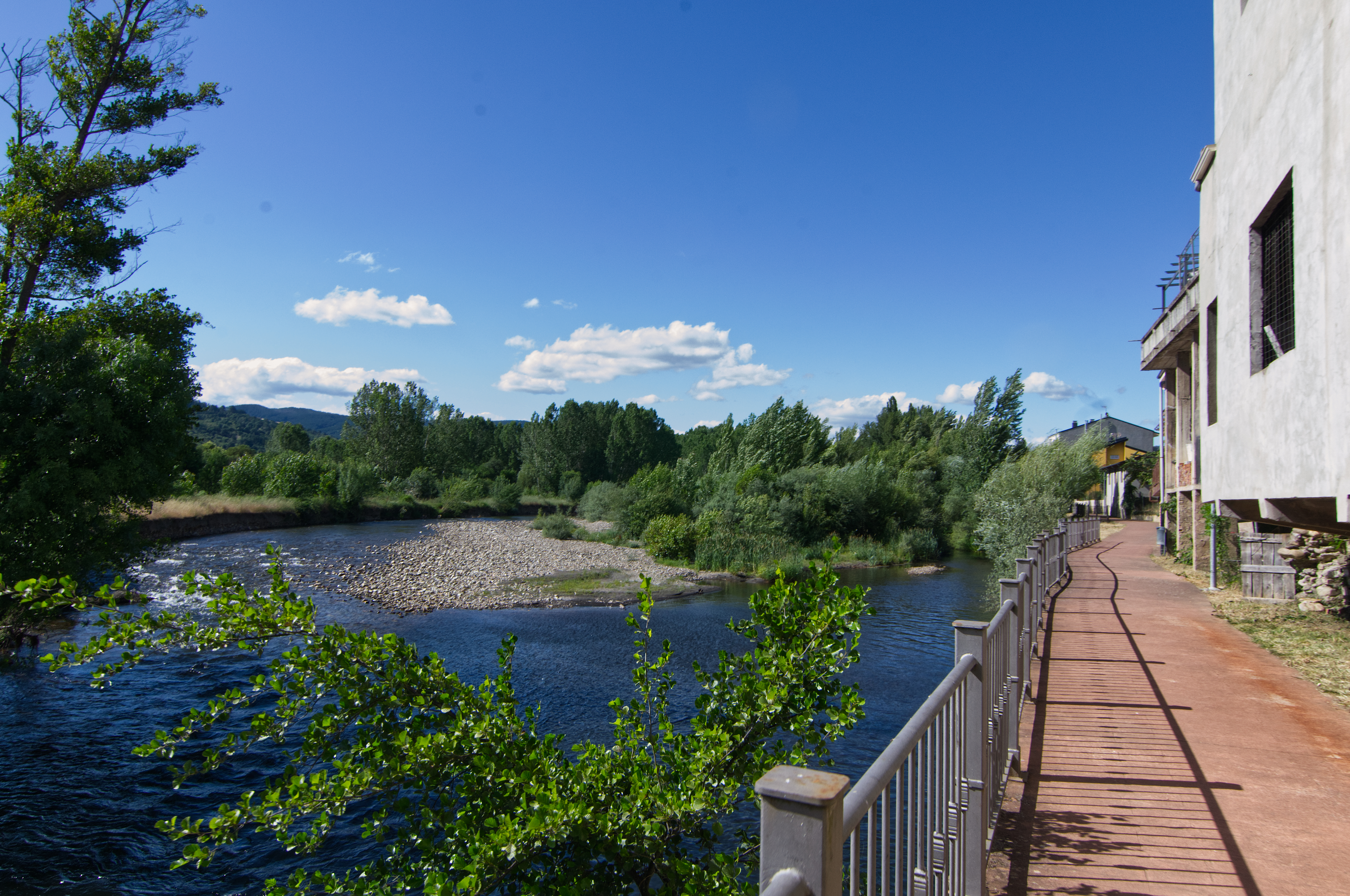
After crossing the road, the route starts along a path, between the river and the last houses in the village, paved with compressed concrete that looks like wood. A wrought-iron railing protects passers-by from falling, and the surrounding vegetation consists of a classic riverside woodland dominated by poplars (Populus spp.), alongside ash trees (Fraxinus sp.) and willows (Salix spp.).
After about 700 metres, the path turns right, away from the river, and leads to a tarmac-surfaced open area next to the swimming pool and sports facilities of Cacabelos. The route skirts along the esplanade and, before reaching the roundabout at the entrance to the town, crosses a road and a small wooden bridge over an irrigation channel.
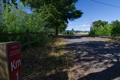
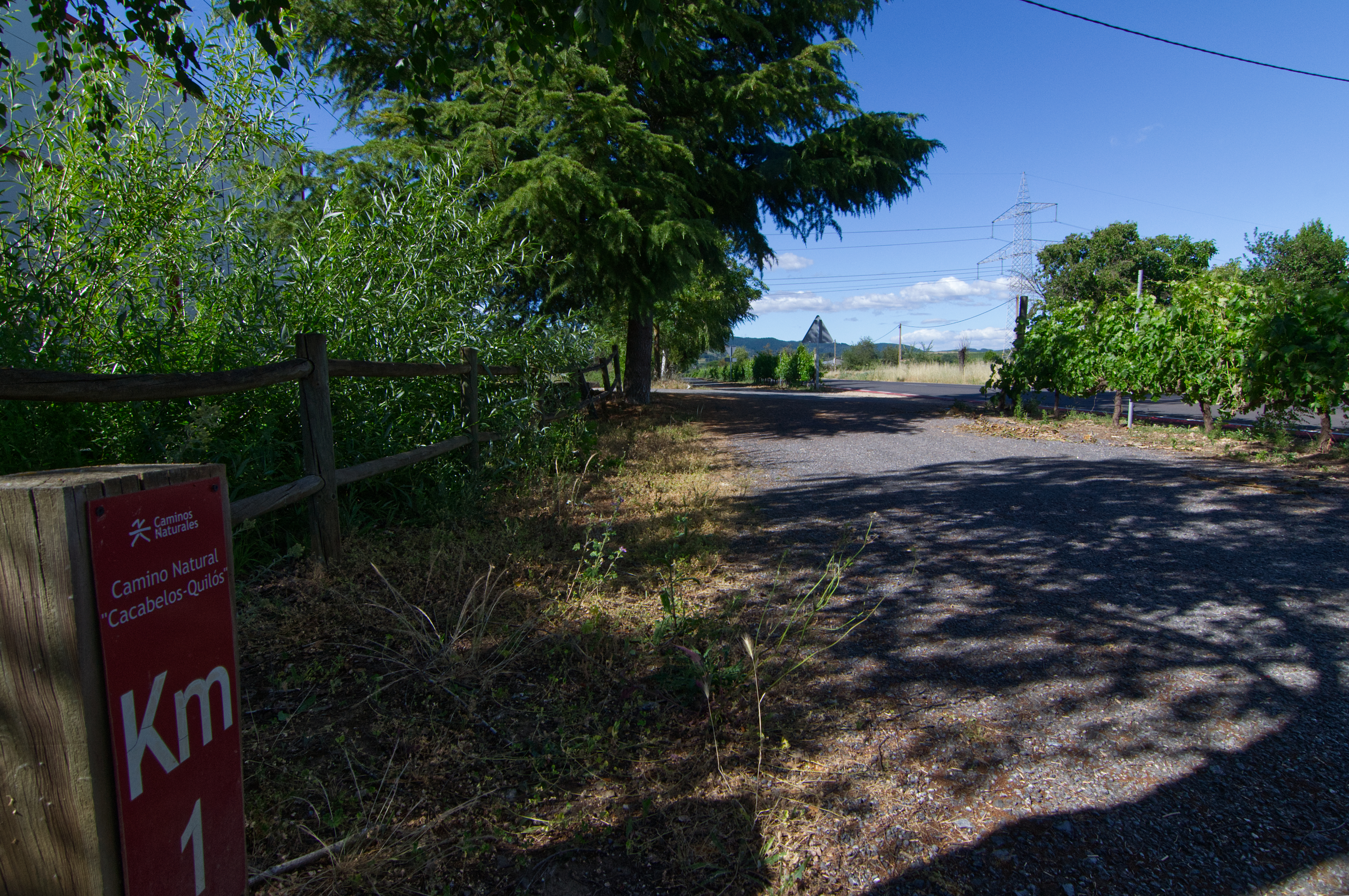
From this point onwards, and for almost 1.7 km, the path follows a long straight stretch of tarmac road between the road from Cacabelos to Quilós, on the right, along an irrigation ditch on the left. Whilst a wooden railing prevents people from falling into the canal, a hedge consisting of grapevines (Vitis vinifera) acts as a barrier between the canal and the road.
This pleasant walk goes past a stand of various tree species planted to provide shade along the path: cork oaks (Quercus suber), small-leaved linden trees (Tilia cordata), holly (Ilex aquifolium), sweet chestnut (Castanea sativa), maple (Acer spp.), oak (Quercus sp.), Aleppo pines (Pinus halepensis) and cedars (Cedrus atlantica), amongst other species, to provide shade along the path. On both sides of the road there is a succession of country houses and farmland (vineyards, other fruit trees such as cherry and fig trees, and pastureland), and it is common to see white stork (Ciconia ciconia) nests atop the telephone poles alongside the road.
Although this route is closed to motorised traffic, there are several access points to these houses and estates off the road along the way, and it crosses a water channel via a small wooden bridge. Just 500 metres after the bridge, the path curves slightly to the right and runs closer to the road until it reaches the roundabout leading to Quilós.
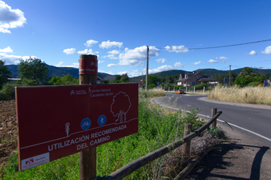
From this point onwards, and until its end, the route follows roads and streets shared with motorised traffic, so please exercise the necessary caution.
The entrance to Quilós is made via Santos Cascallana Avenue; occasionally, a small irrigation channel runs alongside the roadside verge, so be careful not to trip. The village of Quilós still boasts many of the area’s traditional buildings, which can be discovered by wandering through its streets towards the end of the route.
After passing through the town square, the route continues along Calle del Piñon until it reaches Calle de la Fragua, which turns left and ends at a roundabout with a stone column in its centre, next to the San Antonio Chapel, a small church built in the 20th century.
Management entities:
Sites of interest
Puntos de interés
Culture
Hydrography
Municipality
Hostel
Profile
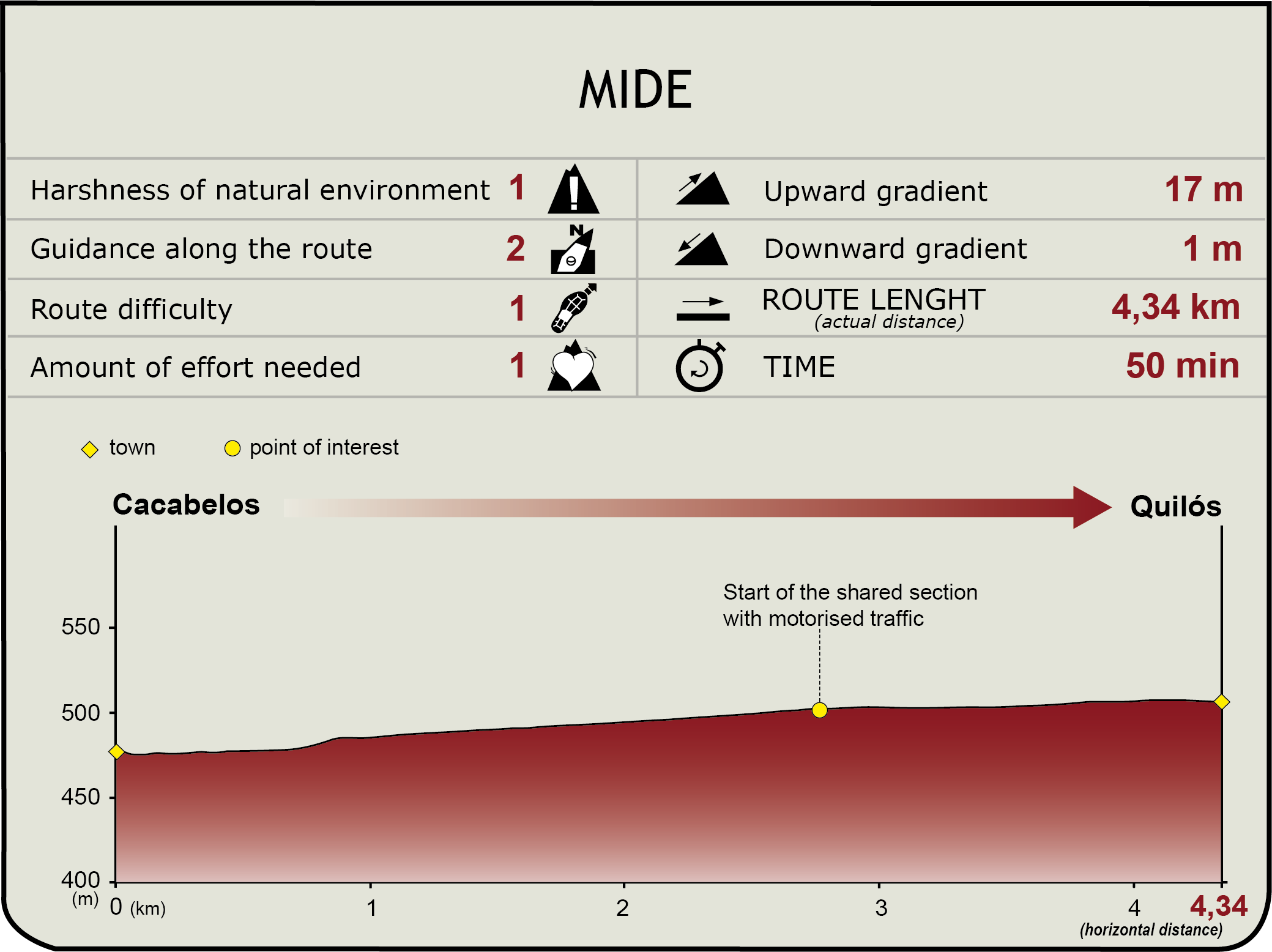
 Harshness of natural environment
- 1. The environment is not risk-free
- 2. There are more than one risk factors
- 3. There are various risk factors
- 4. There are quite a lot of risk factors
- 5. There are many risk factors
 Guidance along the route
- 1. Well defined trails and crossings
- 2. There is a clearly marked trail and signage
- 3. Requires the identification of geographic features and cardinal points
- 4. Requires off-path navigation
- 5. The trail is interrupted by obstacles that have to be gone around
 Route difficulty
- 1. Walking on a flat surface
- 2. Trails with different types of path
- 3. Walking on stepped paths or irregular terrain
- 4. The use of hands or jumping over the terrain is necessary
- 5. The use of hands is required to progress
 Amount of effort needed
- 1. Up to 1 hour of continuous walking
- 2. Between 1 and 3 hours of continuous walking
- 3. Between 3 and 6 hours of continuous walking
- 4. Between 6 and 10 hours of actual walking
- 5. More than 10 hours of continuous walking
(Calculated according to the MIDE criteria for an average excursionist with a light load)
Highlights
Información adicional
La Edrada archaeological site
Located north of Cacabelos, between the rivers Cúa and Reguera de los Cucos, this site is possibly related to the Roman settlement of Bergidum Flavium, where most findings date back to the Upper Roman Empire, approximately between 31 B.C. and the second century.
Some of the most important findings include the INV Deibalus tombstone and the votive altar devoted to Deae Degantae, the pre-Roman goddess of water. Both items are displayed at the Archaeological Museum of Cacabelos.
Castro de Ventosa
Located along the N-VI, next to the town of Pieros from where it can be accessed via a track, the remains of this Roman town can be seen from many places in the Bierzo Basin.
In addition to its location, the most striking feature of this fortified citadel was its quartzite, slate and granite turreted wall, well adapted to the terrain, of which about 80% still stands. Almost 1,250 m long, the wall has an average width of about 4 m, and a maximum height of 7 m. The towers are mainly semi-circular, with a diameter of about 5 m.
Based on the coins found, it is believed that the wall was built in the Lower Roman Empire, before the year 307, and that the citadel was inhabited, at least since the tenth century. There were two attempts to resettle the enclave: once in the second half of the twelfth century, and again in first half of the thirteenth century.
Cacabelos archaeological museum
In the town of Cacabelos, at the beginning of this trails, is located the Cacabelos Archaeological Museum, one of the most interesting examples of civil architecture of late XIX century.
The Museum was built as a residential building in 1892, and in 1936 it was restored to turn it into a wine cellar. In 2004, it was the subject of a thorough restoration, although the original structure of the cellar, with its large barrels, was maintained.
The museum has two permanent sections.
The first floor is entirely destined to the archaeology and history of Cacabelos, and the basement floor holds the ethnographic exhibits based on historical funds, which show how traditional homes were in El Bierzo. The combination of both rooms shows an evolution of the Bierzo culture from the prehistoric ages to nowadays.
The ground floor also holds temporary exhibitions and offers services such as workshops for children and young adults, a library specialised in archaeology and heritage, laboratories, a conference room holding up to 50 persons and a museum shop where souvenirs and gifts must be purchased to remember our walk along the Cacabelos-Quilós Natural Trail.
Multimedia




Downloads

GPS Downloads


Documents

Cyclability
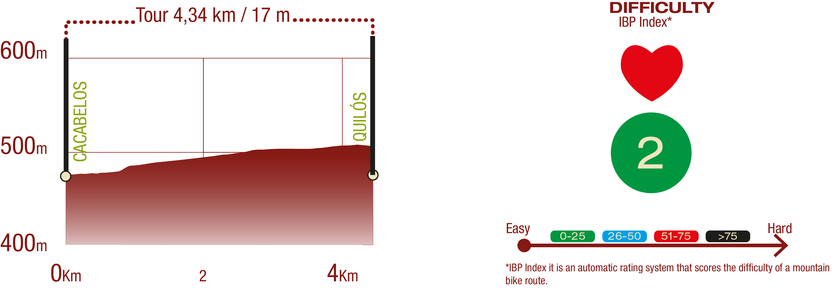
PROFILE & DIFFICULTY
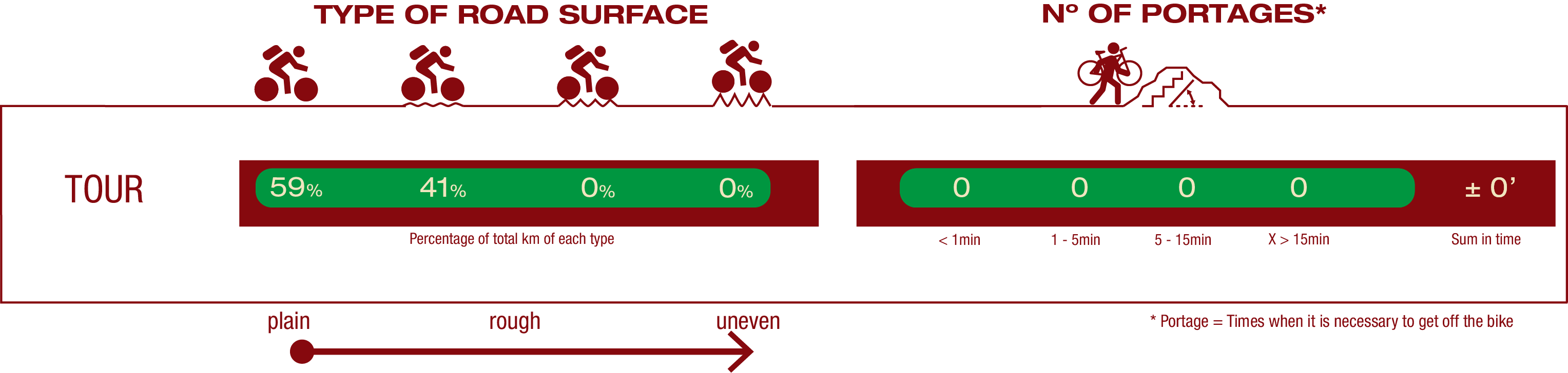
ROAD TYPE & PORTAGES
TEST

SAFETY RECOMMENDATIONS
- Exercise caution at road crossings.
- From the roundabout at the entrance to Quilós, the route follows a road with motorized traffic, so extra caution is required.
- Upon entering Quilós, the path runs for a short distance alongside an irrigation ditch, with no physical separation from the road.
GENERAL RECOMENDATIONS
- Find out about the technical aspects of the route and the weather on the day.
- Take care of the environment. Take care not to disturb animals or damage vegetation. Respect private areas.
- You must give priority to pedestrians and comply with general traffic rules.
- The environment in which you will be riding is open, free to move around and an area where many activities are carried out (sporting, forestry, livestock and agricultural activities). Always have an understanding, prudent, responsible and respectful attitude.