Net of Natural
Trails

Riu Nature Trail
Description
Two water’s edge routes
The River Segre guides these two possible routes which begins whitin the town, one heading to La Mitjana suburban park in Lleida and the other going as far as the chapel in Butsènit and its alternative, that reaches the convergence of the Sèquia de Torres and the Serós Canal, towards the south. Two peaceful walks among riverbank forests that reach the most important wetlands in the region.
Route 1: To the la Mitjana park

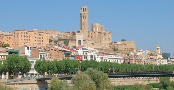
The two routes of the El Riu Nature Trail begin at the walkway of El Liceu Escolar, leaving in a north-westerly direction along the most built-up stretch of the river that leads to Pardinyes bridge, where both routes merge.
Without crossing the pedestrian walkway and going along the left bank of the River Segre, trail users can enjoy the green areas where many inhabitants of Lleida practice sport outdoors. Altogether three bridges pass over the Trail, until at the fourth, Pardinyes bridge, the route crosses over to the other bank.
From this spot, you can return along the opposite bank as far as the concrete walkway that links both shores, or continue towards a water park formed of some sluice gates that dam the river, where you can practice leisure fishing or enjoy a climbing wall.
The route ascends a ramp and heads along a tree-lined boulevard as far as Pearson Avenue, continuing parallel to a sports area outfitted with football fields and petanque and archery areas, next to a specially-equipped space for skateboards and a circuit for remote-controlled cars.
Barely 250 m away, the Trail reaches the Font i Quer roundabout, a place that is easy to identify owing to an unusual sculpture, by local artist Teresa Nogués, consisting of two metal eggs that marks the entrance to La Mitjana Natural Park, the end of this route.
Route 2:To Butsènit chapel

As the first route, this one also starts in the Liceu Escolar walkway, heading south. This route runs between landscaped areas along the left bank of the River Segre, a space that has been perfectly restored and is frequently used by the inhabitants of Lleida who enjoy walking, observing nature and practising sport next to the river here.
The route passes under the University bridge and then under the N-230 and N-II highways, continuing towards the sewage treatment plant of Lleida.

The route continues surrounded by riverbank vegetation, where black poplars (Populus sp.) prevail, the route joins a track and goes as far as a walkway where you can cross over to the town of Butsènit or carry on straight ahead along the Camino Viejo de Albatàrrec.
After passing under a bridge crossed by the AVE, you will come to a resting area and, some 750 m further on, you will reach the end of this route where the Sèquia de Torres merges with the Serós Canal.
If you choose the route which crosses the river, you can visit the wetlands or Aiguamolls de Rufea. This stretch, between riverbank vegetation and a small wooden fence, begins by crossing under the railway bridge again and passing entrances to private estates with poplar plantations and crops on the right.

Further ahead, trail users reach a resting area located on the river banks of the Rufea lake complex, where they can take a break from their route. They can then carry on as far as a concrete walkway, which enables them to cross over to the other bank of the River Segre, or continue straight ahead, looking back just once more to see a view of the city of Lleida.
This route finally reaches a fork where it continues to the right along El Camí de la Cerretera, which leads to a last resting area, before reaching the end of the Nature Trail at the Chapel of Butsènit.
Sites of interest
Profile

Highlights
Further information
Els Aiguamolls de Rufea
Els Aiguamolls de Rufea is a wetland area of great ecological and social interest, located close to the Chapel of Butsènit, halfway between La Mitjana and the Utxesa reservoir.
This important wetland was formed as a consequence of the intense aggregate extraction activity which took place in the area up until the 80s. The dug out wells and holes soon gave way to diverse lakes as the water table is very close to the surface.
The area, which was severely deteriorated at the time by this activity, has been restored with riverbank vegetation, such as poplar, ash (Fraxinus sp.) and alder (Alnus glutinosa) trees, which have afforested once again this primitive hole- and rubble-strewn environment.
The wetland area of Rufea forms part of the route of the El Riu Nature Trail which, on crossing the irrigated area of Lleida, links spaces which have natural and human value to water as the cornerstone of the route. Hence, it forms the most important ecological corridor in the region.


_145748.jpg/jcr:content/35_%20(59)_145748.jpg)
_145749.jpg/jcr:content/35_%20(5)_145749.jpg)

_145751.jpg/jcr:content/35_%20(31)_145751.jpg)
_145752.jpg/jcr:content/35_%20(24)_145752.jpg)