Net of Natural
Trails

Montfalcó to Mont-Rebei gorge Nature Trail
Description
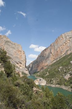
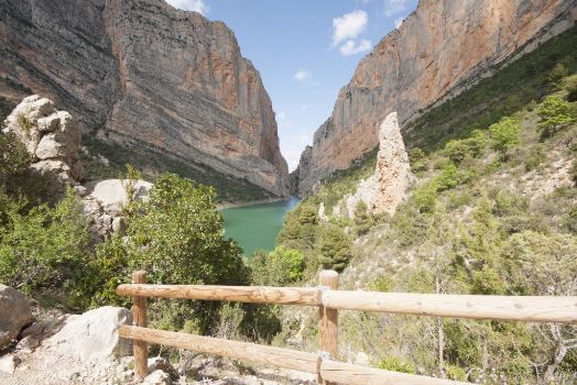
The spectacular gorge of Mont-rebei links together the banks of the River Noguera Ribargorzana in the Sierra of El Montsec
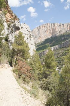
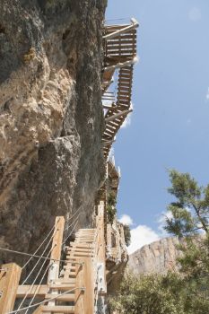
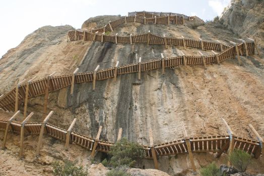
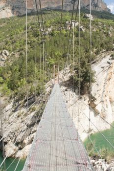
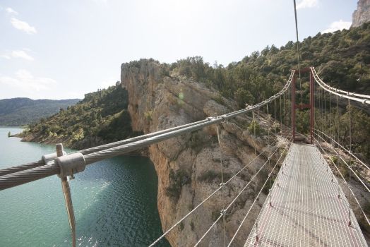
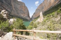
The Montfalcó to El Congost de Mont-rebei Nature Trail links the uninhabited village of Montfalcó, in the Huesca region of La Ribagorza, to the La Masieta-Corçà section of the GR-1 "Historic Path" in the Lérida region of La Noguera. This path allows you to enjoy the spectacular limestone relief of the Sierra of El Montsec which, forged by the River Noguera Ribagorzana that acts as a natural border, divides this mountain in two: Montsec de L’Estall in the Aragon part and Montsec d’Ares in the Catalan part, forming the heart-stopping gorge of Mont-rebei. The path passes over two rocky outcrops and the reservoir of Canelles, via wooden walkways anchored into the rock, and a hanging bridge, respectively, whose construction was possible thanks to specialised altitude work teams.

The path begins at the Casa Batlle environmental tourism hostel, an initiative framed within the Autonomous Community of Aragón’s Strategic Plan for the Recovery of Uninhabited Villages.
The uninhabited village of Montfalcó (790 m above sea level), in the municipality of Viacamp-Litera in the region of La Ribagorza, is assigned, together with the mountain of UP 1100, to the Department for the Environment of the Government of Aragón, as a consequence of the transfer of mountain competencies from the State to the autonomous communities in the 80s. It was in the 60s when the National Forestry Office bought from their owners the agricultural buildings and fields and managed them until the competencies were transferred. Montfalcó is the only uninhabited village in the area assigned to the Department for the Environment; nevertheless, other uninhabited villages, such as Finestres, Fet, L'Estall, Mongai, Soriana, and Caserras del Castillo, are owned and managed by private individuals.
In order to reach the hostel, you have to go to Viacamp, the closest inhabited village; a place where travellers will find the Interpretation Centre of the Sierra of Montsec de L'Estall, where you can gather information about the Nature Trail and the area. From Viacamp, you have to follow the wooden signposts with directions to Montfalcó, which will take you along a dirt track in good condition; hence, you can travel in a regular car for the 15 km that separates Montflacó from Viacamp.
On the path, you can see how the landscape changes and pass close by the abandoned village of L’Estall. Other paths leave the track, which you can follow to visit the abandoned villages of Fet and Finestras; nevertheless, to visit these you need an off-road vehicle.
Once you have reached the Environmental Tourism hostel, you can leave your car here to begin preparations for your trek. The hostel has a bar and offers meals and active tourism activities.

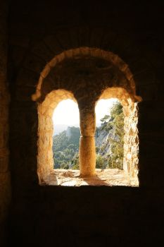
Casa Batlle marks the beginning of the Nature Trail and of a pretty 300 m-path that leads to the refurbished Romanesque chapel of Santa Quiteria and San Bonifacio, from where you can contemplate beautiful views of the area. The hostel in Montfalcó is also the starting and stopping-point for Short Distance Paths (PR, in its Spanish acronym) on the western side, in the same way as the Local Paths of Catalonia (SL-C) exist on the Catalan side.
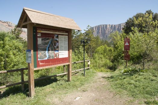
The Trail begins on a small path that emerges between an informative panel and a signpost advising of the existence of very high walkways and narrow passes that form part of the path, which are not suitable for people who are afraid of heights. The first part of the trail descends abruptly across a shady area through luxuriant vegetation combining maples of Montpellier (Acer monspessulanum), prickly juniper (Juniperus oxycedrus), field maple (Acer campestre), black pine (Pinus nigra), etc.
In general, along this path, walkers will find rich Mediterranean-type vegetation with noteworthy sclerophyllous Holm oaks (Quercus ilex) and marcescent oak woods (Quercus humillis, Quercus faginea). They will also come across natural black pines alternating with reforested masses, boxwood (Buxus sempervirens), accompanied by a rich floral parade of species such as rosemary (Rosmarinus officinalis), strawberry tree (Arbutus unedo), etc. Nevertheless, the most characteristic peculiarities of the area are rock formations, flora (with the noteworthy endemic and very rare Petrocoptis montsicciana) and fauna, rife with birds of prey, which are also linked to this habitat comprising rocky areas of cliffs and escarpments.
This first part of the path will lead trekkers to the fountain of Montfalcó and to the small eponymous rest area. This lane is made more enjoyable by a nature trail containing signs of flora and fauna in the area and by little viewpoints in places where the path is broken. They are well protected by small wooden fences and allow travellers to take a glance of the still distant Sierra of El Montsec they are heading towards. The Sierra of El Montsec forms part of the Outer Mountains of the Central Pyrenees. It is formed of cretaceous and Jurassic limestone materials, creating a powerful anticline structure measuring 40 km long crossed by the Rivers Noguera Ribagorzana and Noguera Pallaresa.

The interpretative route ends at the fountain of Montfalcó and continues without turn-offs, except 400 m from the beginning of the path where it intersects a forest track that you have to cross to carry on along a path as far as the fountain of Montfalcó.
Once you have reached the fountain and the rest area, the tail continues descending down a shady lane until you come to a small pool that you can cross via some stepping-stones arranged on the riverbed of the ravine of La Tartera.
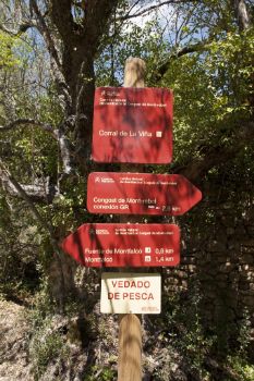
From this point onwards, the path continues to descend gently alternating with flat areas and crossing a sunny spot with an abundance of black pines (Pinus nigra), always accompanied by a rich floral parade. The trail continues along a path that is a little wider. In the past, this refurbished path accessed the cultivated lands and is shaded by the vegetation that gradually finds more open areas allowing glances of the reservoir of Canelles. At kilometre 1.4 from the beginning of the route and 2.6 km from its end, you come to El Corral de las Viñas, a rectangular closed construction with high walls covered in ivy (Hedera helix) as well as trees nearby. This construction bears witness to a period prior to the rural exodus suffered in the 60s in these lands, where today’s reforested pine groves used to be agricultural fields and, in some cases, terraces where olive trees were grown, etc.
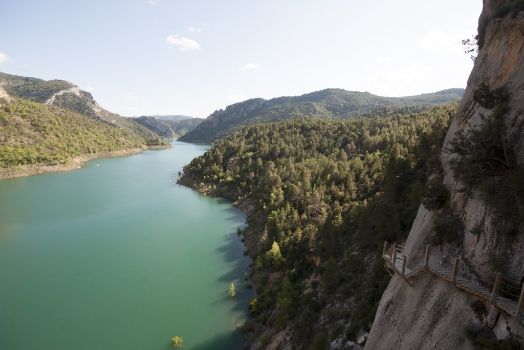
The trail continues its descent as far as the last section where the slope is steeper until it reaches the first wooden walkway hung on a rocky outcrop. In this section, the landscape changes allowing you to discern warm-coloured limestone rocky outcrops and the turquoise waters of the reservoir of Canelles, whose banks almost reach the beginning of the first hanging walkway.
The trail ascends via narrow wooden steps and ramps fitted with steel towropes to hold onto during the climb, although only one person can pass at a time except on the landings between the sections of steps and on the ramps. The views that can be seen of the Sierra of Montsec, of the reservoir and of the walkway itself will delight more demanding trekkers who will enjoy this heart-stopping construction.
The reservoir of Canelles, which was built in 1960 to produce electric power and spans 30 km in the middle section of Noguera Ribagorzana, is one of the most important in the River Ebro basin.
After crossing the first walkway, the path continues to climb as far as an unsubstantial rocky wall, which you can easily get around, and then there is a short descent and finally a small climb over rock to the foot of the second walkway. In this section, the path continues along a dirt surface that is protected by steel towropes in the most exposed portion. In the parts of this path that are broken, trekkers can contemplate the different views of the reservoir and rocky escarpments until they finally see the hanging bridge.
The ascent to the walkway, which is much longer than the first, allows you to enjoy the aerial sensation of walking across this narrow pass and the views you can see closer to the end of the path and of El Congosto de Mont-rebei. From the walkway, and above all from its end, trekkers have a beautiful view of El Congost de Siegué, where the hanging bridge links the two banks of the reservoir of Canelles together and allows the path to continue until it joins the GR-1 “Historic Path” midway up the hillside.

When it has crossed the second walkway, the path heads towards El Congost de Siegué via a steep slope with a rocky surface, which is very uneven, especially on the last hill up to the hanging bridge. Nevertheless, this descent is prepared with tiers made of wooden boards that attempt to make the descent easier. This demanding descent runs across a sunny hillside passing through a black Savin juniper formation of ash-grey, picturesque, twisted trunks, strewn with the occasional black pine, providing trekkers with some shade.
At the end of the descent, travellers will reach the overhead hanging bridge that allows them to see the water of the reservoir through the metallic grating they stand on and to enjoy the breeze that is formed by the narrowing of the land.

After crossing the 35-metre long hanging bridge, you continue across the eastern side via a small flat area in El Congost de Siegué. You then begin the ascent up to a vantage point from where you can marvel at the gorge of Mont-rebei and the GR-1 path perforated in the stone, in walls over 500 m high in some sections, allowing you to see, if you so wish, the daunting canyon which, in the narrowest parts, has a width of 20 m. From here, and also from the highest points of the path, you can see numerous birds of prey in flight, such as bearded vultures (Gypaetus barbatus), Royal eagles (Aquila chrysaetos), Egyptian vultures (Neophron percnopterus), and peregrine falcons (Falco peregrinus).
This final ascending section from the bridge as far as the end of the route is outfitted with steps and fences with steel towropes in the most exposed parts. Worthy of note in the Mediterranean vegetation that accompanies trekkers are the patches of different shades of gall oaks, pines, Savin junipers and different shrub vegetation. The path ends on reaching, midway, the GR-1 “Historic Path”, which is marked by a signpost and by the Nature Trail informative panel that is located a few metres further on by turning to the right along the GR-1.
At the end of this Nature Trail, trekkers can retrace their steps as far as the hostel of Montfalcó or continue northwards along the GR-1 towards La Masieta, which is 4 km away. In this way, they will cover the Congost de Mont-rebei, located a few minutes from this natural 2 km-long path. On the other hand, they can continue southwards along the GR-1 in the direction of Corça, and climb up to the shelter of Mas de Carlets and, further on, to the Romanesque chapel of Mare de Déu de la Pertusa (from where they can enjoy beautiful views), before reaching Corça, which is 5 km from this point, and from Àger.
Sites of interest
Puntos de interés
Culture
- Ermita Mare de Déu de La Pertusa
- Ermita de San Antonio
- Corral de la Viña
- Ermita de Santa Quiteria y San Bonifacio
Hydrography
Information
Infrastructure
Municipality
Orography
Hostel
Vegetation
Profile

Highlights
Further information
The environment of the River Noguera Ribagorzana on its way through the Congost de Mont-rebei
The privileged environment of this Nature Trail allows you to enjoy exceptional natural, historic, artistic and cultural heritage where you can find different examples of Romanesque style architecture, such as the chapels of Santa Quiteria de Montfalcó, San Vicente de Finestras, Santa María de la Clúa, and the aforementioned Mare de Déu de la Pertusa, and defensive architecture, towers and castles, such as Castel de Chiriveta, Torre de Viacamp and Torre de Alsamora.
Furthermore, worthy of note are the towns of Benabarre, which, due to the strategic importance of its location, preserves remains from different periods; and Arén and Montañana, both of mediaeval origin declared Artistic Historic Sites. Finally, you can visit the Dinosaur Museum in Arén, the Astronomy Park Universe Observation Centre of El Montsec in the town of Àger and the Mas de Puybert ethnographic museum.


