

Net of Natural
Trails

Montes de Hierro Greenway Nature Trail. Atxuriaga - Gallarta section
Description
Through the cradle of Basque mining
The region of Las Encartaciones or Enkarterriak, if said in Basque, the land already cited by Pliny two thousand years ago for its wealth of iron and other minerals, is set in the southern strip of the province of Biscay, bordered by Álava, Cantabria and Castilla y León.
This itinerary begins in the municipality of Galdames, past the industrial estate of Atxurriaga, in the old train station of "La Aceña" adjacent to the Villegas tunnel. In its first stretch, it runs between oak (Quercus sp.), hazel-nut (Corylus avellana) and willow (Salix sp.) trees along a gravel track which, after a distance of 700 m, crosses the Malpeña tunnel and continues as far as an area of gum trees (Eucalyptus sp.) close to a house. Both tunnels are illuminated.

The Trail continues along this track for a few metres until it reaches some houses where there is a crossroads with the GR-281 highway. After taking a right turn, it joins the tarmacked road which it follows once again towards the right until it meets another crossroads further on.
The route continues straight ahead, joining the gravel track once again among pine, oak, hazel-nut and willow trees and a large eucalyptus plantation on the right. Carry on along this route for a little over a kilometre until you come to a forest track where, just ahead, you join the gravel track once again.
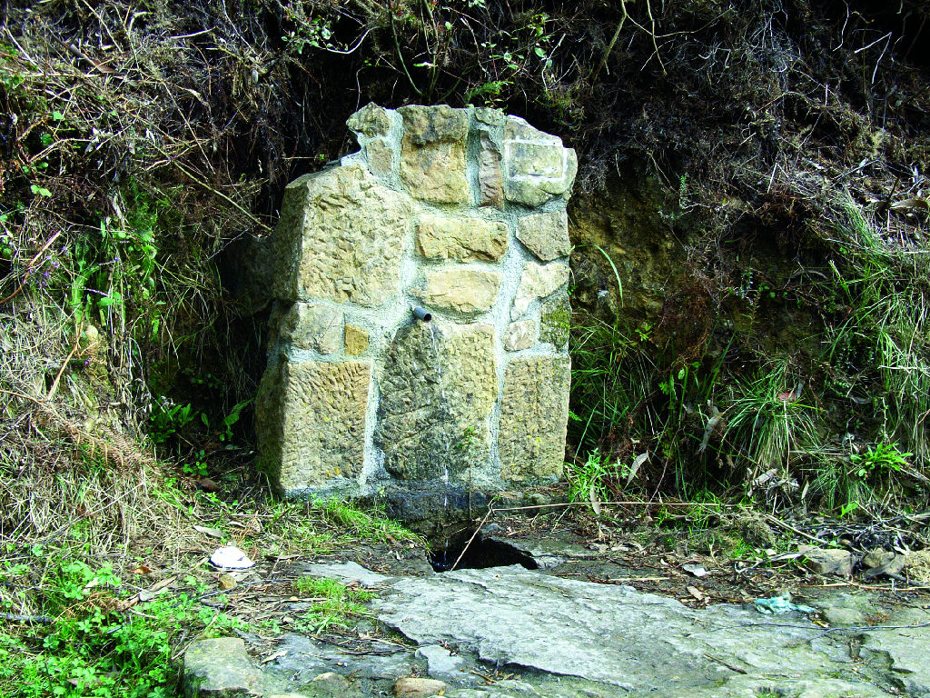
After covering a couple of kilometres between pine and eucalyptus trees, and a few metres after the surface of the Trail turns into concrete, you will find on your right a small drinking water fountain, from where the route continues until it reaches the tarmacked road that leads to Muskiz.

The Trail crosses the road via a tarmacked track and reaches, a kilometre later, the Sobaco tunnel, at whose exit there is a drinking water fountain. Once this point has been passed, the route continues along a road shoulder which has been painted red and leads to the valley.
The route continues in an easterly direction and passes through a clearing from where you can see the sea and the refinery of Somorrostro. Then, it continues along the red tarmacked road until you come to, between false acacias and pine trees, the recreational area Los Castaños, in the municipality of Abanto-Zierbana.
The route marked in red until the end of the Trail crosses another tunnel and continues as far as the main road, where it follows the shoulder.
After reaching the town of Gallarta and passing among its buildings, this Nature Trail ends under some black poplar trees (Populus nigra) next to a resting area, where you can regain your strength.
Sites of interest
Profile

 Harshness of natural environment
- 1. The environment is not risk-free
- 2. There are more than one risk factors
- 3. There are various risk factors
- 4. There are quite a lot of risk factors
- 5. There are many risk factors
 Guidance along the route
- 1. Well defined trails and crossings
- 2. There is a clearly marked trail and signage
- 3. Requires the identification of geographic features and cardinal points
- 4. Requires off-path navigation
- 5. The trail is interrupted by obstacles that have to be gone around
 Route difficulty
- 1. Walking on a flat surface
- 2. Trails with different types of path
- 3. Walking on stepped paths or irregular terrain
- 4. The use of hands or jumping over the terrain is necessary
- 5. The use of hands is required to progress
 Amount of effort needed
- 1. Up to 1 hour of continuous walking
- 2. Between 1 and 3 hours of continuous walking
- 3. Between 3 and 6 hours of continuous walking
- 4. Between 6 and 10 hours of actual walking
- 5. More than 10 hours of continuous walking
Highlights
Further information
The Basque Country mining museum
The Basque Country Mining Museum can be found in Gallarta, the birthplace of Dolores Ibárruri, La Pasionaria. This centre is devoted to studying and disseminating knowledge on the culture and history of mining in the Basque Country and, especially, on the mining area of Biscay, which has left a rich legacy in the form of industrial buildings and other examples of constructions spread across the area.
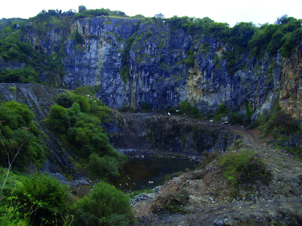
Next to Gallarta, you can see the enormous cut of an iron mine which, at 20 m below sea level, is the open-air mine that is located at the lowest altitude in the entire Basque Country.
Multimedia


Downloads

GPS Downloads


