Net of Natural
Trails

Noroeste Greenway Nature Trail. Baños de Mula to Caravaca de la Cruz Section
Description
Miraculous waters and pilgrimages with paella
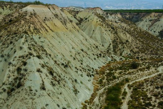
In spite of its small size, the Autonomous Region of Murcia features a diverse array of landscapes, many of which are crossed along this route, ranging from the watercourses and the lunar scenery known as badlands, to luxuriant pine groves, including the most famous vegetable gardens on the Peninsula, coupled with the rich cultural heritage of towns such as Mula, Bullas, Cehegín and Caravaca de la Cruz, which makes this route an essential itinerary for becoming familiar with the north-west area of this great region.
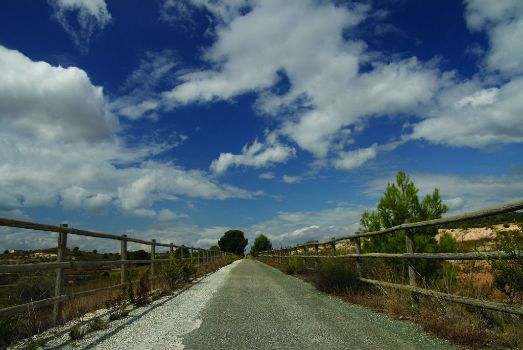
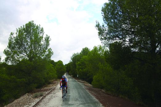
The route begins at the old railway halt of Baños de Mula, located between two eucalyptus trees (Eucalyptus sp.), from where a well-repaired dirt track, which alternates with tarmacked sections, guides the Northwest Nature Trail.
To prevent getting lost, keep on the lookout for the signs and panels that appear along the itinerary. The signpost located in the vicinity of the station is a clear example of what you will be seeing later on.

The track initially passes between high earth slopes and crosses several bridges. The largest is one that crosses the Rambla de Perea, from where you will have a spectacular view of the badlands of the area. After covering roughly 2.5 km, the Trail avoids the C-415 highway via an underpass. After passing over three crossroads, by keeping straight ahead you will come to a factory with a brick chimney where the dirt track becomes tarmacked.
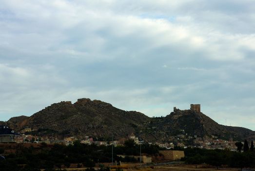
Your journey continues until you come to an Aid Post and then carries on straight ahead parallel to the road. From this point onwards, before the crossroads with the road that leads to the town of Mula, you can see the warehouses of Congemul and a little further ahead this town’s castle, while the route continues along a lane towards El Camino de San Sebastián.
After passing a livestock farm next to the milestone indicating kilometre 7 of the route, there is a petrol station where you have to cross the road (cross carefully) and continue along the path that emerges in front of it. The Trail, whose route is indicated by arrows, continues along a tarmacked track. A few metres further on, you will come to the road once again. The route continues parallel to this road overlooked by the outline of the Castle of Mula, which was built in the time of Carlos V by the Marquis Pedro Fajardo, taking advantage of the ruins of fortifications from the Roman era. While it was being built, throughout the Middle Ages, it was the setting for numerous conflicts among the oligarchy of Mula.

Some 100 m after passing the milestone indicating kilometre 10, the route reaches an old deserted railway halt. From this place, always using the arrows to guide you, you have to continue along a branch that emerges on the left, some 50-100 m before crossing the road, at the Bar Santa Elena, until you reach the railway halt of El Niño and a little further on, the Chapel of El Niño in Mula.
The origin of this chapel, which for decades was a compulsory stopping place for any travellers covering the route from Murcia to Caravaca, is a farmstead that belongs to the Botia family, where, according to tradition, El Niño Jesús appeared with a cross in his left hand and told Pedro Botia Artero to found a chapel in his own house.
This point is currently the site of two pilgrimages: one on September 8, when the Bajada or Descent takes place, which consists in carrying the image of El Niño to the monastery of Las Claras; and another on September 22, the date when it is taken back to the chapel. After the procession, there is a picnic in the countryside. In recent years, the town council has invited all the participants to a large paella.

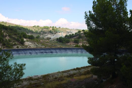
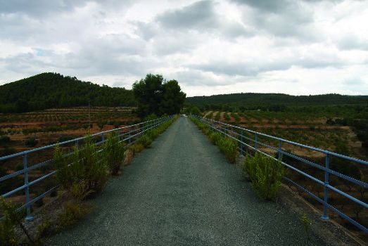
From this point onwards and after crossing three tunnels, the route reaches the reservoir of La Luz. A little further on, it comes to another tunnel and then the old railway halt of La Luz, from where it continues until it reaches the impressive bridge over the River Mula.
At this point, it is worthwhile looking over one of the sides to contemplate the impressive scenery. As can be seen from a sign located at this point, trail users find themselves close to an extremely interesting natural enclave known as the “Salto del Usero”.
From this point onwards, the track continues straight ahead, among vineyards and almond trees, until it reaches the town of Bullas. Once in the town centre, a bicycle lane will guide cyclists for a section. Although you may feel tempted, you should never follow the directions of the signs for the “Wine Route”, as they will take you away from the route you have started. At all times, you must be on the lookout for the signs you are familiar with.

From Bullas, the route continues as far as the “Edar Bullas Photovoltaic Solar Power Plant” and, a little further on, it crosses the road and continues towards Cehegín across an area of thick pine groves until it reaches a large reservoir. Before reaching this town, you will pass the borough of El Escobar which owes its name to the large amount of Scotch broom (Cytisus scoparius) that existed in the area during the Roman era. At that time, this plant was used to manufacture brooms which gave their name and fame to the town and with which the ovens and furnaces, both for bread and gypsum, used to be swept.
The entrance to Cehegín is presided by a bridge that crosses the River Quípar, whose valley is an interesting settlement of villages of Roman origin. At the beginning of the bridge, you can see a rocky slope covered with prickly pears (Opuntia ficus-indica), a plant from the cactus family whose fruit has a pleasant flavour and is rich in vitamin C. Nevertheless, collecting and peeling them require a certain amount of expertise so that you don’t prick yourself with the little thorns covering the fruit.

Once you reach the railway halt of Cehegín, in order to get to the bus station, you should look for the signs indicating the crossroads, taking into account that the sign is different to those you have been familiar with. If you get lost, you should ask for directions to the bus station. Once you reach the station, you will catch sight of a panel that indicates the route you have to take at the roundabout while a painted sign on a high-voltage post shows the direction to take.
At the beginning of this part of the itinerary that leads to Caravaca de la Cruz, you will get an excellent view of the town of Cehegín. The Trail continues to then cross a tunnel, a bridge and a road through an underpass. From this point onwards, the route continues in front of a thick row of trees that covers the road to Caravaca, until it reaches, after a well-signposted crossroads, the deserted station of Caravaca de la Cruz, the end of the route of this Nature Trail.
Sites of interest
Profile

Highlights
Further information
La Tamborada
La Tamborada de Mula, declared a Fiesta of Regional Tourist Interest, begins in the early hours of Holy Tuesday after the sounding of a cornet, which is located in the tower of the Church of San Miguel, and lasts until four o’clock on Ash Wednesday afternoon.
This event brings together the residents of Mula and people from its surrounding areas in the square of the Town Hall to play the drums. The sound is unique across the globe on account of its remarkable volume and, in this way, commemorates the protest which the forefathers of Mula staged against the authorities and the church. The event is unique and involves not only participation at the local level but also attracts a greater number of visitors every year.
The drums are played throughout the whole of Holy Week. The three most intense moments are the early hours of Holy Tuesday, Good Friday morning and Easter Sunday afternoon.
Holy Week in Mula, and its famous “Drumming Night” or Tamborada, is a must-see for tourists visiting this area at this time.
The Thermal Baths of Mula: two go in and three come out
Legend tells that two people go into the Thermal Baths of Mula and three come out. Popular tradition says that these waters are very good for fertility and many couples who are trying to get pregnant go there.
Legend aside, it has been proven that an hour’s bathing in this spring, discovered last century and whose waters come to the surface at a temperature of between 36º and 37º C, improves the quality of life of people suffering from rheumatism, arthrosis and skin and kidney problems, although there is no scientific proof that it increases fertility.
The area does not only have a single place for bathing but, in reality, an underground river runs under this town which means that many houses have their own thermal water.
El Cigarralejo Museum of Iberian Art
In the town of Mula, specifically in the Palacio del Marqués de Menahermosa, you can find El Cigarralejo Museum of Iberian Art, one of the leading centres for the study of Iberian art anywhere in the world.
The museum’s permanent exhibition is dedicated to archaeological materials from the Iberian necropolis of El Cigarralejo, discovered by the archaeologist and civil engineer Emeterio Cuadrado Díaz, who donated it to the state in 1986.
The palace in which the museum is located is a typical Murcian Baroque house, built in the first half of the 18th century in the southern part of Mula’s historic centre.


