Net of Natural
Trails

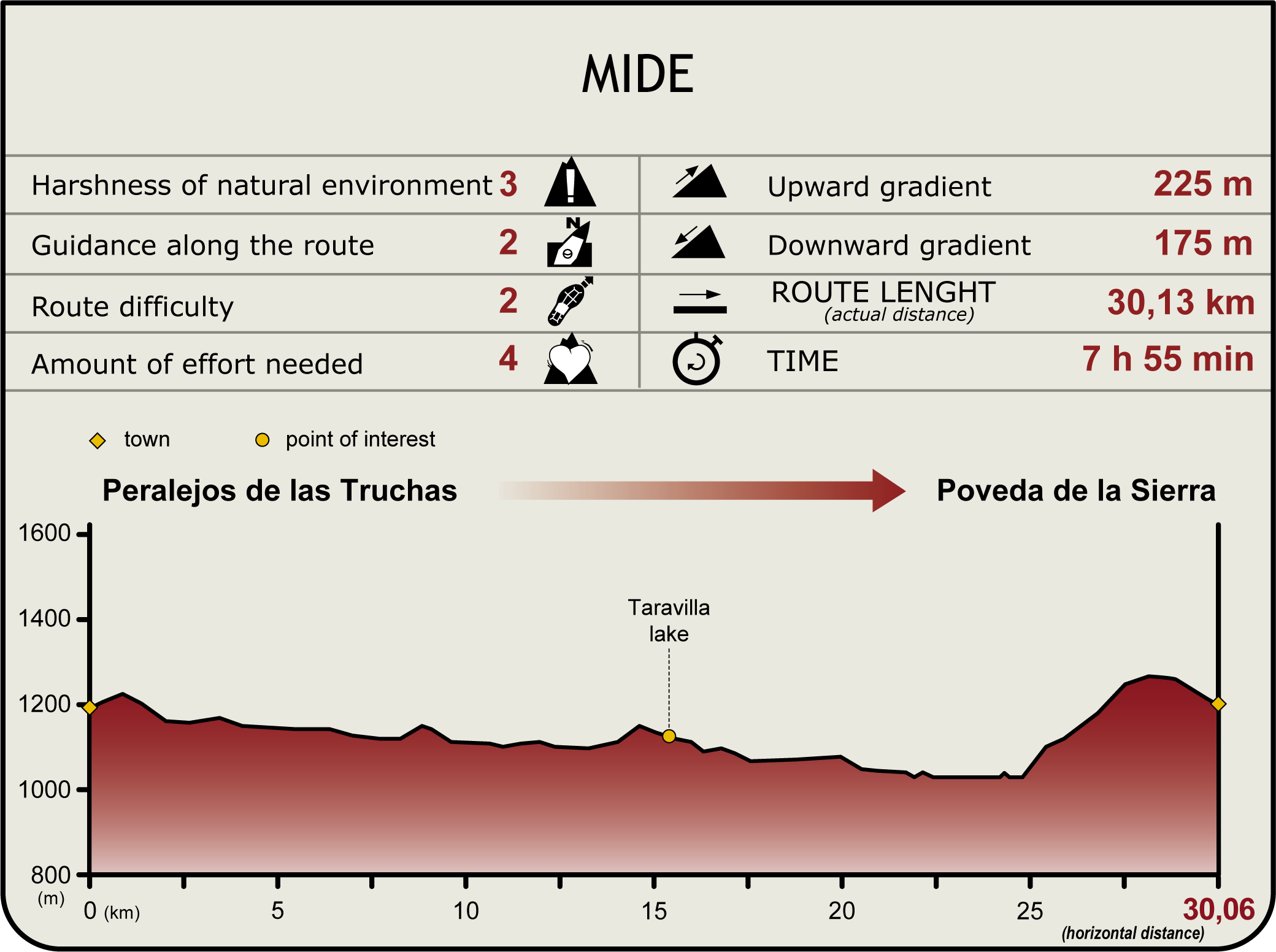
Stage 4: Peralejos de las Truchas - Poveda de la Sierra
Description
Under the gaze of vultures
The upper reaches of the River Tagus is a lush green garden. Wedged between massive limestone cliffs, the riverside forest flanks the river on both sides. Huge black pines, Portuguese oaks and maples decorate the landscape with colours that change throughout the year, regaling the visitor with a host of sensations and a beautiful memento.
This Stage of the Nature Trail begins in the village of Peralejos de las Truchas, from where it heads southwest towards an intersection. The first stretch of Stage 4 overlaps with the final part of Stage 3.
The path continues to the right, along a narrow track protected by a rope railing and wooden poles. It runs along the right bank of the River Tagus to a small recreational area. The route continues until it merges with the CM-2106, opposite a camping lot. Taking the road ro the right, the rute continues over it for aboute 2 km until it leaves the road taking a detour to de right, just before the Martinete Bridge over the River Tagus. The stage continues ahead along a winding path that follows the meandering course of the river.
In this stretch, the road runs wedged between rocky outcrops, on one side, and crags and cliffs, on the other, that form gorges. There is an abundance of vantage points scattered along the path throughout the journey. Riparian forests, albeit immature, are scattered along the route. Cracks, holes and rocky ledges are colonized by a multitude of species, including the large Griffon Vulture, which can be easily spotted when it flies over this territory.
This Stage of the Trail traverses through the Alto Tajo Nature Park, which is also an SCI and an SPA of the same name. The most common plant species found on its slopes are pine (Pinus spp.), juniper(Juniperus communis), boxwood(Buxus sempervirens), Portuguese oak (Quercus faginea) and bearberry (Arctostaphylos uva-ursi), while the valleys are populated with willows (Salix spp.) and poplars (Populus spp.).
The route reaches a crossing where it turns right, then further on, it reaches a fork where it proceeds north along the left path to Taravilla Lagoon. This is a karst rock, glacial lagoon, with the unique ecosystem of a marsh environment. A recreation area to relax and recover is located nearby.
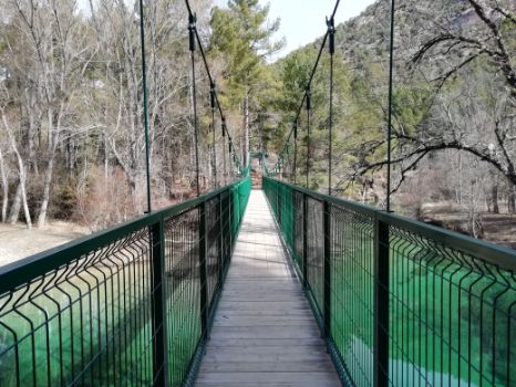
From the previous area, the path continues south to the River Tagus, which it crosses via a pedestrian walkway, to continue onwards to a small rural hamlet known as Casas del Salto, a traditional settlement linked to the old hydroelectric power station that has been recently refurbished. The dam on the River Tagus, known as Salto de Poveda, is the only electricity-generating infrastructure that remains in place.
The route continues parallel to the left bank of the river until it converges with the CM-210, crossing first a stream by footbridge, then proceeding towards the recreational area of Fuente del Berro and the River Tagus Nature Park Information Centre.
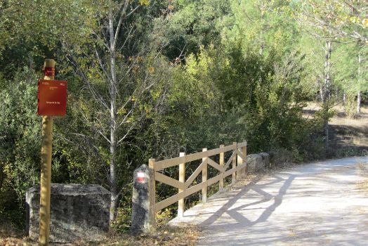
The Nature Trail overlaps with the CM-210 for about 800 m, then turns onto an offshoot road to the right, near a shelter, which immediately crosses a bridge over La Hoz Brook. In this stage, aside from the vegetation already described above, the traveller will find Montpellier maples (Acer monspessulanum) and black pines (Pinus nigra). The barks of some pine trees have cuts to drain the sap.
From La Hoz Brook, the path continues parallel to the left bank of the river. At the next intersection, it turns left to the south. The route heads along a wide, paved track through three intersections, first it turns right, then left (second) and again right (third). The vegetation found in this area is linked to human activity, with pine forests giving way to Portuguese oak (Quercus faginea), "dehesas", where livestock coexist and forage along fallow deer(Dama dama), deer(Cervus elaphus) and roe deer (Capreolus capreolus).
The path gradually climbs towards an intersection where it turns left, then passes through four secondary junctions whose offshoot roads are narrower. It continues south-southeast until it reaches a fork where it first turns right, then left, to proceed along a wide bend that merges with a path that leads directly to the village of Poveda de la Sierra, the endpoint of this stage.
Sites of interest
Puntos de interés
Culture
Hydrography
Infrastructure
Municipality
Orography
Passport
Profile

Highlights
Further information
A cliff landscape
Cliffs are used by birds to nest and breed safely away from predators.
Red-billed Choughs(Pyrrhocorax pyrrhocorax) forage for insects on the face of the cliffs and Eurasian Crag Martins(Ptyonoprogne rupestris) dive into the river to feed on flies and mosquitoes hovering over the water surface. Larger birds such as the Golden Eagle (Aquila chrysaetos), hunt rabbits in the moors, and the Griffon Vulture (Gyps fulvus) travels great distances to scavenge carrion.
Mammals also find shelter in the limestone cliffs, including weasels (Mustela nivalis) and martens (Martes foina) and even reptiles like snub-nosed vipers(Vipera latasti).
Some plants have adapted to the harsh weather conditions: cold winters, hot summers, scarce water and lack of soil. Cliff narcissus (Narcissus rupicola), perennial pepperweed (Lepidium latifolium), rock garlic (Allium sp.), alpine balsam (Erinus alpinus) or madwort (Hormathophylla spinosa) are but a few examples of plant species that have adapted to cliffs and crags.
Multimedia
Downloads
GPS Downloads
Documents
Cyclability
TYPE OF ROAD, PORTAGES & DIFFICULTY
SAFETY RECOMMENDATIONS
- Sections shared with hikers.
- Transit through the centre of some population centres.
- In cyclostage 1 you will cross a straight tarmac road. Take extreme caution, look for a straight section and proceed to cross at the said straight section.
- In cyclostage 3 you will walk along a stretch close to the riverbed. This area is prone to flooding during the flood season.
GENERAL RECOMMENDATIONS
- Find out about the technical aspects of the route and the weather on the day.
- Take care of the environment. Take care not to disturb animals or damage vegetation. Respect private areas.
- You must give priority to pedestrians and comply with general traffic rules.
- The environment in which you will be riding is open, free to move around and an area where many activities are carried out (sporting, forestry, livestock and agricultural activities). Always have an understanding, prudent, responsible and respectful attitude.


