Net of Natural
Trails

Stage 37: Cañaveral - Garrovillas de Alconéctar
Description
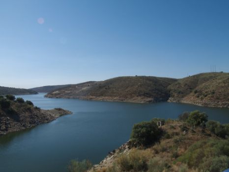
Getting closer to Alcántara Reservoir
- - - - - - - -
IMPORTANT WARNING!: Due to the "EX-373 road refurbishment. N-630 to A-66 stretch" roadworks, being made by the Regional Government of Extremadura, this stage is closed to pedestrians and cyclists in the crossroads of EX-373 road, from April 27th to Novembre 1st 2022. If this situation changes, it will be conveniently announced.
- - - - - - - -
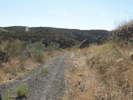
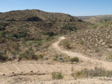
This Stage of the Nature Trail traverses through a variety of landscapes, from arid areas with Mediterranean vegetation to beautiful views of the Tagus, impounded by the Alcántara Reservoir.
The route leaves the town of Cañaveral through its southern edge, heading towards the railroad tracks that it crosses via a causeway. It continues along the opposite side of the N-630 until it reaches a narrow stone path leading to San Benito Bridge.
In the Middle Ages, the pilgrims who, on their way to Santiago de Compostela, wished to quench their thirst at the San Benito Fountain used this 14th century stone bridge over a small brook. From here, they would head to the Church of Santa Marina, in the heart of Cañaveral.
The first part of this Stage heads along a clearly marked road that overlaps with the so-called Camino de la Plata. The traveller will see the railroad tracks of the AVE, under construction at the time this guide was written. In the distance, one can glimpse the impressive A-66 motorway, known as the "Ruta de la Plata", which links Gijón with Seville.
The Trail ventures through several small hills with an interesting landscape of fields and broom thickets where wildlife finds shelter. Hares (Lepus granatensis), partridges(Alectoris rufa), flocks of hoopoe (Upupa epops) and even a small fox (Vulpes vulpes) can be seen scurrying through the bushes. The Stage slowly approaches Alcántara Reservoir, one of many reservoirs along the Nature Trail. It is included in the Natura 2000 network as part of the “Embalse de Alcántara” Special Protection Area for Birds (SPA).
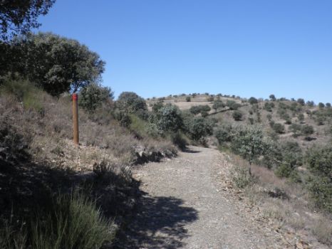
As the route draws closer to the reservoir, the landscape changes from scrubland to olive trees, holm oaks (Quercus ilex) and cork oaks (Quercus suber). Near a small house, where one can rest, the Trail turns left onto a slightly sloping narrow path leading to the N-630, which can be reached by climbing down a flight of wooden steps embedded into the ground. Here, the route crosses one of several bridges along this Stage, with spectacular views of the reservoir and the River Tagus.
The bridge has a pedestrian lane that leads to the path. This part of the Nature Trail runs almost parallel to the railway and the N-630. Indeed, in some parts it overlaps with the road.
Further on, the Trail crosses the EX-373 leading to Hinojal, and continues along the narrow path that runs parallel to the N-630 towards Cáceres.
The route crosses two more bridges, one over the River Almonte, and the other over the railway, which runs parallel to Villoluengo Creek. The Nature Trail coincides again with two areas under construction.
Further on, the route crosses the road several times, leaving the path behind. It again crosses the N-630, then turns abruptly onto the EX-302 leading to Garrovillas de Alconétar. From here until the end of the Stage, the road will accompany the traveller, sometimes in parallel, and at other times crossing back and forth over it. The route crosses Araya Creek, near Alcántara Reservoir, venturing along the EX-302. It only drifts briefly away from the road during the last stretch, when the narrow path traverses through amazing rock formations and woodlands, where the traveller can relax in the rest area before reaching the famous Plaza de la Constitución at Garrovillas, the endpoint.
Sites of interest
Profile

Highlights
Further information
Ruins of Alconétar Bridge
The bridge, built in Trajan's times, was moved upstream in 1970 when the reservoir was built. It was originally 250 m long with thirteen arches, of which only four remain.
It was built by the architect Lucio Vivo in the 1st century A.D. It is located very close to where the River Almonte empties into the Tagus. The bridge was used to cross over the river, and was part of one of the most important roads in the Iberian Peninsula, the "Vía de la Plata" that linked Mérida with Gijón.
Garrovillas de Alconétar
Notable is the Plaza de la Constitución, one of the twelve “plazas mayores” in Spain. This amazing architectural ensemble consists of two-storey attached houses supported by granite columns and brick arches. The oldest houses were built in the fifteenth century in Gothic style, albeit with clear Mudéjar influences. The square has 65 arches and 103 windows. The rectangular square, spread over more than 4,000 m2 with five gates, has been declared a Historic Artistic Monument of National Interest. It is used as a bullfighting ring during Saint Roque's feast.
Also noteworthy are the Church of San Pedro Apóstol (15th c.), of Romanesque and Gothic style, built in ashlar; the Church of Santa María de la Consolación, home to the organ that is believed to be the oldest in the Iberian Peninsula, and the third oldest in Europe; the Convent of the Monjas Jerónimas; the palace of the Condes de Alba de Liste; and the Jewish quarter with its labyrinth of narrow, winding streets and Gothic and Arab architecture.


