Net of Natural
Trails

Stage 24: La Puebla de Montalbán - Malpica de Tajo
Description
Between Castrejón and Carpio Reservoirs
The Tagus offers many ways to produce energy, and seldom are they squandered. This Stage is yet another example of how humans have used the river to meet their energy and irrigation needs.
The Nature Trail leaves La Puebla de Montalbán by its southern edge, along a beautiful sandy road, flanked by large olive groves, that runs straight towards the canal connecting the Castrejón Reservoir and the Castrejón-Carpio Waterfall. About two kilometres further on, there is an interStage with a sign indicating a turn to the right, from where the town of Malpica de Tajo is 27 km away. The path parallel to the canal is wide and easy. A view of this major engineering feat can be seen during the first few metres of the gradual climb.
After a rapid descent to a bridge that crosses the canal, the route continues towards the CM-4009. The route crosses another bridge over the Tagus, formerly used by motorised vehicles, before it reaches the road.
From here, the Trail runs 1.5 km parallel to a road up a small hill leading to "La Rinconada". This route crosses over Torcón Brook and continues towards the farming estate where an information sign is located. The path heads west along a wide track that passes next to an aggregates depot.

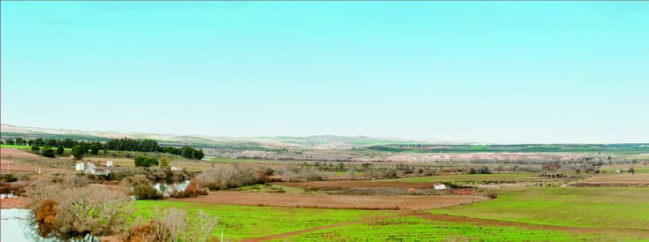
The perfectly straight paths that divide the vast croplands, both rainfed and irrigated, on both sides of the Trail lead slowly towards the Castrejón-Carpio Waterfall. The route first passes through hamlets with large farms where it is possible to rest under the shade on hot days. This track reaches the road and crosses a bridge on the Tagus, heading towards the waterfall that one can already glimpse. The Trail runs parallel to the road for about two kilometres along the right bank of the River Tagus. Further on, a sign indicates that the route veers left onto a farm road. There is a rest area with an information panel about the river, where one can rest after the long walk.

The Trail continues along the river until it reaches an interStage where it veers right, then left in less than one kilometre, then drifts back and runs parallel to the river during several kilometres more.
The path turns yet again towards the CM-4000, running parallel to it for about 150 m. Caution should be exercised here as an access used by quarry lorries is located closeby.
The route is once again surrounded by fields of grain, then crosses a wooden bridge at the confluence of three ravines: Carrascales, del Molinillo and Grande.
The last stretch to Malpica is an agricultural road that runs parallel to the CM-4000 for 1.5 km. The route passes next to an electricity substation and cornfields, then reaches an interStage with the TO-760, from where one can see the castle of Malpica, this city’s landmark on the River Tagus. The iron bridge at the entrance to Malpica de Tajo is the best balcony to observe the castle.
It should be mentioned that this Stage passes through the “Río Tajo en Castrejón, Islas de Malpica de Tajo y Azután” and “Ríos de la Margen Izquierda del Tajo y Berrocales del Tajo” Sites of Community Importance (SCI), and the “Río Tajo en Castrejón, Islas de Malpica de Tajo y Azután” Special Protection Area for Birds (SPA).
Sites of interest
Profile

Highlights
Further information
Malpica Castle
It is a Moorish fortress with a square plan. The keep, which is also square, is located at the southwest façade. A chapel with an octagonal dome covered with Mudejar-style ceramics is located under the keep.
One of the sides of the castle is protected by the Tagus, a natural barrier, whereas the other three sides that do not border the river have a moat. The castle is made of bricks and adobe.
Las Tamujas archaeological site
Roman remains have been found at Las Tamujas archaeological site, near Malpica de Tajo. The ruins of rooms with elegant mosaic floor tiles are proof that a villa existed here in the past. A sort of clay column has also been found that may have been used in thermal baths.


