Net of Natural
Trails

Stage 20: Aranjuez - Villamejor
Description
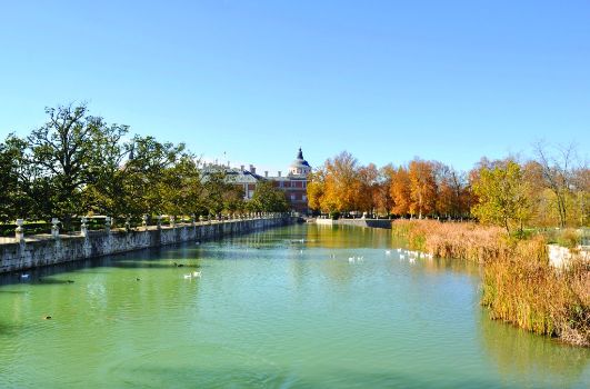
The River Tagus through the Real Sitio de Aranjuez and the large Caseríos (farmhouses)
This Stage leaves behind the Real Sitio and its awe-inspiring monuments to meander along the Tagus. It irrigates the lands of large farmhouses on its way to Villamejor.

The route leaves the Real Sitio via the large avenue that starts at Plaza de Armas and continues towards Toledo on the M-416. There is an information panel near the exit from Aranjuez. Further on, the Trail crosses over the railroad through an overpass, and follows the signs until it reaches an interStage in the outskirts of the city. Please exercise caution when approaching interStages due to heavy traffic.
The route continues mostly west to the next crossing at Los Infantes. After crossing a roundabout with a direction sign and the AVE tracks, a perfectly straight road with little traffic leads to the Apeadero de Las Infantas.
Human activity and the proximity of the River Tagus have enabled the use of the land for agricultural development. Additionally, the richness of its fertile soil makes this land one of the most productive Stages of the river. Indeed, the region is named Las Vegas because of the breadth and width of the fertile lands and the number of rivers and brooks.
The Trail proceeds along a wide and easy track that skirts around the many farms and farmland that dot the area.
During two kilometres, the route runs parallel to the rail tracks, from which it drifts away after a few bends to continue west along a rarely travelled road, evidence by the large bushes of up to two metres in height that flank the Trail. Further on, the route borders a large farming estate, closed with metal crash barriers, until it reaches the River Tagus again. From here, it proceeds a few metres, and then turns south.
The new direction leads back to the rail tracks, where the path turns right and continues along a perfectly straight road from where one can glimpse the large structures of the local quarries. Gradually, the Trail draws closer to the quarries, even sharing the track with lorries. Extra caution should be exercised due to heavy traffic.
Just past the quarry, the path reaches an interStage with the CM-4004. A number of wide tracks lead to the hamlet of Villamejor, the endpoint of this Stage, which is accessed after a right turn.
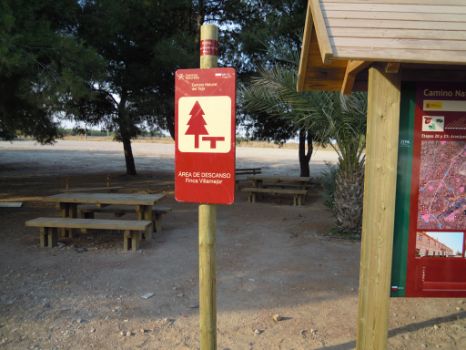
Further on, to the right of a large farmhouse surrounded by 1,500 ha of land, the route ends in a place surrounded by beautiful gardens that provide shade and rest.
Sites of interest
Profile

Highlights
Further information
Carrizal de Villamejor Nature Reserve
This nature reserve (56 ha) is located at the mouth of the Martin Roman Brook. This saline wetland sits in the northern edge of the brook, and consists of thick reed beds with an African tamarisk (Tamarix africana) grove in the centre.
The Decree 21/1991 of March 21 extends protection to this wetland rich in flora and fauna. The most representative plant species include glaucous glasswort (Arthrocnemum macrostachyum), an endangered species endemic only to these reed beds. These wetlands are also an important habitat for bird species, including Northern Lapwings(Vanellus vanellus) and Western Marsh Harriers(Circus aeruginosus).


