Net of Natural
Trails

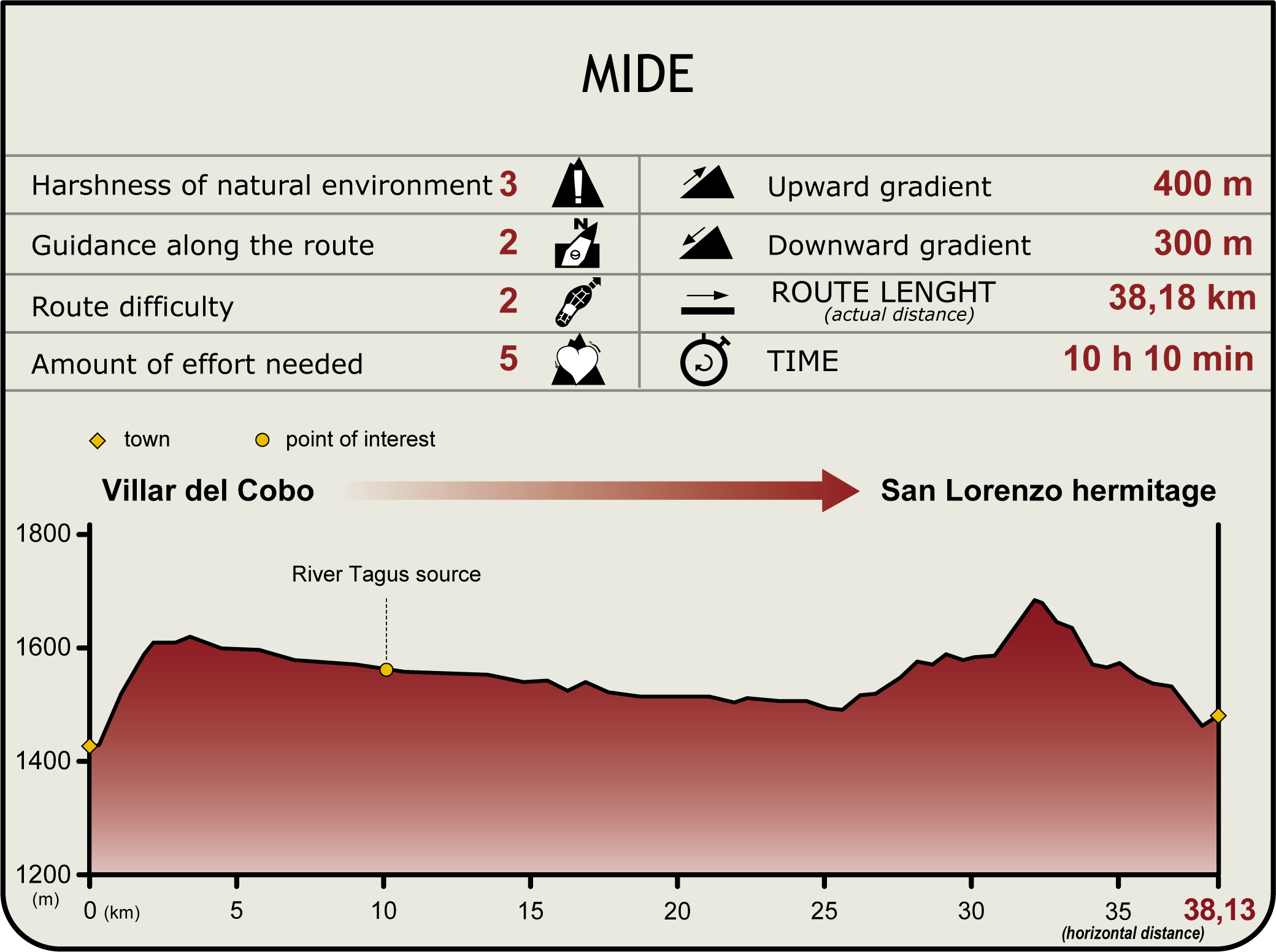
Stage 2: Villar del Cobo - Ermita de San Lorenzo
Description
Along the upper reaches of the river
This Stage, which begins in the town of Villar del Cobo, traverses through landscapes refashioned by human activity, including farmlands and pastures. As the route draws closer to the headwaters of the River Tagus, the riparian forest gives way to a landscape dominated by white pines. Regardless of the season, you will always encounter nature at its finest in this Stage of the Trail.
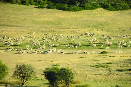
This Stage of the Tagus Nature Trail begins in the town of Villar del Cobo, which spreads from the edge of the River Guadalaviar to the slopes of the surrounding mountains. The Trail leaves the town via a southbound road leading to an interseccion where the route continues to the right, turning onto a wide, paved track. The next crossroads is in the area known as La Cañada, which refers to the 15,000 head of cattle that exist in this area. This stretch of Stage 2 overlaps with the final part of Stage 1.

From here, the route continues south, then turns left at the next junction and, further on, crosses the Rollo Stream. At the next two intersections, the path turns right to the southeast until it reaches a fork where it continues left. Further on is a fountain whose water is collected in a unique way, using staggered concrete troughs that discharge into a hollow log.
The Trail ventures through Scots pine (Pinus sylvestris) forests as it approaches the headwaters of the River Tagus. The riparian forest is barely evident, or non-existent, in the headwaters of the rivers located at a certain altitude. The route traverses through the Alto Tajo-Muela de San Juan SCI and the Montes Universales-Sierra del Tremedal SPA, which extends to the end of the Stage.
The journey continues northwest from the headwaters through a 1-metre wide track, parallel to the river. The house of Inocencio Blas stands at a crossroads, near a pasture, from where the path continues straight ahead. At the edge of the path is a farm known as Pajar del Cuartillo, and further on, is a recreational area on the opposite side of the TE-V-9032. Scots pines flank the path throughout this stage.

The River Tagus and the Nature Trail no longer run parallel to each other after the interseccion. The Trail turns north along a wide forest track, leading out of Teruel province into Guadalajara. This stretch traverses through the areas known as El Tesorillo, Valdeminguete, La Cerrada and Las Arenillas.
The path arrives at a crossroads, next to grassland, where it turns right, then, further on, to the left towards La Herradura, following a long bend where the forest fire watchtower, Escambronar Tower, is located.
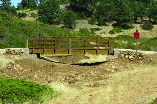
The path becomes stonier as the route ventures into wastelands. A wooden footbridge crosses the Cañada Magosa Brook, and continues to Cuesta del Cañuelo.
The route continues halfway up the hill for 1.5 km until it reaches Huecos Brook, which can be waded using the concrete blocks placed on the streambed. After crossing the river, the Nature Trail merges with the road to Sarguillas, which climbs up its namesake valley, along a path that leads to the shrine of San Lorenzo, where this Stage ends. It should be noted that there is no accommodation or shelters available near the shrine.
Sites of interest
Puntos de interés
Culture
- Ermita de San Lorenzo
- Iglesia de los Santos Justo y Pastor
- Ermita del Rosario
- Monumento del Nacimiento del Río Tajo
Hydrography
Municipality
Orography
Hostel
Passport
Profile

Highlights
Further information
The landscape of the upper reaches
From the headwaters to the lower reaches, the Tagus Nature Trail traverses a variety of landscapes, and the peoples and traditions also vary with the landscape.
In the upper reaches of the Tagus, from its headwaters to Peralejos de las Truchas, the white waters of the river are highly oxygenated and clean. The wildlife that inhabit this part of the river, including insects like mayflies and European hoverflies, have adapted to these conditions, transforming their limbs into hooks to avoid being washed away.
Wastelands and forest stewards
Wastelands are fertile grounds used for agriculture in the past. After several years, new small herbaceous plants grow in these barren places. The gorse (Genista scorpius), a thorny thicket with grey-green and yellow flowers, is just one of many examples. These types of plants, which cover the land, are the true stewards of the forest, protecting other species from livestock thanks to their thorns.
"Leopard skin" savin
The savin juniper (Juniperus sabina) grows in clusters scattered across the high moorlands, close to Pyrenean oak, Portuguese oak and white pine forests. Grazing animals helped shape the juniper clusters, producing a distinctive limestone moorland landscape known as “leopard skin”.
Multimedia
Downloads
GPS Downloads
Documents
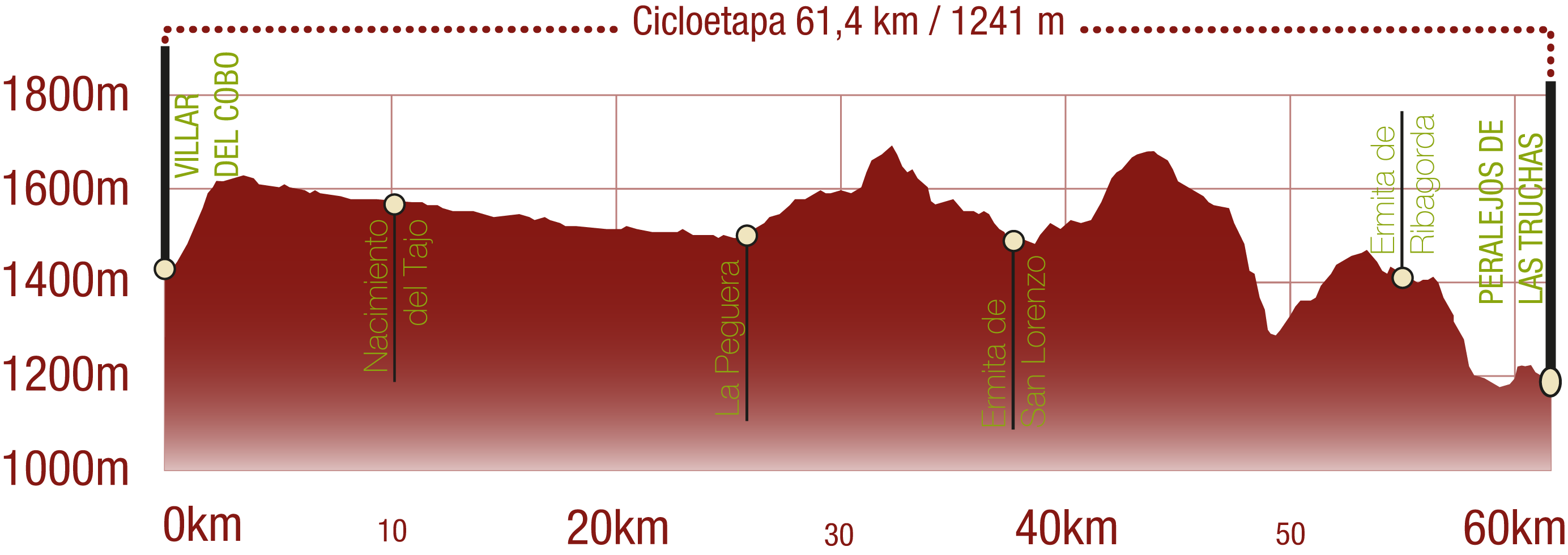
Cyclability
TIPO DE FIRME, PORTEOS Y DIFICULTAD
RECOMENDACIONES DE SEGURIDAD
- Tramos compartidos con senderistas.
- Tránsito por el centro algunos núcleos poblacionales.
- Cruce de vías asfaltadas donde se recomienda extremar la precaución.
- Tránsito por tramos próximos al cauce del río. Zona inundable en época de crecida.
RECOMENDACIONES GENERALES
-Infórmate sobre los aspectos técnicos de la ruta y sobre la meteorología del día.
-Cuida del medio ambiente. Procura no molestar a los animales ni deteriorar la vegetación. Respeta las zonas privadas.
-Debes dar prioridad a los peatones y cumplir con las normas generales de circulación.
-El entorno por el que vas a circular es abierto, de libre circulación y escenario de múltiples actividades (deportivas, forestales, ganaderas y agrícolas). Mantén una actitud comprensiva, prudente, responsable y respetuosa.


