Net of Natural
Trails

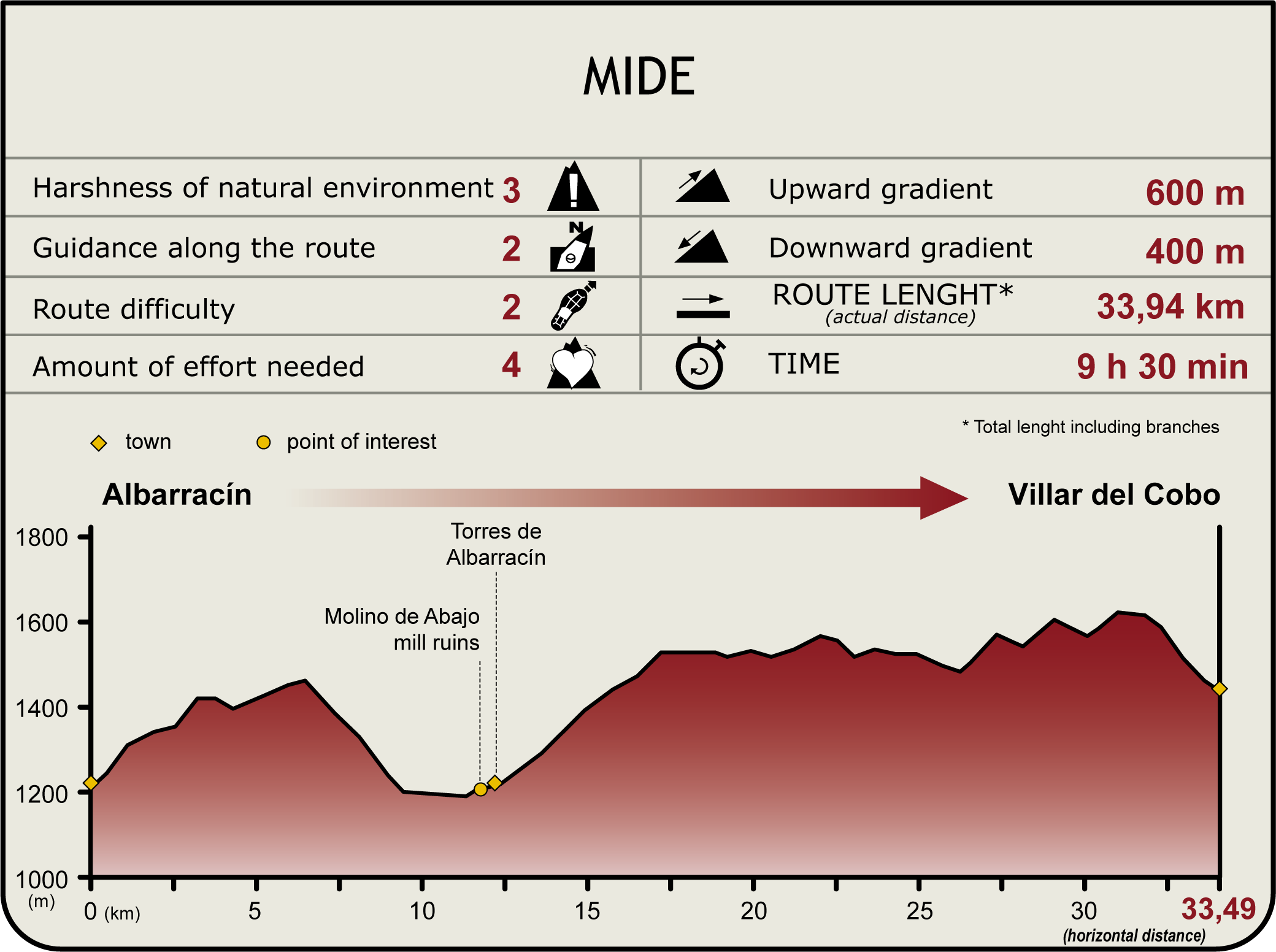
Stage 1: Albarracín - Villar del Cobo
Description
Searching for the headwaters of the River Tagus
The Tagus Nature Trail begins a few metres away from the village of Albarracín. Although the headwaters are only a few kilometres away, the town after which the mountain is named, and on whose steep slopes the Tagus rises is well worth a visit. Although its waters initially flow through a mountain landscape punctuated with rocky cliffs and crags, magnificent and vast forests of black pine on the soon appear on the slopes of Sierra de Albarracín. As the trail continues, the landscape becomes increasingly level as it descends towards pastures, farmland and olive groves.

This first stage begins in the outskirts of Albarracín, a medieval town set on a hill, in a bend formed by the River Guadalaviar, which once served as a natural moat. It boasts an abundance of artistic and historic monuments, including religious buildings and its houses, streets and squares, which perfectly reflect the population's ability to adapt to the rugged terrain.
The Trail heads northwest passing through an opening in the wall surrounding the village, along the road to Valdemán, which gradually climbs to the top of the hill. Spectacular views of the medieval town can be seen from here.
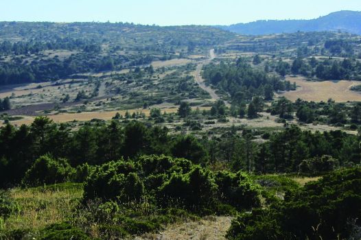
The landscape seems barren and devoid of life, but nothing could be further from the truth. The moorland is inhabited by many animal and plant species that have adapted to the prevailing environmental conditions.

The path continues along the upper reaches of the moorland, surrounded by farms and a few patches of juniper (Juniperus thurifera), until the Rochilla farmhouse, located on the right bank. The descent into the Moñigueros Ravine starts here. After about 1.5 km, the Trail arrives at a junction and turns left onto a wide track leading to Puntal de Antonio. This stage of the Tagus Nature Trail passes through the Sabinar de Monterde de Albarracín SCI. The landscape changes as the journey continues, with junipers giving way to pines (Pinus spp.).
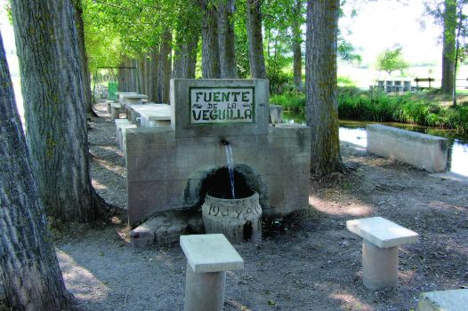
The path continues downward until it merges with the A-1512 for a few metres, then continues left and crosses a bridge over the River Guadalaviar. It continues along the right bank until it crosses the river again, heading back north until it eventually reaches the town of Torres de Albarracín. On the river, next to this last bridge, are Fuente de Veguilla and its recreational area, with benches, tables and riverside trees that provide shade for rest, and even some refreshment, before visiting the town.

The stage continues from Torres de Albarracín, retracing the path to cross the bridge again, where it continues south, climbing up Fuentes Gully. At the next junction, the route turns right and skirts around Las Fuentecillas Hill.
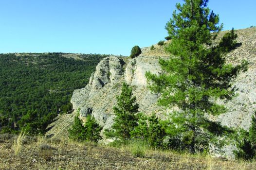
The path continues up and down La Loma Valley until it reaches the River Guadalaviar Canyon, where rocky cliffs and crags form a unique landscape. The flight of the Griffon Vulture (Gyps fulvus). can be enjoyed from the natural balconies. This landscape is protected under the Estrechos del Guadalaviar SCI.
The path merges onto the road to Villar del Cobo, next to Zarramora, for a few kilometres, until it reaches a sharp bend from where the route continues along a track that passes over the Rollo Stream. At the next intersection, it turns right in a north-westerly direction to return to the road, and continues for a few metres until it reaches Villar del Cobo, the endpoint of this stage.
Sites of interest
Puntos de interés
Culture
- Iglesia de los Santos Justo y Pastor
- Ermita del Rosario
- Iglesia Parroquial de San Miguel
- Ermita de San Roque
- Alcázar de Albarracín
- Torre del Andador
- Ermita del Carmen
- Torre de Doña Blanca
Municipality
Hostel
Passport
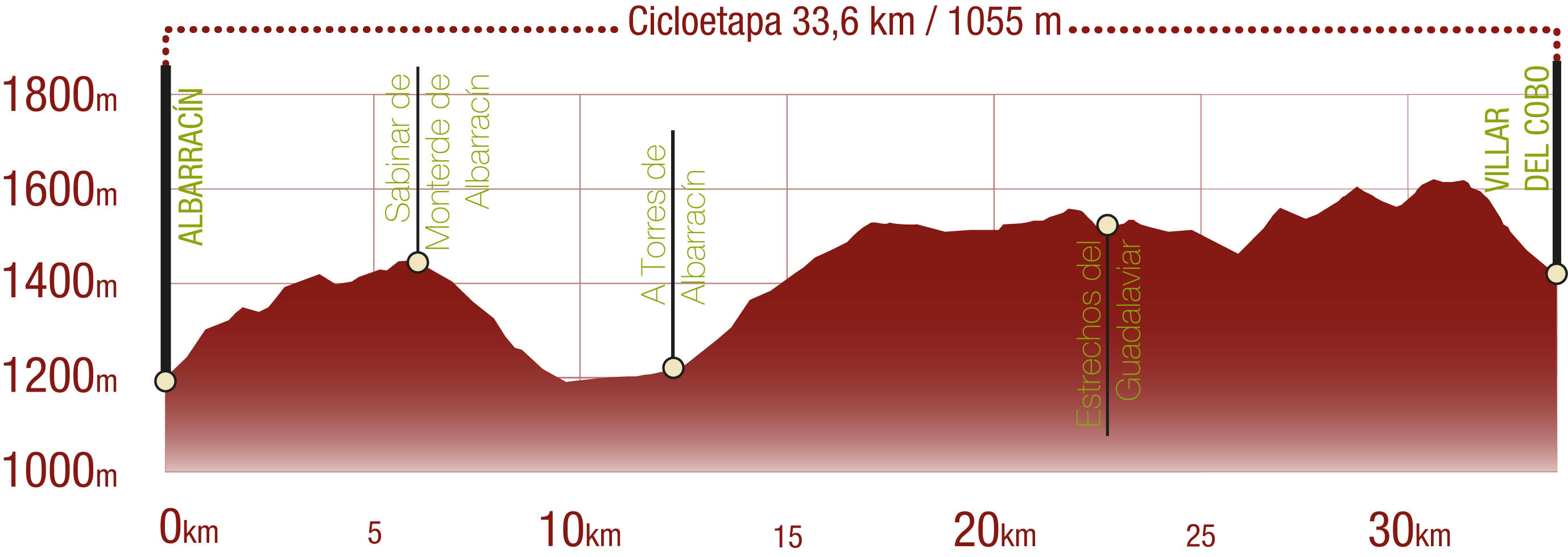
Profile
Highlights
Further information
Life in the moorland
Vegetation is sparse and steppe-like in the upper, exposed areas, where weather conditions are extreme. Only a few cereal farms and wastelands for cattle dot the inhospitable moorland plains.
Only the best-adapted species can survive in the moorlands and in this terrain, with little soil, extreme temperatures, lack of water and intense exposure to the sun. The plants protect their leaves and branches with spikes to reduce water loss and keep cattle at bay. A good example is the gorse (Genista scorpius), whose flowers produce a yellow dye that was used to colour wool; blackthorn (Prunus spinosa) with fruits particularly high in vitamin C that are used to flavour "pacharán"; or thistles.
Some species, such as lavender (Lavandula stoechas) or thyme (Thymus sp.), have small leaves that are bent downwards to avoid direct sunlight and prevent drying out from water loss.
Animals have also adapted to the harsh conditions of the moorland, with brown feathers to camouflage on the ground, a quick flight and elusive behaviour to escape predators in this open space. Curlews (Burhinus oedicnemus), Pipits(Anthus trivialis), Calendra Larks (Melanocorypha calandra), Eurasian Skylarks (Alauda arvensis), Crested Larks (Galerida cristata) and Woodlarks (Lullula arborea) are some of the species that nest in the moors.
Multimedia
Downloads
GPS Downloads
Documents
Cyclability
TIPO DE FIRME, PORTEOS Y DIFICULTAD
RECOMENDACIONES DE SEGURIDAD
- Tramos compartidos con senderistas.
- Tránsito por el centro algunos núcleos poblacionales.
- Cruce de vías asfaltadas donde se recomienda extremar la precaución.
- Tránsito por tramos próximos al cauce del río. Zona inundable en época de crecida.
RECOMENDACIONES GENERALES
-Infórmate sobre los aspectos técnicos de la ruta y sobre la meteorología del día.
-Cuida del medio ambiente. Procura no molestar a los animales ni deteriorar la vegetación. Respeta las zonas privadas.
-Debes dar prioridad a los peatones y cumplir con las normas generales de circulación.
-El entorno por el que vas a circular es abierto, de libre circulación y escenario de múltiples actividades (deportivas, forestales, ganaderas y agrícolas). Mantén una actitud comprensiva, prudente, responsable y respetuosa.


