

Net of Nature
Trails

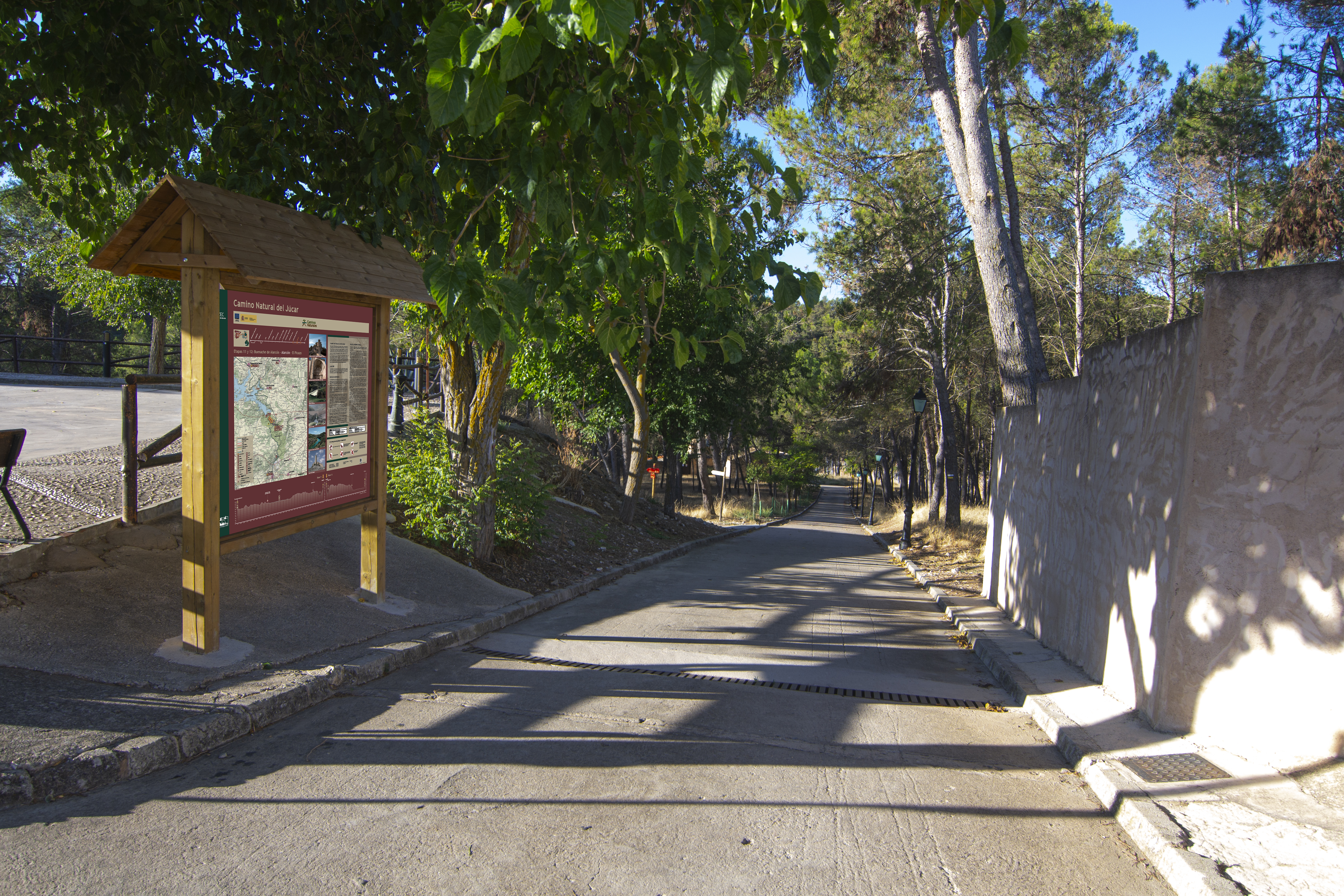
Stage 12: Alarcón - El Picazo
Description
The moors of La Manchuela Conquense
This section runs up the gorge of the Júcar in Alarcón through moorlands covered with Mediterranean forest alternating with tree and cereal crops. The route returns to the area around the Júcar after passing over the Tajo-Segura water transfer canal, following the river until almost the end of the route at El Picazo.

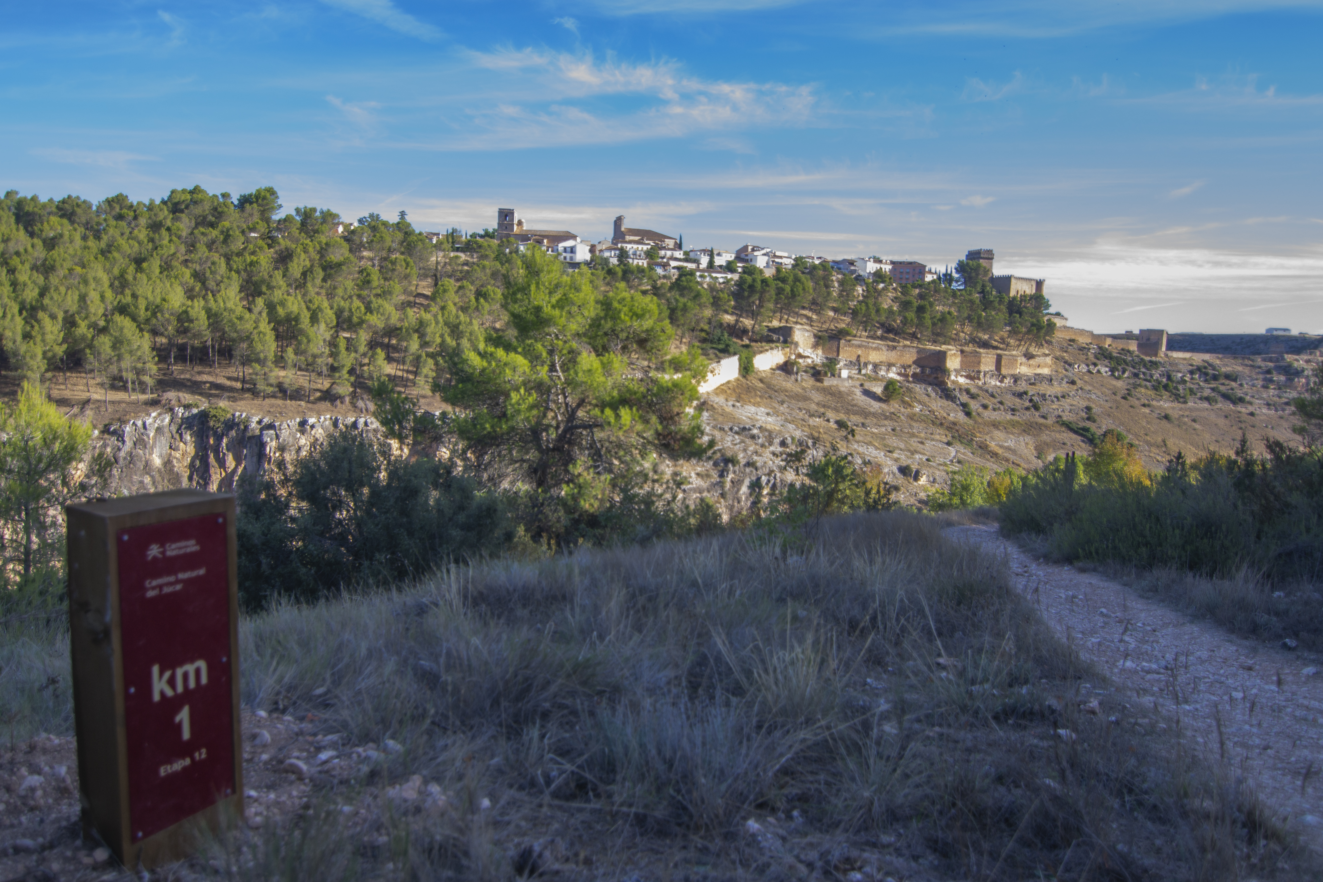
This new stage of the Júcar Nature Trail begins in Alarcón, on the cemetery road, although it soon changes to a pedestrian path descending through pine trees to Chinchilla Gate, which served as the access from the south to the walled enclosure of Alarcón. After passing through the gate, we leave the pine trees behind and continue descending through a rockier area almost devoid of vegetation with the remains of the Alarcón wall on the left-hand side.

The pedestrian path leads to the El Picazo bridge, a masonry bridge of medieval origin that crosses the Júcar gorge. Once on the other side of the river, a continuous ascent begins where the traveller can look back and enjoy the beautiful panoramic views of the village of Alarcón and the gorge of the river. After almost a kilometre of ascent in the company of kermes oaks, holm oaks, junipers and junipers, you leave the river canyon for good.
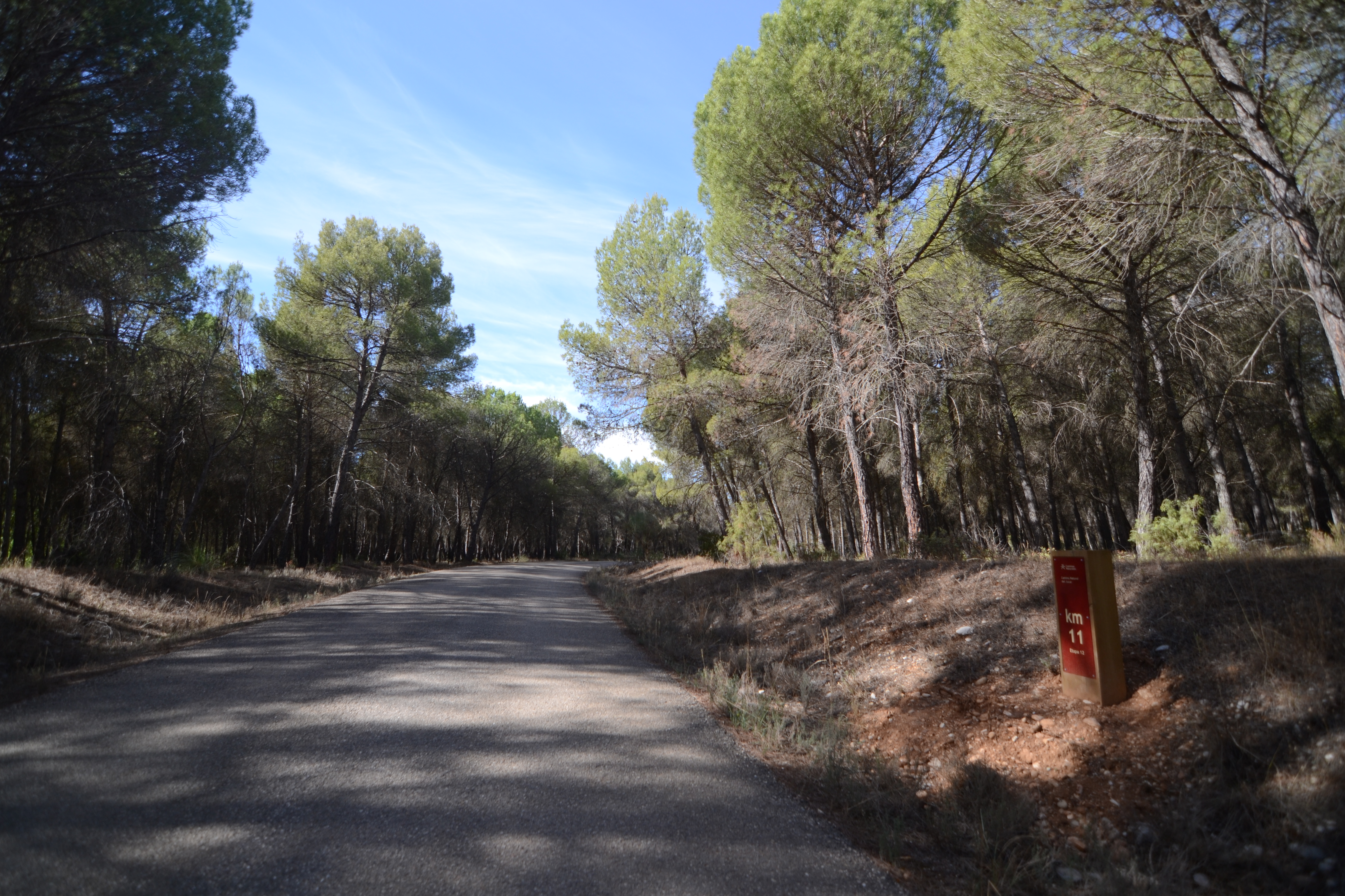
The footpath leads to a wide dirt track in a westerly direction. From this point on, the route heads away from the river for almost 9 km.

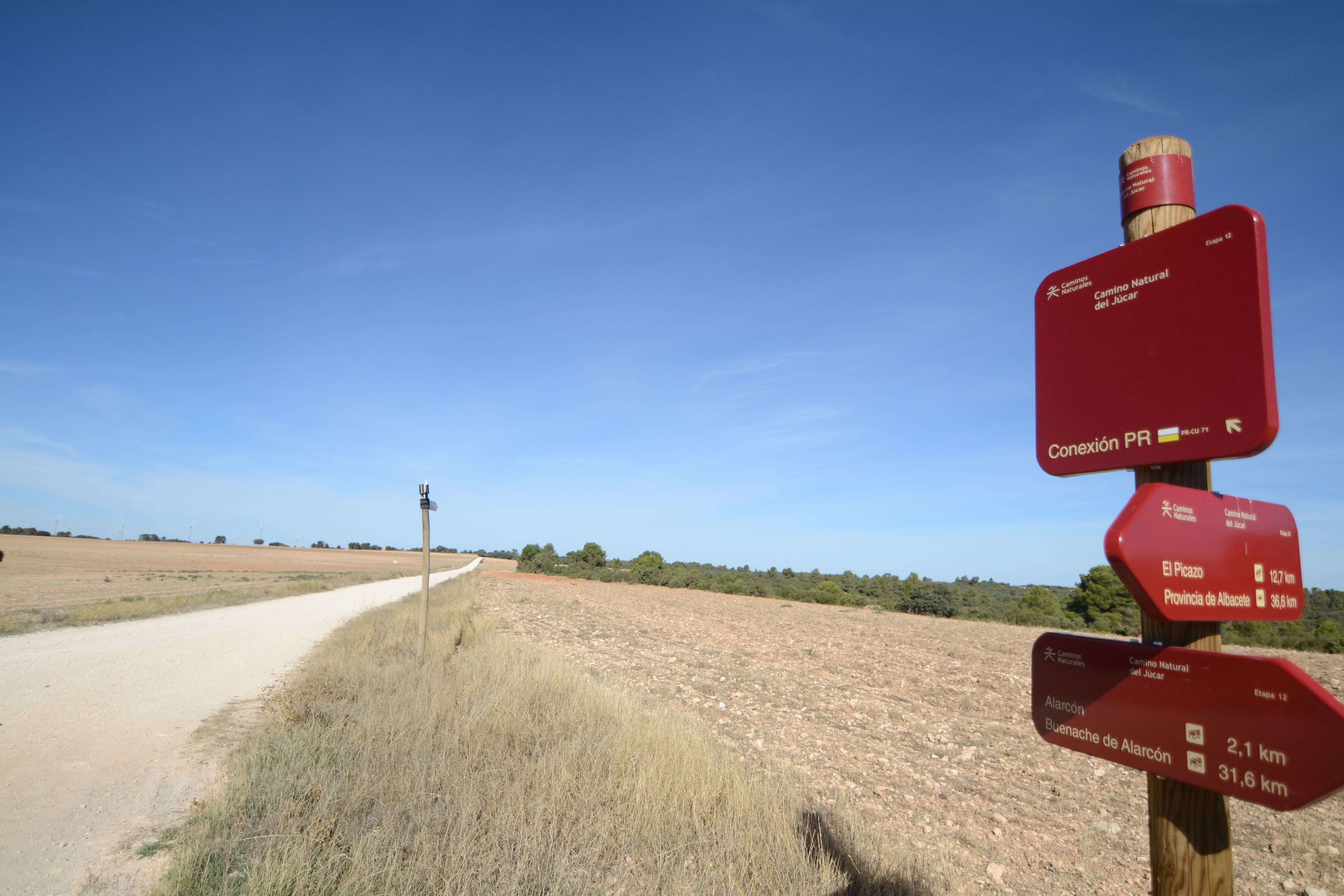
. After 750 m along this track, you reach a crossroads where you take another track on the left in a south-easterly direction. From the front, you could continue along the PR-CU 71 path, returning to Alarcón, to the north of the town (in fact, this is a circular path that shares the same route as part of this stage of the Nature Trail).
We’ll stay on this new track for the rest of the stage, so the orientation is not complicated, needing only to avoid all the junctions. The landscape for the next few kilometres will consist of slightly undulating terrain alternating between a mixed Mediterranean forest dominated by pine and holm oaks, and areas of crops, either cereals or trees such as almond trees.

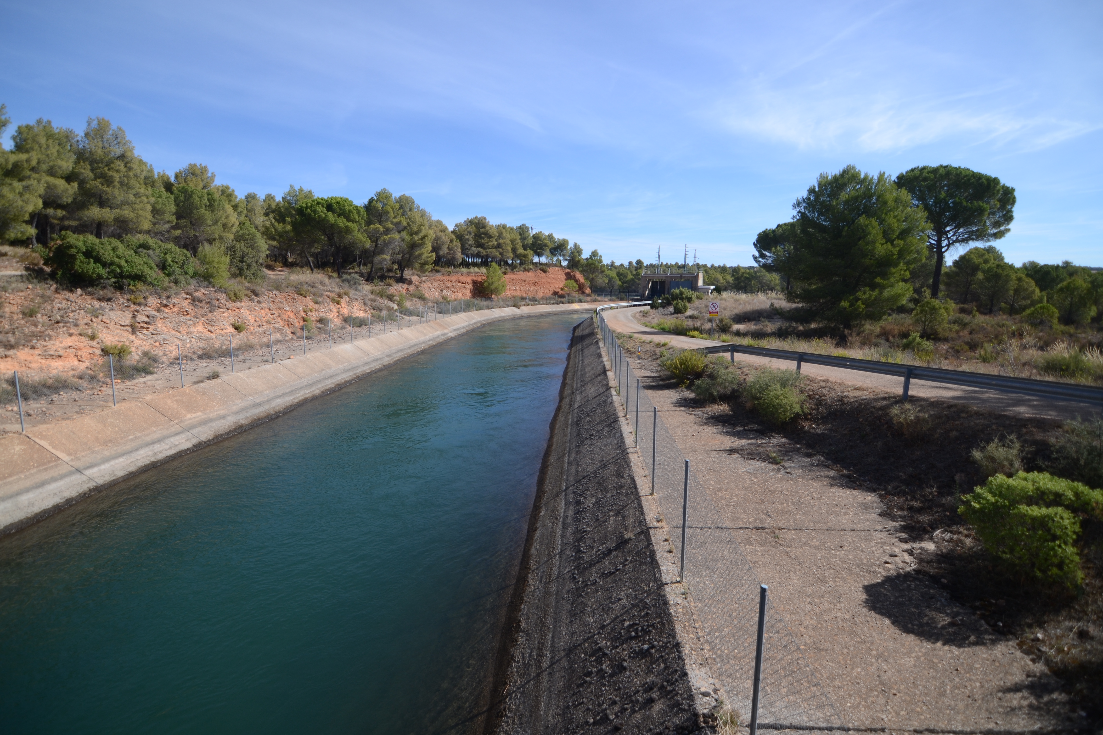
After passing by some farm buildings, the track starts to descend again in search of the river Júcar. After a little more than 1 km, we reach another of the milestones of this stage when we cross over the Tajo-Segura water transfer canal. Despite its name, this immense engineering work also uses part of the course of the river Júcar, from the north of the Alarcón reservoir to this point, where the water is re-channelled.
Once we cross the canal, the slope becomes steeper for a few hundred metres, entering the Júcar valley again, although in this section it is no longer so steep. Almost at the river plain, you reach a hydroelectric power station, and the dirt road becomes asphalted.

The route takes a south-westerly direction, leaving the Júcar on the left and passing through a pine forest through which, due to the proximity of the river, some trees typical of gallery forests, such as poplars and ash trees, can be seen. After passing by the Castillejos weir, the asphalted track passes under the A3 viaduct and the tree-covered vegetation gives way to a largely cultivated area. This will be the landscape until we reach El Picazo.
The village is entered from the north, and the first thing to catch the eye is the chimney of an old oil press. Just before reaching the chimney, take the road a left. The route goes through the streets of El Picazo, passing through the Plaza Mayor (where the palace-house of Ruiz de Monsalve is located) and next to the church (a temple whose construction dates back to the 16th century). The route leaves the old quarter of El Picazo along the Avenida de Juan Carlos I, ending this stage next to the N-310 road.
Sites of interest
Puntos de interés
Culture
- Molino del Concejo
- Puerta del Campo
- Puerta del Bodegón
- Torre del Cañavete
- Torre de Armas
- Puerta del Calabozo
- Castillo de Alarcón
- Puerta del río
- Puerta de la Chinchilla
Hydrography
Infrastructure
- Puente del Picazo
- Canal del Trasvase Tajo-Segura
- sendero PR-CU 71
- Puente de Tébar
- Presa de Henchideros
Municipality
Hostel
Vegetation
Profile

MIDE (Method for the Information of Excursions)
 Harshness of natural environment
- 1. The environment is not risk-free
- 2. There are more than one risk factors
- 3. There are various risk factors
- 4. There are quite a lot of risk factors
- 5. There are many risk factors
 Guidance along the route
- 1. Well defined trails and crossings
- 2. There is a clearly marked trail and signage
- 3. Requires the identification of geographic features and cardinal points
- 4. Requires off-path navigation
- 5. The trail is interrupted by obstacles that have to be gone around
 Route difficulty
- 1. Walking on a flat surface
- 2. Trails with different types of path
- 3. Walking on stepped paths or irregular terrain
- 4. The use of hands or jumping over the terrain is necessary
- 5. The use of hands is required to progress
 Amount of effort needed
- 1. Up to 1 hour of continuous walking
- 2. Between 1 and 3 hours of continuous walking
- 3. Between 3 and 6 hours of continuous walking
- 4. Between 6 and 10 hours of actual walking
- 5. More than 10 hours of continuous walking
Highlights
Tajo-Segura Transfer
The Tagus-Segura Transfer initially proposed in the National Water Works Plan of 1933, although it was not developed until decades later in the "General Preliminary Plan for Shared Exploitation of Water Resource in Central and South-East Spain. Tajo-Segura Complex" of 1967.
This is a complex engineering project designed to connect the Tagus basin with the Segura basin, bringing water from the headwaters of the former to the more fertile lands of the southeast of the peninsula, but with little availability of water for irrigation.
The water transfer consists of a number of reservoirs, canals, aqueducts and tunnels that connect the two basins, crossing the Júcar and Guadiana river basin districts. The route begins at the Bolarque reservoir on the river Tajo (in the province of Guadalajara) and flows into the Talave reservoir on the river Mundo (a tributary of the Segura), located in the town of Liétor in the province of Albacete.
The water regulation of the Tagus and Guadiela rivers is carried out in the Entrepeñas (835 m3) and Buendía (1,639 hm3) reservoirs, which, in addition to regulating the river's headwaters, also serve to regulate floods and to allow the hydroelectric exploitation of the basin.
The water transfer route is divided into four sections:
In the first, water is raised from the Bolarque reservoir to the La Bujeda reservoir, in the Altomira mountain range. To bridge the 245 m difference in level between the two, a double penstock with a diameter of three metres was built, running for a distance of 1070 m in length from the Bolarque II reversible power station.
The second section carries water from the La Bujeda reservoir to the Alarcón reservoir in the Júcar basin. This section is 93 km long and is divided into four canals, the Villarejo, Belmontejo and Juncosillo canals. To overcome different geographical features, aqueducts have been built, such as the Riansares aqueduct, which is almost 3 km long and 48 m high, and a series of tunnels: Altomira, Carrascosa and Villarejo. In the Alarcón reservoir, the water from the aqueduct joins the water from the Júcar, acting as a regulator of water transfers in the middle section.
The third links this Alarcón reservoir with the Talave tunnel. From the exit of the El Picazo tunnel, where we are, the water flows through the El Picazo canals, which include the Santa Quiteria and La Fuensanta aqueducts, until it reaches Los Anguijes.
The last section consists of the Talave tunnel, almost 32 m long and 4 m in diameter, which was bored into the ground at a depth of between 150 and 320 m. The tunnel flows into the reservoir of the same name on the Mundo river. The construction, pioneering in its time in terms of length and complexity in Europe, overcame the numerous adversities caused by the depth of the tunnel and the seepage of groundwater from the aquifer.
At the La Bujeda reservoir there is a diversion to the Tablas de Daimiel National Park in the Guadiana basin. Its use is activated as an emergency measure in times of extreme drought in the wetland.
Multimedia


Downloads

GPS Downloads


Documents

Cyclability
This Cyclostage corresponds to part of stage 12 and stage 12 branch of the Nature Trail
PROFILE

TYPE OF ROADS, PORTAGES & DIFFICULTY

TEST

GENERAL RECOMMENDATIONS
- Find out about the technical aspects of the route and the weather on the day.
- Take care of the environment. Take care not to disturb animals or damage vegetation. Respect private areas.
- You must give priority to pedestrians and comply with general traffic rules.
- The environment in which you will be riding is open, free to move around and an area where many activities are carried out (sporting, forestry, livestock and agricultural activities).
- Always have an understanding, prudent, responsible and respectful attitude.
SAFETY RECOMMENDATIONS
- The trail runs mainly along tracks with access to farms and rural holding, so there is a certain risk of collision.
- Caution is advised at the junction of the N-310 and CM-3114 roads.
- There are two walking sections where cyclists must dismount (one of which takes about 25 minutes, the other 14 minutes) along sections of uneven footpath with some danger of falling