Net of Natural
Trails

Stage 1: Source of the River Júcar - Tragacete
Description
A great river rises, an amazing journey begins
The undisputed star of this Nature Trail, and thus of this first stage, is the River Júcar and, specifically, the place where it rises. A short yet spectacular stage where you can enjoy the surroundings, with spots of such great beauty as the El Infierno Narrows, the San Blas Narrows and the Molino de la Chorrera waterfall, all of which are in the heart of the Serranía de Cuenca Natural Park.

The River Júcar awakens each day to the sweet twittering of the various bird species that inhabit this environment. This enclave invites travellers not to start the stage immediately but rather to stop unhurriedly to enjoy every second here, which will undoubtedly remain engraved in their memory.
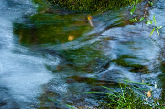
This is the source of the River Júcar, in what is known as the El Infierno Narrows. An area in the heart of the Serranía de Cuenca Natural Park, where, due to the calcareous nature of the rock, numerous springs gush premium-quality crystal-clear water.

Upon leaving this enclave and starting this first stage, travellers already have in their backpacks sensations they will never forget, such as the sound of the water of this nascent River Júcar. A few metres after leaving the interpretative panel behind, you leave the path to the right along which the branch of stage 1 will reach the source of the Júcar.
The traveller then continues straight on, mainly downhill through pine woods with specimens of different ages. If you are in a small group and, most importantly, if you travel in relative silence, you will quite easily observe such beautiful animals red deer (Cervus elaphus) and fallow deer (Dama dama). Moreover, if you make the trip in autumn, you will be able to hear and enjoy the bellowing and rutting of the stags of red deer and fallow deer respectively.
After passing kilometre two of this stage, the signage indicates that you can visit the Pino del Ocejón, a spectacular specimen of laricio pine (Pinus nigra). This itinerary is not included within the Júcar Natural Trail and is more than 4 kilometres from this point, so travellers, at their own risk, must make the decision that best suits them.

Without stepping off the nature trail, you will reach the San Blas Narrows, a place of special beauty where the cliffs present a spectacular range of colours. The River Júcar appears and disappears between the El Infierno Narrows and the San Blas Narrows, due to the nature of the materials forming its bed, but from here onwards it has a continuous course of crystalline waters fed by new springs. The San Blas Narrows invites you to take a break and enjoy the spring bearing the same name, which contains an image of the saint of the same name, the rest area and the car park that are there.

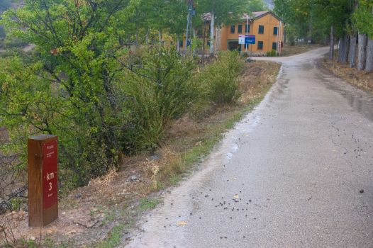
A few metres later, beside the kilometre 3 market for the stage, you will find the San Blas Youth Hostel, which offers a range of activities and accommodation services to allow you to enjoy the Serranía de Cuenca to the full. From the hostel, the Júcar Nature Trail is asphalted and continues downhill, reaching the car park from where you can visit the Molino de la Chorrera waterfall vantage point.
After you pass the aforementioned mill (now in private hands), a small botanical path (PNSC-S06) leads off, allowing you to enjoy the beauty of the Molino de la Chorrera waterfall in all its splendour. An impressive waterfall that once powered the mill and today delights the traveller’s senses.

As you continue you will reach a dirt car park and shortly thereafter the Tío Portero fountain, beside kilometre five of the stage. From this point on, small family vegetable gardens run by the residents of Tragacete begin to appear. After passing the San Antonio shrine, you will encounter a succession of fountains such as La Trinidad and La Toba, which precede the end point of this first stage of the Júcar Nature Trail, in the highland village of Tragacete.
Sites of interest
Puntos de interés
Culture
Hydrography
- Fuente del Tío Portero
- Manantiales del Estrecho del Infierno
- Fuente de la Toba
- Cascada del Molino de la Chorrera
- Nacimiento del río Júcar
Infrastructure
Municipality
Orography
Hostel
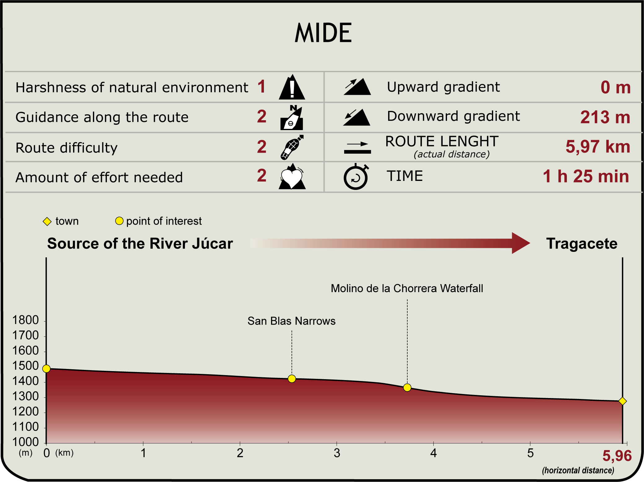
Profile
Highlights
Further information
Source of the River Júcar
In the Montes Universales, in the heart of the Serranía de Cuenca Natural Park, is the source of the great rivers that will gradually grow and wash much of the Iberian Peninsula. They include the River Júcar, which rises in the area known as Ojuelos de Valdeminguete, in the Muela de San Felipe.
The River Júcar is the result of the combination of small springs from which pure and crystalline water emerges from the limestone rock itself in a small canyon known as El Infierno Narrows. Over its first few metres, between the aforementioned El Infierno Narrows and the San Blas Narrows, the waters of the River Júcar appear and disappear owing to the more or less permeable nature of its course.
From the San Blas Narrows, it runs a continuous course for a total of 509 km, washing the provinces of Cuenca, Albacete and Valencia. It has 22 tributaries in total, such as the Húecar and the Cabriel and reservoirs such as Alarcón or El Naranjero. On its journey it crosses the Serranía de Cuenca in its upper course, where the mountain landscape contrasts with the extensive citrus groves so characteristic of its lower course, before emptying into the Mediterranean Sea, at the village of Cullera.
Tragacete
A beautiful village in the province of Cuenca, in the heart of the Serranía de Cuenca Natural Park. It has a forestry culture and tradition, and is surrounded by large masses of mainly Scots pine (Pinus sylvestris) and laricio pine (Pinus nigra); it also features green valleys with plentiful pastureland irrigated by the many streams that flow down from the mountains, with the River Júcar, which rises in the El Infierno Narrows, a spot a few kilometres from the village of Tragacete, standing out from the rest. Fountains and springs pepper this municipality, and some of them feature what are known as gamellones or tornajos: wooden trunks from the nearby forests in which an inner hollow has been carved out which acts as a channel for the water from the fountain while at the same time acting as a watering place for both wildlife and domestic animals.
Multimedia
Downloads
GPS Downloads
Documents
Cyclability
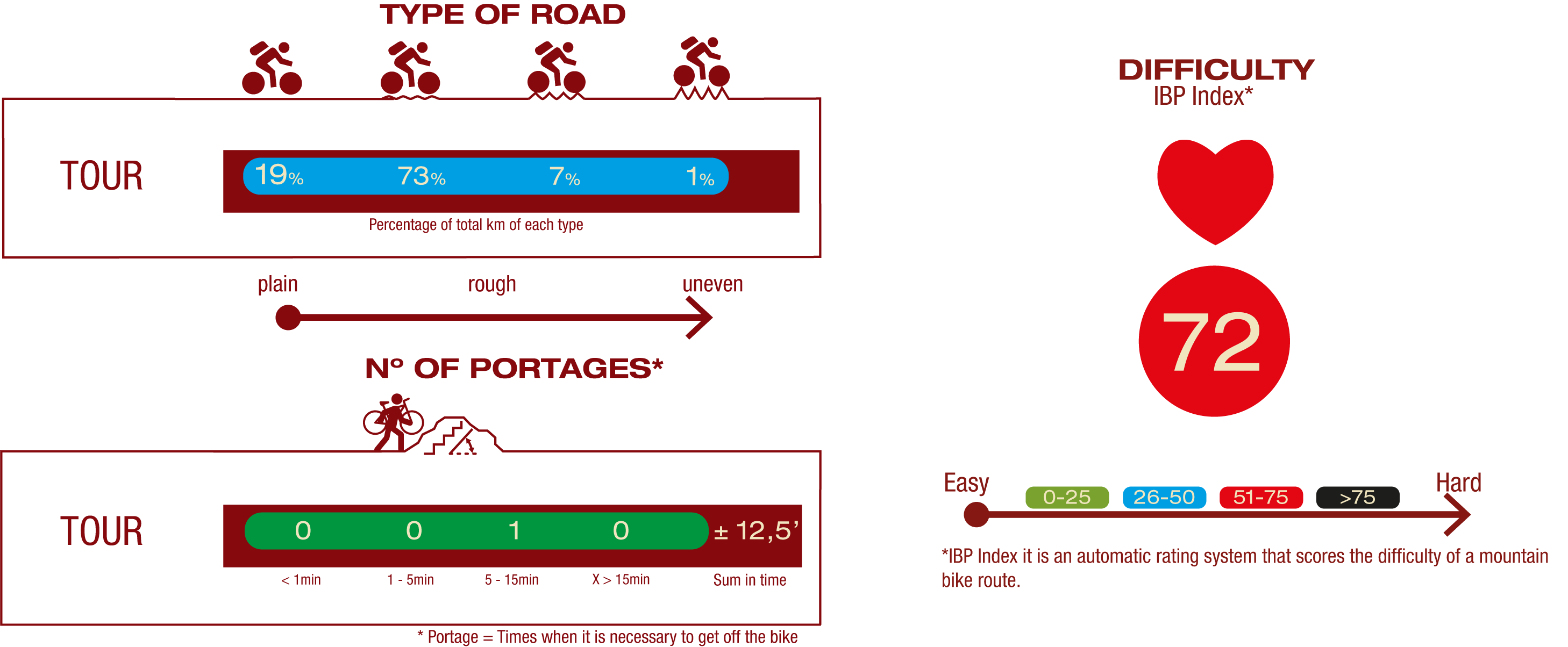
TYPE OF ROADS, PORTAGES & DIFFICULTY
SAFETY RECOMMENDATIONS
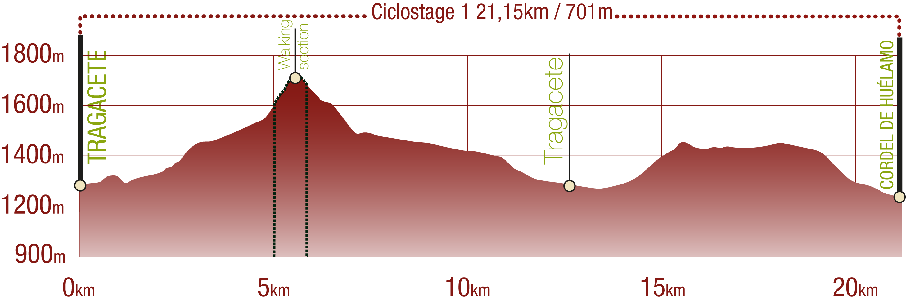
- Mountain stages for cyclists with a walking section between them of more than 3 kilometres.
- You must exercise extreme caution and carefully read all the information aimed at touring cyclists and you must abandon the trip if in doubt.
- There are portages on both cycle stages, path sections, sections with rocky outcrops, sections with loose stones, challenging climbs and long descents.
- They run through an area of great scenic value with the risks inherent in the Serranía de Cuenca.
GENERAL RECOMMENDATIONS
- Find out about the technical aspects of the route and the weather on the day.
- Take care of the environment. Take care not to disturb animals or damage vegetation. Respect private areas.
- You must give priority to pedestrians and comply with general traffic rules.
- The environment in which you will be riding is open, free to move around and an area where many activities are carried out (sporting, forestry, livestock and agricultural activities). Always have an understanding, prudent, responsible and respectful attitude.


